
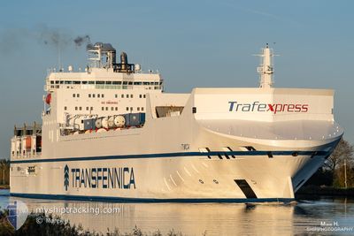
TIMCA
Ro-Ro Cargo
Current Trip
| Time Travelled | 2 days |
|---|---|
| Remaining Time | 6 h, 44 mins |
| Distance Travelled | 1082.40 nm |
| Remaining Distance | 125.92 nm |
| AVG Speed | 18.9 Knots |
| MAX Speed | 22.4 Knots |
| AVG Wind | 16.4 knots |
| MAX Wind | 36.8 knots |
| MIN Temp | 4.2°C / 39.56°F |
| MAX Temp | 10.9°C / 51.62°F |
| Dybgang | 7.1 m |
| Position Modtaget | 1 m siden |
Current Position
| Longitude | --- |
|---|---|
| Latitude | --- |
| Status | Under way using engine |
| Fart | 16.5 Knots |
| Kurs | 229° |
| Område | North Sea |
| Station | T-AIS |
| Position Modtaget | 1 m siden |
Info
Information
The current position of TIMCA is in North Sea with coordinates 53.12188° / 4.31492° as reported on 2025-12-19 07:12 by AIS to our vessel tracker app. The vessel's current speed is 16.5 Knots and is heading at the port of VLISSINGEN. The estimated time of arrival as calculated by MyShipTracking vessel tracking app is 2025-12-19 14:57 LT
The vessel TIMCA (IMO: 9307358, MMSI: 246521000) is a Ro-Ro Cargo that was built in 2006 ( 19 år gamle ). It's sailing under the flag of [NL] Netherlands.
In this page you can find informations about the vessels current position, last detected port calls, and current voyage information. If the vessels is not in coverage by AIS you will find the latest position.
The current position of TIMCA is detected by our AIS receivers and we are not responsible for the reliability of the data. The last position was recorded while the vessel was in Coverage by the Ais receivers of our vessel tracking app.
The current draught of TIMCA as reported by AIS is 7.1 meters
Weather
| Temperature | 10°C / 50°F |
|---|---|
| Wind Speed | 13 knots |
| Direction | 275° W |
| Pressure | 1010.3 hPa |
| Humidity | 81.2 % |
| Cloud Coverage | 100 % |
Featured Company
Last Port Calls
| Port | Arrival | Departure | Time In Port |
|---|---|---|---|
| 2025-12-16 11:19 | 2025-12-17 01:09 | 13 h | |
| 2025-12-15 15:17 | 2025-12-16 01:08 | 9 h | |
| 2025-12-12 10:10 | 2025-12-13 02:05 | 15 h | |
| 2025-12-09 01:57 | 2025-12-11 19:16 | 2 d | |
| 2025-12-04 06:20 | 2025-12-04 15:01 | 8 h | |
| 2025-12-03 05:56 | 2025-12-03 14:55 | 8 h | |
| 2025-11-30 21:40 | 2025-12-02 19:28 | 1 d | |
| 2025-11-30 09:12 | 2025-11-30 13:19 | 4 h | |
| 2025-11-27 04:03 | 2025-11-27 11:12 | 7 h | |
| 2025-11-26 02:27 | 2025-11-27 00:40 | 22 h |
Last Trips
| Origin | Departure | Destination | Arrival | Distance | |
|---|---|---|---|---|---|
| 2025-12-16 01:08 | 2025-12-16 11:19 | 185.63 nm | |||
| 2025-12-13 02:05 | 2025-12-15 15:17 | 970.09 nm | |||
| 2025-12-11 19:16 | 2025-12-12 10:10 | 163.89 nm | |||
| 2025-12-04 15:01 | 2025-12-09 01:57 | 1408.20 nm | |||
| 2025-12-03 14:55 | 2025-12-04 06:20 | 189.27 nm | |||
| 2025-12-02 19:28 | 2025-12-03 05:56 | 139.65 nm | |||
| 2025-11-30 13:19 | 2025-11-30 21:40 | 147.03 nm | |||
| 2025-11-27 11:12 | 2025-11-30 09:12 | 1163.83 nm | |||
| 2025-11-27 00:40 | 2025-11-27 04:03 | 51.31 nm | |||
| 2025-11-26 00:33 | 2025-11-26 02:27 | 31.84 nm |
Events
| Tid | Hændelsen | Detaljer | Position / Dest | Info |
|---|---|---|---|---|
| 2025-12-19 04:46 | Ændre havområde | Dutch part of the North Sea Danish part of the North Sea |
53.77466 / 4.77020
North Sea
NLVLI
|
Fart: 17.9 kn Kurs: 201.4° |
| 2025-12-19 04:46 | Status er ændret | Under way using engine Default |
53.77466 / 4.77020
NLVLI
|
Fart: 17.7 kn Kurs: 201° |
| 2025-12-19 04:28 | Indenfor Dækning |
53.77466 / 4.77020
North Sea
NLVLI
|
Fart: 17.9 kn Kurs: 201.4° |
|
| 2025-12-18 21:32 | Status er ændret | Default Under way using engine |
55.69931 / 6.64630
NLVLI
|
Fart: 18.5 kn Kurs: 211.2° |
| 2025-12-18 21:27 | Status er ændret | Under way using engine Default |
55.72330 / 6.67211
NLVLI
|
Fart: 18.6 kn Kurs: 211° |
| 2025-12-18 21:27 | Udenfor Dækning |
55.72330 / 6.67211
North Sea
NLVLI
|
Fart: 18.5 kn Kurs: 211.2° |
|
| 2025-12-18 21:03 | Status er ændret | Default Under way using engine |
55.82715 / 6.78495
NLVLI
|
Fart: 18.8 kn Kurs: 211.6° |
| 2025-12-18 15:55 | Ændre havområde | Danish part of the North Sea Danish part of the Skaggerak |
57.16664 / 8.48177
North Sea
NLVLI
|
Fart: 19.6 kn Kurs: 238.4° |
| 2025-12-18 11:10 | Ændre havområde | Danish part of the Skaggerak Danish part of the Kattegat |
57.81489 / 10.91086
Skaggerak
NLVLI
|
Fart: 21.5 kn Kurs: 313.5° |
| 2025-12-18 10:31 | Ændre havområde | Danish part of the Kattegat Swedish part of the Kattegat |
57.64348 / 11.19669
Kattegat
NLVLI
|
Fart: 21.4 kn Kurs: 318.5° |