
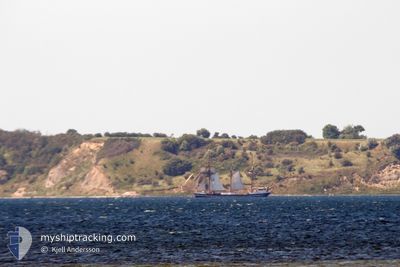
THOR HEYERDAHL
Passengers Ship
Current Trip
KIEL
| Time Travelled | 1 day |
|---|---|
| Remaining Time | --- |
| Distance Travelled | 37.83 nm |
| Remaining Distance | --- |
| AVG Speed | 4.5 Knots |
| MAX Speed | 5.6 Knots |
| AVG Wind | 9 knots |
| MAX Wind | 11 knots |
| MIN Temp | 10.3°C / 50.54°F |
| MAX Temp | 15°C / 59°F |
| Draught | 3 m |
| Position Received | 3 m ago |
Current Position
| Longitude | 10.93324° |
|---|---|
| Latitude | 54.38937° |
| Status | At anchor |
| Speed | |
| Course | 290° |
| Area | Baltic Sea |
| Station | T-AIS |
| Position Received | 3 m ago |
Info
Information
The current position of THOR HEYERDAHL is in Baltic Sea with coordinates 54.38937° / 10.93324° as reported on 2024-05-11 03:20 by AIS to our vessel tracker app. The vessel's current speed is 0 Knots
The vessel THOR HEYERDAHL (IMO: 5221491, MMSI: 211232340) is a Passengers Ship that was built in 1931 ( 93 years old ). It's sailing under the flag of [DE] Germany.
In this page you can find informations about the vessels current position, last detected port calls, and current voyage information. If the vessels is not in coverage by AIS you will find the latest position.
The current position of THOR HEYERDAHL is detected by our AIS receivers and we are not responsible for the reliability of the data. The last position was recorded while the vessel was in Coverage by the Ais receivers of our vessel tracking app.
The current draught of THOR HEYERDAHL as reported by AIS is 3 meters
Weather
| Temperature | 11.4°C / 52.52°F |
|---|---|
| Wind Speed | 8 knots |
| Direction | 334° NNW |
| Pressure | 1023 hPa |
| Humidity | 73.9 % |
| Cloud Coverage | 97 % |
Featured Company
Last Port Calls
| Port | Arrival | Departure | Time In Port |
|---|---|---|---|
| 2024-05-09 07:05 | 2024-05-09 15:59 | 8 h | |
| 2024-05-06 14:28 | 2024-05-07 10:05 | 19 h | |
| 2024-04-20 07:21 | 2024-05-03 18:16 | 13 d | |
| 2024-04-18 13:35 | 2024-04-18 18:12 | 4 h | |
| 2024-04-15 18:22 | 2024-04-18 04:36 | 2 d | |
| 2024-04-10 06:09 | 2024-04-15 09:09 | 5 d |
Most Visited Ports (Last year)
| Port | Arrivals | |
|---|---|---|
| 42 | ||
| 4 | ||
| 3 | ||
| 3 | ||
| 2 | ||
| 2 |
Last Trips
| Origin | Departure | Destination | Arrival | Distance | |
|---|---|---|---|---|---|
| 2024-05-07 12:05 | 2024-05-09 09:05 | 84.48 nm | |||
| 2024-05-03 20:16 | 2024-05-06 16:28 | 67.09 nm | |||
| 2024-04-18 20:12 | 2024-04-20 09:21 | 2.51 nm | |||
| 2024-04-18 06:36 | 2024-04-18 15:35 | 50.03 nm | |||
| 2024-04-15 11:09 | 2024-04-15 20:22 | 55.42 nm | |||
| 2024-02-14 14:10 | 2024-04-10 08:09 | 3648.37 nm |
Events
| Time | Event | Details | Position / Dest | Info |
|---|---|---|---|---|
| 2024-05-11 01:02 | Status Changed | At anchor Default |
54.38931 / 10.93316
KIEL
|
Speed: Course: 299° |
| 2024-05-11 00:56 | Status Changed | Default At anchor |
54.38931 / 10.93319
KIEL
|
Speed: Course: 301° |
| 2024-05-11 00:29 | Status Changed | At anchor Default |
54.38929 / 10.93318
KIEL
|
Speed: Course: 300° |
| 2024-05-11 00:26 | Status Changed | Default At anchor |
54.38930 / 10.93319
KIEL
|
Speed: Course: 299° |
| 2024-05-10 21:53 | Status Changed | At anchor Default |
54.38936 / 10.93317
KIEL
|
Speed: Course: 293° |
| 2024-05-10 21:50 | Status Changed | Default At anchor |
54.38937 / 10.93318
KIEL
|
Speed: Course: 290° |
| 2024-05-10 21:23 | STOP Moving | 2.82 nm, West of HEILIGENHAFEN |
54.38978 / 10.93309
KIEL
|
Speed: 0.3 kn Course: 262° |
| 2024-05-10 21:14 | Status Changed | At anchor Under way using engine |
54.38972 / 10.93169
KIEL
|
Speed: 0.4 kn Course: 166° |
| 2024-05-10 18:29 | Status Changed | Under way using engine Under way sailing |
54.40251 / 10.59269
KIEL
|
Speed: 3.7 kn Course: 91° |
| 2024-05-10 18:15 | START Moving | 10.22 nm, East of WENDTORF |
54.40436 / 10.56820
KIEL
|
Speed: 3.1 kn Course: 93° |