
THOR HEYERDAHL
Passengers Ship
Current Trip
| Time Travelled | 1 day |
|---|---|
| Remaining Time | --- |
| Distance Travelled | 1.56 nm |
| Remaining Distance | --- |
| AVG Speed | --- |
| MAX Speed | --- |
| AVG Wind | 10 knots |
| MAX Wind | 14.8 knots |
| MIN Temp | 3.1°C / 37.58°F |
| MAX Temp | 8.9°C / 48.02°F |
| Tirant d eau | 3 m |
| Position reçue | 2 m depuis |
Current Position
| Longitude | 10.18639° |
|---|---|
| Latitude | 54.36775° |
| Etat | At anchor |
| Vitesse | 0.1 Noeuds |
| Parcours | 345° |
| Zone | North Sea |
| Station | T-AIS |
| Position reçue | 2 m depuis |
Info
Information
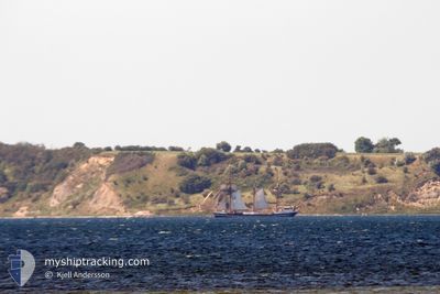
The current position of THOR HEYERDAHL is in North Sea with coordinates 54.36775° / 10.18639° as reported on 2024-04-19 23:30 by AIS to our vessel tracker app. The vessel's current speed is 0.1 Noeuds
The vessel THOR HEYERDAHL (IMO: 5221491, MMSI: 211232340) is a Passengers Ship that was built in 1931 ( 93 Age ). It's sailing under the flag of [DE] Germany.
In this page you can find informations about the vessels current position, last detected port calls, and current voyage information. If the vessels is not in coverage by AIS you will find the latest position.
The current position of THOR HEYERDAHL is detected by our AIS receivers and we are not responsible for the reliability of the data. The last position was recorded while the vessel was in Coverage by the Ais receivers of our vessel tracking app.
The current draught of THOR HEYERDAHL as reported by AIS is 3 meters
Weather
| Temperature | 3.3°C / 37.94°F |
|---|---|
| Wind Speed | 8 knots |
| Direction | 27° NNE |
| Pressure | 1009.5 hPa |
| Humidity | 88.2 % |
| Cloud Coverage | 94 % |
Featured Company
Last Port Calls
| Port | Arrival | Departure | Time In Port |
|---|---|---|---|
| 2024-04-18 13:35 | 2024-04-18 18:12 | 4 h | |
| 2024-04-15 18:22 | 2024-04-18 04:36 | 2 d | |
| 2024-04-10 06:09 | 2024-04-15 09:09 | 5 d | |
| 2024-02-11 14:13 | 2024-02-14 19:10 | 3 d | |
| 2024-02-08 21:55 |
Most Visited Ports (Last year)
| Port | Arrivals | |
|---|---|---|
| 44 | ||
| 4 | ||
| 3 | ||
| 2 | ||
| 2 | ||
| 2 |
Last Trips
| Origin | Departure | Destination | Arrival | Distance | |
|---|---|---|---|---|---|
| 2024-04-18 06:36 | 2024-04-18 15:35 | 50.03 nm | |||
| 2024-04-15 11:09 | 2024-04-15 20:22 | 55.42 nm | |||
| 2024-02-14 14:10 | 2024-04-10 08:09 | 3648.37 nm | |||
| 2024-02-08 16:55 | 2024-02-11 09:13 | 269.50 nm |
Events
| Heure | Evenement | Détails | Position/ Destination | Info |
|---|---|---|---|---|
| 2024-04-18 18:32 | Etat Changé | At anchor Under way using engine |
54.36875 / 10.18642
KIEL
|
Vitesse: 0.3 kn Parcours: 256° |
| 2024-04-18 18:29 | Arret | 0.49 nm, South West of MOELTENORT |
54.36893 / 10.18636
KIEL
|
Vitesse: 0.3 kn Parcours: 255° |
| 2024-04-18 18:12 | PORT DE DEPART |
|
54.36380 / 10.17543
KIEL
|
Vitesse: 5.8 kn Parcours: 27° |
| 2024-04-18 17:45 | Démarrage |
54.32922 / 10.17740
[DE] KIEL
|
Vitesse: 3.1 kn Parcours: 302° |
|
| 2024-04-18 17:38 | Etat Changé | Under way using engine Moored |
54.32857 / 10.17909
[DE] KIEL
|
Vitesse: Parcours: 288° |
| 2024-04-18 14:22 | Etat Changé | Moored Under way using engine |
54.32858 / 10.17912
[DE] KIEL
|
Vitesse: Parcours: 286° |
| 2024-04-18 14:07 | Arret |
54.32887 / 10.18088
[DE] KIEL
|
Vitesse: 0.3 kn Parcours: 253° |
|
| 2024-04-18 13:35 | Port d'arrivée |
|
54.36394 / 10.15225
[DE] KIEL
|
Vitesse: 6.7 kn Parcours: 122.9° |
| 2024-04-18 13:32 | Démarrage | 1.34 nm, South West of STICKENHΟRN SPORT |
54.36590 / 10.14321
KIEL
|
Vitesse: 4.7 kn Parcours: 100° |
| 2024-04-18 12:50 | Arret | 1.4 nm, South West of STICKENHΟRN SPORT |
54.36624 / 10.13991
KIEL
|
Vitesse: 0.2 kn Parcours: 94° |