
THEBEN
Cargo
Current Trip
| Time Travelled | 23 days |
|---|---|
| Remaining Time | --- |
| Distance Travelled | 9234.66 nm |
| Remaining Distance | --- |
| AVG Speed | 16.4 Knots |
| MAX Speed | 19.1 Knots |
| AVG Wind | 11.9 knots |
| MAX Wind | 28.2 knots |
| MIN Temp | 18°C / 64.4°F |
| MAX Temp | 29.3°C / 84.74°F |
| Draught | 10.5 m |
| Position Received | 2 m ago |
Current Position
| Longitude | --- |
|---|---|
| Latitude | --- |
| Status | Under way using engine |
| Speed | 14.7 Knots |
| Course | 348.9° |
| Area | North Atlantic Ocean |
| Station | T-AIS |
| Position Received | 2 m ago |
Info
Information
The current position of THEBEN is in North Atlantic Ocean with coordinates 13.95345° / -17.75643° as reported on 2025-12-15 00:34 by AIS to our vessel tracker app. The vessel's current speed is 14.7 Knots and is heading at the port of PORTBURY. The estimated time of arrival as calculated by MyShipTracking vessel tracking app is 2025-12-21 01:00 LT
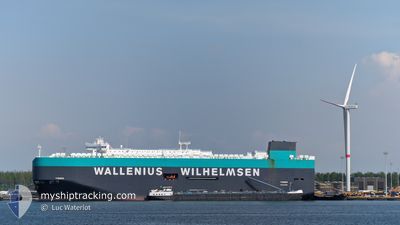
The vessel THEBEN (IMO: 9722302, MMSI: 566044000) is a Cargo It's sailing under the flag of [SG] Singapore.
In this page you can find informations about the vessels current position, last detected port calls, and current voyage information. If the vessels is not in coverage by AIS you will find the latest position.
The current position of THEBEN is detected by our AIS receivers and we are not responsible for the reliability of the data. The last position was recorded while the vessel was in Coverage by the Ais receivers of our vessel tracking app.
The current draught of THEBEN as reported by AIS is 10.5 meters
Weather
| Temperature | 22.1°C / 71.78°F |
|---|---|
| Wind Speed | 18 knots |
| Direction | 18° NNE |
| Pressure | 1015.2 hPa |
| Humidity | 63.6 % |
| Cloud Coverage | 3 % |
Featured Company
Last Port Calls
| Port | Arrival | Departure | Time In Port |
|---|---|---|---|
| 2025-11-21 17:29 | 2025-11-22 00:33 | 7 h | |
| 2025-11-15 01:38 | 2025-11-15 20:40 | 19 h | |
| 2025-11-11 05:59 | 2025-11-11 13:32 | 7 h | |
| 2025-11-08 08:16 | 2025-11-08 22:50 | 14 h | |
| 2025-11-06 17:04 | 2025-11-07 17:00 | 23 h | |
| 2025-11-06 06:04 | 2025-11-06 13:32 | 7 h | |
| 2025-10-21 05:33 | 2025-10-21 18:34 | 13 h | |
| 2025-10-16 05:19 | 2025-10-16 17:19 | 12 h | |
| 2025-10-03 15:50 | 2025-10-04 10:58 | 19 h |
Most Visited Ports (Last year)
| Port | Arrivals | |
|---|---|---|
| 4 | ||
| 3 | ||
| 3 | ||
| 2 | ||
| 2 | ||
| 2 |
Last Trips
| Origin | Departure | Destination | Arrival | Distance | |
|---|---|---|---|---|---|
| 2025-11-15 20:40 | 2025-11-21 17:29 | 2324.05 nm | |||
| 2025-11-11 13:32 | 2025-11-15 01:38 | 626.64 nm | |||
| 2025-11-08 22:50 | 2025-11-11 05:59 | 718.21 nm | |||
| 2025-11-07 17:00 | 2025-11-08 08:16 | 217.26 nm | |||
| 2025-11-06 13:32 | 2025-11-06 17:04 | 45.58 nm | |||
| 2025-10-21 18:34 | 2025-11-06 06:04 | 5426.50 nm | |||
| 2025-10-16 17:19 | 2025-10-21 05:33 | 1180.30 nm | |||
| 2025-10-04 10:58 | 2025-10-16 05:19 | 3215.81 nm | |||
| 2025-09-27 23:29 | 2025-10-03 15:50 | 1624.28 nm |
Events
| Time | Event | Details | Position / Dest | Info |
|---|---|---|---|---|
| 2025-12-14 23:07 | Change Sea Area | Senegalese part of the North Atlantic Ocean Gambian part of the North Atlantic Ocean |
13.59553 / -17.70204
North Atlantic Ocean
GB BRS
|
Speed: 14.9 kn Course: 352.8° |
| 2025-12-14 22:16 | Draught Changed | 10.5 10.6 |
13.38404 / -17.68236
GB BRS
|
Speed: 14.9 kn Course: 356.5° |
| 2025-12-14 22:16 | ETA Changed | 2025/12/21 01:00 2025/12/20 01:00 |
13.38404 / -17.68236
GB BRS
|
Speed: 14.9 kn Course: 356.5° |
| 2025-12-14 21:59 | Status Changed | Under way using engine Default |
13.31453 / -17.67630
GB BRS
|
Speed: 14 kn Course: 355° |
| 2025-12-14 21:41 | Status Changed | Default Under way using engine |
13.24500 / -17.66833
GB BRS
|
Speed: 14.6 kn Course: 351.7° |
| 2025-12-14 21:36 | Status Changed | Under way using engine Default |
13.22537 / -17.66606
GB BRS
|
Speed: 14.5 kn Course: 351° |
| 2025-12-14 21:05 | Status Changed | Default Under way using engine |
13.09833 / -17.63833
GB BRS
|
Speed: 15.1 kn Course: 337.7° |
| 2025-12-14 21:01 | Status Changed | Under way using engine Default |
13.08402 / -17.63300
GB BRS
|
Speed: 15.1 kn Course: 338° |
| 2025-12-14 21:01 | IN Coverage |
13.08402 / -17.63300
North Atlantic Ocean
GB BRS
|
Speed: 15.1 kn Course: 337.7° |
|
| 2025-12-14 21:01 | Change Sea Area | Gambian part of the North Atlantic Ocean Senegalese part of the North Atlantic Ocean |
13.08402 / -17.63300
North Atlantic Ocean
GB BRS
|
Speed: 15.1 kn Course: 337.7° |