
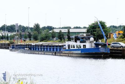
SYMPATHIE
Wing in ground
Current Trip
N/A
| Time Travelled | 18 days |
|---|---|
| Remaining Time | --- |
| Distance Travelled | 170.65 nm |
| Remaining Distance | --- |
| AVG Speed | 5.7 Knots |
| MAX Speed | 7.3 Knots |
| AVG Wind | 5.9 knots |
| MAX Wind | 10.1 knots |
| MIN Temp | 2.6°C / 36.68°F |
| MAX Temp | 18°C / 64.4°F |
| Draught | 1.4 m |
| Position Received | 1 d ago |
Current Position
| Longitude | 7.86080° |
|---|---|
| Latitude | 52.37138° |
| Status | Under way using engine |
| Speed | 4.7 Knots |
| Course | 233.1° |
| Area | North Sea |
| Station | T-AIS |
| Position Received | 1 d ago |
Info
Information
The current position of SYMPATHIE is in North Sea with coordinates 52.37138° / 7.86080° as reported on 2024-05-11 08:12 by AIS to our vessel tracker app. The vessel's current speed is 4.7 Knots
The vessel SYMPATHIE (MMSI: 244660340) is a Wing in ground It's sailing under the flag of [NL] Netherlands.
In this page you can find informations about the vessels current position, last detected port calls, and current voyage information. If the vessels is not in coverage by AIS you will find the latest position.
The current position of SYMPATHIE is detected by our AIS receivers and we are not responsible for the reliability of the data. The last position was recorded while the vessel was in Coverage by the Ais receivers of our vessel tracking app.
The current draught of SYMPATHIE as reported by AIS is 1.4 meters
Weather
| Temperature | 15.6°C / 60.08°F |
|---|---|
| Wind Speed | 7 knots |
| Direction | 65° ENE |
| Pressure | 1023.3 hPa |
| Humidity | 75.2 % |
| Cloud Coverage | 100 % |
Featured Company
Last Port Calls
| Port | Arrival | Departure | Time In Port |
|---|---|---|---|
| 2024-04-24 19:16 | 2024-04-24 20:03 | 47 m | |
| 2024-04-23 14:31 | 2024-04-23 18:17 | 3 h | |
| 2024-04-21 08:34 | 2024-04-22 08:36 | 1 d | |
| 2024-04-21 04:26 | 2024-04-21 05:08 | 41 m | |
| 2024-04-19 14:36 | 2024-04-20 14:29 | 23 h | |
| 2024-04-19 10:09 | 2024-04-19 10:22 | 12 m | |
| 2024-04-18 20:36 | 2024-04-19 07:18 | 10 h | |
| 2024-04-16 11:22 | 2024-04-18 13:25 | 2 d | |
| 2024-03-15 17:44 | 2024-03-15 19:28 | 1 h | |
| 2024-03-15 12:33 | 2024-03-15 14:32 | 1 h |
Most Visited Ports (Last year)
| Port | Arrivals | |
|---|---|---|
| 19 | ||
| 8 | ||
| 7 | ||
| 6 | ||
| 5 | ||
| 5 |
Last Trips
| Origin | Departure | Destination | Arrival | Distance | |
|---|---|---|---|---|---|
| 2024-04-23 18:17 | 2024-04-24 19:16 | 44.76 nm | |||
| 2024-04-22 08:36 | 2024-04-23 14:31 | 82.92 nm | |||
| 2024-04-21 05:08 | 2024-04-21 08:34 | 23.36 nm | |||
| 2024-04-20 14:29 | 2024-04-21 04:26 | 21.81 nm | |||
| 2024-04-19 10:22 | 2024-04-19 14:36 | 34.57 nm | |||
| 2024-04-19 07:18 | 2024-04-19 10:09 | 21.53 nm | |||
| 2024-04-18 13:25 | 2024-04-18 20:36 | 45.01 nm | |||
| 2024-03-15 19:28 | 2024-04-16 11:22 | 77.07 nm | |||
| 2024-03-15 14:32 | 2024-03-15 17:44 | 29.00 nm | |||
| 2024-03-15 10:52 | 2024-03-15 12:33 | 9.06 nm |
Events
| Time | Event | Details | Position / Dest | Info |
|---|---|---|---|---|
| 2024-05-11 08:12 | OUT of Coverage |
52.37138 / 7.86080
North Sea
|
Speed: 4.7 kn Course: 233.1° |
|
| 2024-05-11 04:45 | IN Coverage |
52.35017 / 8.25465
North Sea
|
Speed: 4.9 kn Course: 298.7° |
|
| 2024-05-10 17:41 | OUT of Coverage |
52.34658 / 8.26341
North Sea
|
Speed: Course: 319.2° |
|
| 2024-05-10 17:41 | IN Coverage |
52.34658 / 8.26341
North Sea
|
Speed: Course: 319.2° |
|
| 2024-05-10 08:47 | OUT of Coverage |
52.38887 / 9.34087
North Sea
|
Speed: 4.7 kn Course: 264.7° |
|
| 2024-05-10 07:54 | IN Coverage |
52.39936 / 9.45889
North Sea
|
Speed: 5 kn Course: 248.6° |
|
| 2024-05-10 06:11 | OUT of Coverage |
52.42321 / 9.67644
North Sea
|
Speed: 4.9 kn Course: 266.1° |
|
| 2024-05-10 05:34 | IN Coverage |
52.40504 / 9.75346
North Sea
|
Speed: 4.9 kn Course: 274.7° |
|
| 2024-05-06 17:49 | OUT of Coverage |
52.40656 / 9.74320
North Sea
|
Speed: 7.1 kn Course: 117.2° |
|
| 2024-05-06 12:21 | IN Coverage |
52.30784 / 8.82147
North Sea
|
Speed: 7 kn Course: 122.8° |