
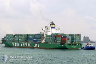
SUNNY PHOENIX
Container Ship
Current Trip
JMKIN
| Time Travelled | 18 h, 23 mins |
|---|---|
| Remaining Time | --- |
| Distance Travelled | 322.85 nm |
| Remaining Distance | --- |
| AVG Speed | 17.8 Knots |
| MAX Speed | 19.1 Knots |
| AVG Wind | 12 knots |
| MAX Wind | 20 knots |
| MIN Temp | 19.7°C / 67.46°F |
| MAX Temp | 26.3°C / 79.34°F |
| Draught | 9.9 m |
| Position Received | 4 d ago |
Current Position
| Longitude | --- |
|---|---|
| Latitude | --- |
| Status | At anchor |
| Speed | |
| Course | 210° |
| Area | Caribbean Sea |
| Station | T-AIS |
| Position Received | 4 d ago |
Info
Information
The current position of SUNNY PHOENIX is in Caribbean Sea with coordinates 17.95884° / -76.77772° as reported on 2026-01-01 19:21 by AIS to our vessel tracker app. The vessel's current speed is 0 Knots
The vessel SUNNY PHOENIX (IMO: 9227027, MMSI: 311001244) is a Container Ship that was built in 2002 ( 24 years old ). It's sailing under the flag of [BS] Bahamas.
In this page you can find informations about the vessels current position, last detected port calls, and current voyage information. If the vessels is not in coverage by AIS you will find the latest position.
The current position of SUNNY PHOENIX is detected by our AIS receivers and we are not responsible for the reliability of the data. The last position was recorded while the vessel was in Coverage by the Ais receivers of our vessel tracking app.
The current draught of SUNNY PHOENIX as reported by AIS is 9.9 meters
Weather
| Temperature | 25.5°C / 77.9°F |
|---|---|
| Wind Speed | 14 knots |
| Direction | 54° NE |
| Pressure | 1016.4 hPa |
| Humidity | 62.6 % |
| Cloud Coverage | --- |
Featured Company
Last Port Calls
| Port | Arrival | Departure | Time In Port |
|---|---|---|---|
| 2026-01-04 05:22 | 2026-01-05 02:30 | 21 h | |
| 2025-12-28 03:54 | 2025-12-28 22:02 | 18 h | |
| 2025-12-25 12:43 | 2025-12-26 00:04 | 11 h | |
| 2025-12-09 16:58 | 2025-12-10 08:26 | 15 h | |
| 2025-12-08 18:02 | 2025-12-09 00:22 | 6 h | |
| 2025-12-08 02:02 | 2025-12-08 12:38 | 10 h | |
| 2025-12-07 12:02 | 2025-12-07 20:22 | 8 h | |
| 2025-12-04 10:18 | 2025-12-04 22:18 | 12 h | |
| 2025-12-02 07:36 | 2025-12-03 04:41 | 21 h | |
| 2025-11-16 04:46 | 2025-11-18 03:34 | 1 d |
Most Visited Ports (Last year)
| Port | Arrivals | |
|---|---|---|
| 11 | ||
| 10 | ||
| 9 | ||
| 7 | ||
| 7 | ||
| 5 |
Last Trips
| Origin | Departure | Destination | Arrival | Distance | |
|---|---|---|---|---|---|
| 2025-12-28 22:02 | 2026-01-04 05:22 | 12.93 nm | |||
| 2025-12-26 00:04 | 2025-12-28 03:54 | 491.90 nm | |||
| 2025-12-10 08:26 | 2025-12-25 12:43 | 4476.80 nm | |||
| 2025-12-09 00:22 | 2025-12-09 16:58 | 202.98 nm | |||
| 2025-12-08 12:38 | 2025-12-08 18:02 | 65.18 nm | |||
| 2025-12-07 20:22 | 2025-12-08 02:02 | 68.39 nm | |||
| 2025-12-04 22:18 | 2025-12-07 12:02 | 816.16 nm | |||
| 2025-12-03 04:41 | 2025-12-04 10:18 | 148.68 nm | |||
| 2025-11-18 03:34 | 2025-12-02 07:36 | 5257.41 nm | |||
| 2025-11-13 00:49 | 2025-11-16 04:46 | 485.94 nm |
Events
| Time | Event | Details | Position / Dest | Info |
|---|---|---|---|---|
| 2026-01-05 07:30 | PORT DEPARTURE |
|
17.96004 / -76.84670
JMKIN
|
Speed: 11.5 kn Course: 245° |
| 2026-01-05 07:19 | START Moving |
17.98083 / -76.82874
[JM] KINGSTON (JM)
|
Speed: 6.5 kn Course: 136° |
|
| 2026-01-04 10:54 | STOP Moving |
17.98752 / -76.83443
[JM] KINGSTON (JM)
|
Speed: 0.1 kn Course: 312° |
|
| 2026-01-04 10:22 | PORT ARRIVAL |
|
17.96535 / -76.81954
[JM] KINGSTON (JM)
|
Speed: 7.5 kn Course: 300° |
| 2026-01-04 10:10 | START Moving | 1.1 nm, East of KINGSTON (JM) |
17.95874 / -76.78975
JMKIN
|
Speed: 11.1 kn Course: 273° |
| 2026-01-01 19:27 | Status Changed | Default At anchor |
17.95882 / -76.77773
JMKIN
|
Speed: Course: 210° |
| 2026-01-01 19:21 | OUT of Coverage |
17.95884 / -76.77772
Caribbean Sea
|
Speed: Course: 273.5° |
|
| 2026-01-01 19:18 | Status Changed | At anchor Default |
17.95884 / -76.77770
JMKIN
|
Speed: Course: 210° |
| 2026-01-01 19:15 | Status Changed | Default At anchor |
17.95885 / -76.77766
JMKIN
|
Speed: Course: 208° |
| 2026-01-01 19:06 | Status Changed | At anchor Default |
17.95883 / -76.77771
JMKIN
|
Speed: Course: 210° |