
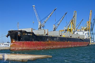
STAR MAINE
Cargo
Current Trip
JP TNY
| Time Travelled | 48 days |
|---|---|
| Remaining Time | --- |
| Distance Travelled | 8809.36 nm |
| Remaining Distance | --- |
| AVG Speed | 13 Knots |
| MAX Speed | 18.9 Knots |
| AVG Wind | 11.4 knots |
| MAX Wind | 26.3 knots |
| MIN Temp | 12.9°C / 55.22°F |
| MAX Temp | 31.6°C / 88.88°F |
| Draught | 12 m |
| Position Received | 5 d ago |
Current Position
| Longitude | 154.04969° |
|---|---|
| Latitude | -27.60576° |
| Status | Under way using engine |
| Speed | 11.6 Knots |
| Course | 1.6° |
| Area | Coral Sea |
| Station | T-AIS |
| Position Received | 5 d ago |
Info
Information
The current position of STAR MAINE is in Coral Sea with coordinates -27.60576° / 154.04969° as reported on 2024-05-08 04:36 by AIS to our vessel tracker app. The vessel's current speed is 11.6 Knots
The vessel STAR MAINE (IMO: 9738959, MMSI: 538006215) is a Cargo It's sailing under the flag of [MH] Marshall Is.
In this page you can find informations about the vessels current position, last detected port calls, and current voyage information. If the vessels is not in coverage by AIS you will find the latest position.
The current position of STAR MAINE is detected by our AIS receivers and we are not responsible for the reliability of the data. The last position was recorded while the vessel was in Coverage by the Ais receivers of our vessel tracking app.
The current draught of STAR MAINE as reported by AIS is 12 meters
Weather
| Temperature | 29.4°C / 84.92°F |
|---|---|
| Wind Speed | 16 knots |
| Direction | 125° SE |
| Pressure | 1008.6 hPa |
| Humidity | 80.1 % |
| Cloud Coverage | 100 % |
Featured Company
Events
| Time | Event | Details | Position / Dest | Info |
|---|---|---|---|---|
| 2024-05-08 04:44 | Status Changed | Default Under way using engine |
-27.58007 / 154.05046
JP TNY
|
Speed: 11.6 kn Course: 1.6° |
| 2024-05-08 04:36 | Change Sea Area | Australian part of the Coral Sea Australian part of the Bass Strait |
-27.60576 / 154.04969
Coral Sea
JP TNY
|
Speed: 11.6 kn Course: 1.6° |
| 2024-05-08 04:36 | Status Changed | Under way using engine Default |
-27.60576 / 154.04969
JP TNY
|
Speed: 11.6 kn Course: 4° |
| 2024-05-08 04:36 | OUT of Coverage |
-27.60576 / 154.04969
Coral Sea
JP TNY
|
Speed: 11.6 kn Course: 1.6° |
|
| 2024-05-08 04:23 | IN Coverage |
-27.60576 / 154.04969
Coral Sea
JP TNY
|
Speed: 11.6 kn Course: 1.6° |
|
| 2024-05-05 07:47 | Status Changed | Default Under way using engine |
-39.11813 / 147.03848
JP TNY
|
Speed: 12 kn Course: 71.6° |
| 2024-05-05 07:40 | OUT of Coverage |
-39.12660 / 147.00620
Bass Strait
JP TNY
|
Speed: 12 kn Course: 71.6° |
|
| 2024-05-05 07:39 | Status Changed | Under way using engine Default |
-39.12805 / 147.00082
JP TNY
|
Speed: 12.1 kn Course: 71° |
| 2024-05-05 07:27 | IN Coverage |
-39.12660 / 147.00620
Bass Strait
JP TNY
|
Speed: 12 kn Course: 71.6° |
|
| 2024-05-05 06:14 | OUT of Coverage |
-39.23786 / 146.65956
Bass Strait
JP TNY
|
Speed: 12.7 kn Course: 65.2° |