
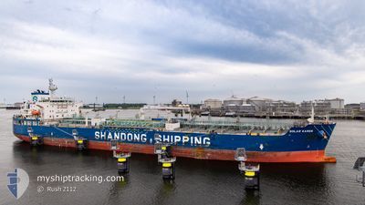
SOLAR KAREN
Tanker
Current Trip
| Time Travelled | 20 h, 14 mins |
|---|---|
| Remaining Time | --- |
| Distance Travelled | 219.60 nm |
| Remaining Distance | --- |
| AVG Speed | 12.2 Knots |
| MAX Speed | 15.6 Knots |
| AVG Wind | 11.2 knots |
| MAX Wind | 16 knots |
| MIN Temp | 26°C / 78.8°F |
| MAX Temp | 28.3°C / 82.94°F |
| Draught | 10.6 m |
| Position Received | 15 h, 47 m ago |
Current Position
| Longitude | --- |
|---|---|
| Latitude | --- |
| Status | Under way using engine |
| Speed | 13.7 Knots |
| Course | 82.3° |
| Area | Singapore Strait |
| Station | T-AIS |
| Position Received | 15 h, 47 m ago |
Info
Information
The current position of SOLAR KAREN is in Singapore Strait with coordinates 1.25959° / 104.19872° as reported on 2024-12-13 08:51 by AIS to our vessel tracker app. The vessel's current speed is 13.7 Knots
The vessel SOLAR KAREN (IMO: 9907823, MMSI: 636019995) is a Tanker It's sailing under the flag of [LR] Liberia.
In this page you can find informations about the vessels current position, last detected port calls, and current voyage information. If the vessels is not in coverage by AIS you will find the latest position.
The current position of SOLAR KAREN is detected by our AIS receivers and we are not responsible for the reliability of the data. The last position was recorded while the vessel was in Coverage by the Ais receivers of our vessel tracking app.
The current draught of SOLAR KAREN as reported by AIS is 10.6 meters
Weather
| Temperature | 27.1°C / 80.78°F |
|---|---|
| Wind Speed | 7 knots |
| Direction | 252° WSW |
| Pressure | 1008.3 hPa |
| Humidity | 77 % |
| Cloud Coverage | 100 % |
Featured Company
Last Port Calls
| Port | Arrival | Departure | Time In Port |
|---|---|---|---|
| 2024-12-12 09:51 | 2024-12-13 04:25 | 18 h | |
| 2024-12-11 04:33 | 2024-12-12 08:56 | 1 d | |
| 2024-12-01 21:51 | 2024-12-02 17:02 | 19 h | |
| 2024-11-30 22:38 | 2024-12-01 13:02 | 14 h | |
| 2024-11-29 07:11 | 2024-11-30 11:30 | 1 d |
Most Visited Ports (Last year)
| Port | Arrivals | |
|---|---|---|
| 3 | ||
| 2 | ||
| 2 | ||
| 2 | ||
| 1 | ||
| 1 |
Last Trips
| Origin | Departure | Destination | Arrival | Distance | |
|---|---|---|---|---|---|
| 2024-12-12 16:56 | 2024-12-12 17:51 | 2.58 nm | |||
| 2024-12-03 02:02 | 2024-12-11 12:33 | 2564.71 nm | |||
| 2024-12-01 22:02 | 2024-12-02 06:51 | 8.02 nm | |||
| 2024-11-30 20:30 | 2024-12-01 07:38 | 50.76 nm | |||
| 2024-09-04 19:35 | 2024-11-29 16:11 | 10884.18 nm |
Events
| Time | Event | Details | Position / Dest | Info |
|---|---|---|---|---|
| 2024-12-13 08:57 | Status Changed | Default Under way using engine |
1.26256 / 104.22006
SGSIN- PGBG
|
Speed: 13.7 kn Course: 82.3° |
| 2024-12-13 08:51 | OUT of Coverage |
1.25959 / 104.19872
Singapore Strait
SGSIN- PGBG
|
Speed: 13.7 kn Course: 82.3° |
|
| 2024-12-13 08:46 | Change Sea Area | Malaysian part of the Singapore Strait Indonesian part of the Singapore Strait |
1.25706 / 104.18082
Singapore Strait
SGSIN- PGBG
|
Speed: 13.8 kn Course: 83.9° |
| 2024-12-13 08:46 | Status Changed | Under way using engine Default |
1.25703 / 104.18038
SGSIN- PGBG
|
Speed: 13.9 kn Course: 86° |
| 2024-12-13 08:45 | Status Changed | Default Under way using engine |
1.25646 / 104.17433
SGSIN- PGBG
|
Speed: 14.1 kn Course: 81.7° |
| 2024-12-13 05:46 | Status Changed | Under way using engine Default |
1.10418 / 103.54963
SGSIN- PGBG
|
Speed: 12.7 kn Course: 149° |
| 2024-12-13 05:45 | Status Changed | Default Under way using engine |
1.10782 / 103.54739
SGSIN- PGBG
|
Speed: 12.2 kn Course: 169.2° |
| 2024-12-13 04:59 | Change Sea Area | Indonesian part of the Singapore Strait Singaporean part of the Singapore Strait |
1.19787 / 103.63864
Singapore Strait
SGSIN- PGBG
|
Speed: 9.8 kn Course: 250.6° |
| 2024-12-13 04:27 | Draught Changed | 10.6 9.6 |
1.23662 / 103.69546
SGSIN- PGBG
|
Speed: 7.5 kn Course: 199.7° |
| 2024-12-13 04:27 | ETA Changed | 2024/12/16 16:00 2025/10/12 20:00 |
1.23662 / 103.69546
SGSIN- PGBG
|
Speed: 7.5 kn Course: 199.7° |