
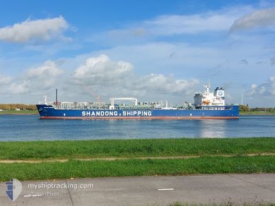
SOLAR KAREN
Tanker
Current Trip
| Time Travelled | 10 days |
|---|---|
| Remaining Time | 2 days |
| Distance Travelled | 2533.45 nm |
| Remaining Distance | 969.78 nm |
| AVG Speed | 11.8 Knop |
| MAX Speed | 14.6 Knop |
| AVG Wind | 13.9 knots |
| MAX Wind | 28.8 knots |
| MIN Temp | 21.6°C / 70.88°F |
| MAX Temp | 33.1°C / 91.58°F |
| Djupgående | 12 m |
| Position mottagen | 3 d sen |
Current Position
| Longitud | -80.47644° |
|---|---|
| Latitude | 6.96535° |
| Status | Under way using engine |
| Fart | 12.2 Knop |
| Kurs | 267.4° |
| Område | North Pacific Ocean |
| Station | T-AIS |
| Position mottagen | 3 d sen |
Info
Information
The current position of SOLAR KAREN is in North Pacific Ocean with coordinates 6.96535° / -80.47644° as reported on 2024-04-15 16:34 by AIS to our vessel tracker app. The vessel's current speed is 12.2 Knop and is heading at the port of CRISTOBAL. The estimated time of arrival as calculated by MyShipTracking vessel tracking app is 2024-04-22 01:54 LT
The vessel SOLAR KAREN (IMO: 9907823, MMSI: 636019995) is a Tanker It's sailing under the flag of [LR] Liberia.
In this page you can find informations about the vessels current position, last detected port calls, and current voyage information. If the vessels is not in coverage by AIS you will find the latest position.
The current position of SOLAR KAREN is detected by our AIS receivers and we are not responsible for the reliability of the data. The last position was recorded while the vessel was in Coverage by the Ais receivers of our vessel tracking app.
The current draught of SOLAR KAREN as reported by AIS is 12 meters
Weather
| Temperature | 27°C / 80.6°F |
|---|---|
| Wind Speed | 6 knots |
| Direction | 310° NW |
| Pressure | 1011.1 hPa |
| Humidity | 72.8 % |
| Cloud Coverage | 39 % |
Featured Company
Last Port Calls
| Port | Arrival | Departure | Time In Port |
|---|---|---|---|
| 2024-04-06 08:51 | 2024-04-08 23:00 | 2 d | |
| 2024-03-24 19:01 | 2024-03-25 17:42 | 22 h | |
| 2024-03-07 11:16 | 2024-03-09 15:18 | 2 d | |
| 2024-03-04 22:51 | 2024-03-06 17:00 | 1 d | |
| 2024-02-08 08:46 | 2024-02-09 19:00 | 1 d | |
| 2024-02-01 21:23 | 2024-02-04 23:06 | 3 d |
Last Trips
| Origin | Departure | Destination | Arrival | Distance | |
|---|---|---|---|---|---|
| 2024-03-25 12:42 | 2024-04-06 03:51 | 2982.67 nm | |||
| 2024-03-09 09:18 | 2024-03-24 14:01 | 2977.38 nm | |||
| 2024-03-06 11:00 | 2024-03-07 05:16 | 45.52 nm | |||
| 2024-02-09 13:00 | 2024-03-04 16:51 | 3382.60 nm | |||
| 2024-02-04 17:06 | 2024-02-08 02:46 | 971.73 nm | |||
| 2023-12-27 17:30 | 2024-02-01 15:23 | 819.32 nm |
Events
| Tid | Event | Detaljer | Position / Dest | Information |
|---|---|---|---|---|
| 2024-04-18 15:15 | STOPPAR förflyttning | 4.12 nm, West of PUERTO QUETZAL |
13.90682 / -90.85859
USHOU>PACTB
|
Fart: 0.1 kn Kurs: 147° |
| 2024-04-18 13:04 | STARTAR förflyttning | 2.35 nm, South West of PUERTO QUETZAL |
13.89645 / -90.82210
USHOU>PACTB
|
Fart: 3.8 kn Kurs: 280° |
| 2024-04-18 05:11 | STOPPAR förflyttning | 1.84 nm, South West of PUERTO QUETZAL |
13.89319 / -90.80599
USHOU>PACTB
|
Fart: 0.2 kn Kurs: 295° |
| 2024-04-15 16:39 | Status ändrad | Default Under way using engine |
6.96555 / -80.49232
USHOU>PACTB
|
Fart: 12.2 kn Kurs: 267.4° |
| 2024-04-15 16:34 | UTANFÖR täckningsområde |
6.96535 / -80.47644
North Pacific Ocean
|
Fart: 12.2 kn Kurs: 267.4° |
|
| 2024-04-15 16:17 | Status ändrad | Under way using engine Default |
6.96725 / -80.41482
USHOU>PACTB
|
Fart: 13.8 kn Kurs: 269° |
| 2024-04-15 16:08 | I täckningsområde |
6.96725 / -80.41482
North Pacific Ocean
|
Fart: 13.6 kn Kurs: 268.5° |
|
| 2024-04-15 07:33 | Status ändrad | Default Under way using engine |
8.44275 / -79.45283
USHOU>PACTB
|
Fart: 13 kn Kurs: 177.3° |
| 2024-04-15 07:31 | UTANFÖR täckningsområde |
8.45312 / -79.45315
North Pacific Ocean
|
Fart: 13 kn Kurs: 177.3° |
|
| 2024-04-15 05:07 | Byter havsområde | Panamanian part of the North Pacific Ocean Panamanian part of the Caribbean Sea |
8.90967 / -79.53903
North Pacific Ocean
|
Fart: 8 kn Kurs: 142.1° |