
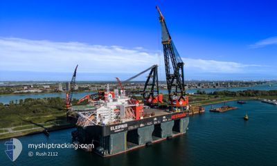
SLEIPNIR
Reserved for future use
Current Trip
| Time Travelled | 16 h, 53 mins |
|---|---|
| Remaining Time | 21 days |
| Distance Travelled | 132.57 nm |
| Remaining Distance | 3191.98 nm |
| AVG Speed | 7.9 Knots |
| MAX Speed | 9.9 Knots |
| AVG Wind | 12.1 knots |
| MAX Wind | 15 knots |
| MIN Temp | 7.6°C / 45.68°F |
| MAX Temp | 10.9°C / 51.62°F |
| Draught | 12.5 m |
| Position Received | Now |
Current Position
| Longitude | --- |
|---|---|
| Latitude | --- |
| Status | Under way using engine |
| Speed | 6.8 Knots |
| Course | 221.9° |
| Area | English Channel |
| Station | T-AIS |
| Position Received | Now |
Info
Information
The current position of SLEIPNIR is in English Channel with coordinates 50.96784° / 1.29052° as reported on 2025-12-21 13:30 by AIS to our vessel tracker app. The vessel's current speed is 6.8 Knots and is heading at the port of NEW YORK. The estimated time of arrival as calculated by MyShipTracking vessel tracking app is 2026-01-11 19:01 LT
The vessel SLEIPNIR (IMO: 9781425, MMSI: 374887000) is a Reserved for future use It's sailing under the flag of [PA] Panama.
In this page you can find informations about the vessels current position, last detected port calls, and current voyage information. If the vessels is not in coverage by AIS you will find the latest position.
The current position of SLEIPNIR is detected by our AIS receivers and we are not responsible for the reliability of the data. The last position was recorded while the vessel was in Coverage by the Ais receivers of our vessel tracking app.
The current draught of SLEIPNIR as reported by AIS is 12.5 meters
Weather
| Temperature | 10.8°C / 51.44°F |
|---|---|
| Wind Speed | 11 knots |
| Direction | 75° ENE |
| Pressure | 1007 hPa |
| Humidity | 88.2 % |
| Cloud Coverage | 100 % |
Featured Company
Last Port Calls
Last Trips
| Origin | Departure | Destination | Arrival | Distance | |
|---|---|---|---|---|---|
| 2025-11-15 07:12 | 2025-11-24 00:33 | 413.00 nm | |||
| 2025-10-21 17:07 | 2025-10-21 17:08 | 1.40 nm | |||
| 2025-10-14 21:50 | 2025-10-19 09:35 | 103.18 nm | |||
| 2025-10-13 21:03 | 2025-10-13 21:08 | 1.46 nm | |||
| 2025-08-25 22:29 | 2025-10-09 01:22 | 736.20 nm |
Events
| Time | Event | Details | Position / Dest | Info |
|---|---|---|---|---|
| 2025-12-21 12:02 | Detected in Sea | United Kingdom part of the English Channel |
51.07483 / 1.46438
English Channel
US NYC
|
Speed: 6.4 kn Course: 230.4° |
| 2025-12-21 05:07 | Draught Changed | 12.5 17.5 |
51.82141 / 2.49103
US NYC
|
Speed: 7.9 kn Course: 229.7° |
| 2025-12-21 05:05 | Change Sea Area | United Kingdom part of the North Sea Belgian part of the North Sea |
51.82471 / 2.49734
North Sea
US NYC
|
Speed: 7.9 kn Course: 229.8° |
| 2025-12-21 05:01 | Status Changed | Under way using engine Constrained by her draught |
51.82987 / 2.50720
US NYC
|
Speed: 7.8 kn Course: 229.6° |
| 2025-12-21 04:42 | Detected in Sea | Belgian part of the North Sea |
51.85225 / 2.56193
North Sea
US NYC
|
Speed: 7.5 kn Course: 226.1° |
| 2025-12-20 20:38 | PORT DEPARTURE |
|
51.96828 / 4.11698
US NYC
|
Speed: 5.5 kn Course: 296° |
| 2025-12-20 19:49 | START Moving |
51.92769 / 4.20179
[NL] ROTTERDAM
|
Speed: 4.1 kn Course: 315° |
|
| 2025-12-20 18:49 | ETA Changed | 2026/01/12 11:00 2025/12/12 11:00 |
51.92602 / 4.20884
[NL] ROTTERDAM
|
Speed: Course: 129° |
| 2025-12-20 18:47 | Status Changed | Constrained by her draught Moored |
51.92602 / 4.20884
[NL] ROTTERDAM
|
Speed: Course: 129° |
| 2025-12-20 18:47 | Draught Changed | 17.5 12.2 |
51.92602 / 4.20883
[NL] ROTTERDAM
|
Speed: Course: 129° |