
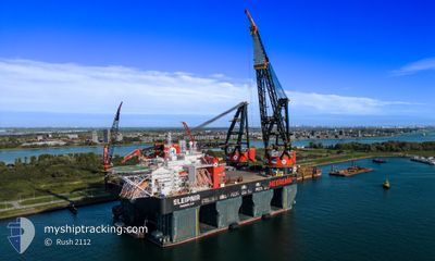
SLEIPNIR
Other Type
Current Trip
| Time Travelled | 8 days |
|---|---|
| Remaining Time | --- |
| Distance Travelled | 474.04 nm |
| Remaining Distance | --- |
| AVG Speed | 7.3 Knopen |
| MAX Speed | 9.7 Knopen |
| AVG Wind | 14.6 knots |
| MAX Wind | 24.3 knots |
| MIN Temp | 3.5°C / 38.3°F |
| MAX Temp | 8.7°C / 47.66°F |
| Diepgang | 19.5 M |
| Positie ontvangen | Nu |
Current Position
| Lengtegraad | 5.68793° |
|---|---|
| Breedtegraat | 59.00878° |
| Status | Restricted manoeuverability |
| Snelheid | |
| Koers | 325° |
| Gebied | North Sea |
| Station | T-AIS |
| Positie ontvangen | Nu |
Info
Information
The current position of SLEIPNIR is in North Sea with coordinates 59.00878° / 5.68793° as reported on 2024-04-25 19:51 by AIS to our vessel tracker app. The vessel's current speed is 0 Knopen
The vessel SLEIPNIR (IMO: 9781425, MMSI: 374887000) is a Other Type It's sailing under the flag of [PA] Panama.
In this page you can find informations about the vessels current position, last detected port calls, and current voyage information. If the vessels is not in coverage by AIS you will find the latest position.
The current position of SLEIPNIR is detected by our AIS receivers and we are not responsible for the reliability of the data. The last position was recorded while the vessel was in Coverage by the Ais receivers of our vessel tracking app.
The current draught of SLEIPNIR as reported by AIS is 19.5 meters
Weather
| Temperature | 4.3°C / 39.74°F |
|---|---|
| Wind Speed | 2 knots |
| Direction | 302° WNW |
| Pressure | 1005.5 hPa |
| Humidity | 77.6 % |
| Cloud Coverage | 100 % |
Featured Company
Most Visited Ports (Last year)
| Port | Arrivals | |
|---|---|---|
| 1 |
Last Trips
| Origin | Departure | Destination | Arrival | Distance |
|---|
Events
| Tijd | Evenement | Details | Positie / Bestemming | Info |
|---|---|---|---|---|
| 2024-04-19 10:58 | Status Changed | Restricted manoeuverability Under way using engine |
59.00859 / 5.68717
NL RTM>NO SVG
|
Snelheid: Koers: 5° |
| 2024-04-19 10:28 | Stop beweging | 0.75 nm, North East of DUSANIK |
59.00862 / 5.68720
NL RTM>NO SVG
|
Snelheid: 0.1 kn Koers: 6° |
| 2024-04-19 08:21 | Status Changed | Under way using engine Restricted manoeuverability |
59.04397 / 5.24496
NL RTM>NO SVG
|
Snelheid: 8.4 kn Koers: 56.8° |
| 2024-04-19 07:25 | Start beweging | 10.66 nm, South of SKUDENESHAVN |
58.97682 / 5.14872
NL RTM>NO SVG
|
Snelheid: 3.5 kn Koers: 36° |
| 2024-04-19 06:50 | Draught Changed | 19.5 12 |
58.97243 / 5.14816
NL RTM>NO SVG
|
Snelheid: 0.1 kn Koers: 16° |
| 2024-04-19 06:50 | ETA Changed | 2024/04/19 10:30 2024/04/20 18:00 |
58.97243 / 5.14816
NL RTM>NO SVG
|
Snelheid: 0.1 kn Koers: 16° |
| 2024-04-19 06:50 | Status Changed | Restricted manoeuverability Under way using engine |
58.97243 / 5.14816
NL RTM>NO SVG
|
Snelheid: 0.2 kn Koers: 16° |
| 2024-04-19 05:41 | Stop beweging | 10.75 nm, South of SKUDENESHAVN |
58.97499 / 5.14995
NL RTM>NO SVG
|
Snelheid: 0.2 kn Koers: 343° |
| 2024-04-18 11:59 | Wijzig zee gebeid | Norwegian part of the North Sea Danish part of the North Sea |
56.58552 / 4.99103
North Sea
NL RTM>NO SVG
|
Snelheid: 8.3 kn Koers: 1.4° |
| 2024-04-18 02:02 | Gevonden in zee | Danish part of the North Sea |
55.30605 / 5.01242
North Sea
NL RTM>NO SVG
|
Snelheid: 7.6 kn Koers: 352.9° |