
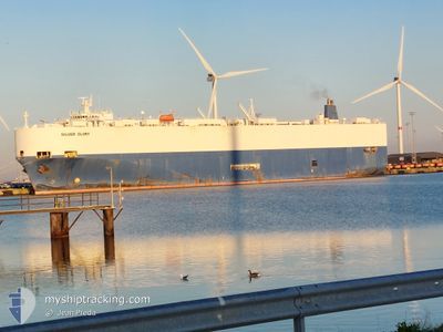
SILVER GLORY
Vehicles Carrier
Current Trip
| Trip Time | 17 days |
|---|---|
| Trip Distance | 3127.35 nm |
| AVG Speed | 12.3 Knots |
| MAX Speed | 17 Knots |
| Draught | 8.9 m |
| AVG Wind | 13.7 knots |
| MAX Wind | 30 knots |
| MIN Temp | 6.3°C / 43.34°F |
| MAX Temp | 27.6°C / 81.68°F |
| Position Received | 9 d ago |
Current Position
| Longitude | --- |
|---|---|
| Latitude | --- |
| Status | Under way using engine |
| Speed | 14.8 Knots |
| Course | 136.5° |
| Area | North Atlantic Ocean |
| Station | T-AIS |
| Position Received | 9 d ago |
Info
Information
The current position of SILVER GLORY is in North Atlantic Ocean with coordinates 10.44944° / -16.97129° as reported on 2025-12-28 09:09 by AIS to our vessel tracker app. The vessel's current speed is 14.8 Knots and is currently inside the port of CONAKRY.
The vessel SILVER GLORY (IMO: 9070474, MMSI: 355989000) is a Vehicles Carrier that was built in 1994 ( 32 years old ). It's sailing under the flag of [PA] Panama.
In this page you can find informations about the vessels current position, last detected port calls, and current voyage information. If the vessels is not in coverage by AIS you will find the latest position.
The current position of SILVER GLORY is detected by our AIS receivers and we are not responsible for the reliability of the data. The last position was recorded while the vessel was in Coverage by the Ais receivers of our vessel tracking app.
The current draught of SILVER GLORY as reported by AIS is 8.9 meters
Weather
| Temperature | 26.5°C / 79.7°F |
|---|---|
| Wind Speed | 2 knots |
| Direction | 223° SW |
| Pressure | 1012.9 hPa |
| Humidity | 67.8 % |
| Cloud Coverage | 100 % |
Featured Company
Last Port Calls
| Port | Arrival | Departure | Time In Port |
|---|---|---|---|
| 2026-01-06 06:19 | |||
| 2025-12-17 22:07 | 2025-12-19 21:05 | 1 d | |
| 2025-12-15 21:53 | 2025-12-16 23:25 | 1 d | |
| 2025-11-20 22:56 | 2025-11-21 19:33 | 20 h | |
| 2025-11-17 08:32 | 2025-11-18 21:11 | 1 d | |
| 2025-11-07 22:00 | 2025-11-08 16:20 | 18 h | |
| 2025-11-03 14:22 | 2025-11-04 10:10 | 19 h |
Most Visited Ports (Last year)
| Port | Arrivals | |
|---|---|---|
| 5 | ||
| 5 | ||
| 4 | ||
| 4 | ||
| 4 | ||
| 3 |
Last Trips
| Origin | Departure | Destination | Arrival | Distance | |
|---|---|---|---|---|---|
| 2025-12-19 21:05 | 2026-01-06 06:19 | 3127.35 nm | |||
| 2025-12-16 23:25 | 2025-12-17 22:07 | 306.53 nm | |||
| 2025-11-21 19:33 | 2025-12-15 21:53 | 7330.66 nm | |||
| 2025-11-18 21:11 | 2025-11-20 22:56 | 456.65 nm | |||
| 2025-11-08 16:20 | 2025-11-17 08:32 | 3050.83 nm | |||
| 2025-11-04 10:10 | 2025-11-07 22:00 | 1177.24 nm | |||
| 2025-10-25 21:03 | 2025-11-03 14:22 | 509.82 nm |
Events
| Time | Event | Details | Position / Dest | Info |
|---|---|---|---|---|
| 2026-01-06 06:24 | STOP Moving |
9.51252 / -13.72329
[GN] CONAKRY
|
Speed: 0.3 kn Course: 36° |
|
| 2026-01-06 06:19 | PORT ARRIVAL |
|
9.51189 / -13.72433
[GN] CONAKRY
|
Speed: 6.4 kn Course: 0° |
| 2026-01-06 03:20 | START Moving | 17.6 nm, South West of KASSA |
9.20704 / -13.86537
BE ANR>>GN CKY
|
Speed: 9.3 kn Course: 5° |
| 2025-12-28 23:12 | STOP Moving | 18.2 nm, South West of KASSA |
9.19599 / -13.86527
BE ANR>>GN CKY
|
Speed: 0.2 kn Course: 282° |
| 2025-12-28 09:13 | Status Changed | Default Under way using engine |
10.43782 / -16.96005
BE ANR>>GN CKY
|
Speed: 14.8 kn Course: 136.5° |
| 2025-12-28 09:09 | OUT of Coverage |
10.44944 / -16.97129
North Atlantic Ocean
BE ANR>>GN CKY
|
Speed: 14.8 kn Course: 136.5° |
|
| 2025-12-28 07:20 | Status Changed | Under way using engine Default |
10.78586 / -17.28713
BE ANR>>GN CKY
|
Speed: 15 kn Course: 135° |
| 2025-12-28 07:19 | Status Changed | Default Under way using engine |
10.78866 / -17.28991
BE ANR>>GN CKY
|
Speed: 15 kn Course: 135.7° |
| 2025-12-28 07:17 | Status Changed | Under way using engine Default |
10.79396 / -17.29516
BE ANR>>GN CKY
|
Speed: 15.1 kn Course: 137° |
| 2025-12-28 06:12 | OUT of Coverage |
10.98493 / -17.47974
North Atlantic Ocean
BE ANR>>GN CKY
|
Speed: 14.6 kn Course: 137.7° |