
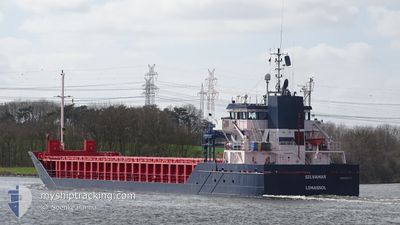
SILVAMAR
General Cargo
Current Trip
| Time Travelled | 4 days |
|---|---|
| Remaining Time | 5 h, 41 mins |
| Distance Travelled | 1008.63 nm |
| Remaining Distance | 55.66 nm |
| AVG Speed | 9.7 Knots |
| MAX Speed | 15.9 Knots |
| AVG Wind | 8.7 knots |
| MAX Wind | 21 knots |
| MIN Temp | 3.3°C / 37.94°F |
| MAX Temp | 15.9°C / 60.62°F |
| Draught | 6 m |
| Position Received | 1 m ago |
Current Position
| Longitude | 3.39215° |
|---|---|
| Latitude | 52.20499° |
| Status | Under way using engine |
| Speed | 9 Knots |
| Course | 189° |
| Area | North Sea |
| Station | T-AIS |
| Position Received | 1 m ago |
Info
Information
The current position of SILVAMAR is in North Sea with coordinates 52.20499° / 3.39215° as reported on 2024-05-07 13:41 by AIS to our vessel tracker app. The vessel's current speed is 9 Knots and is heading at the port of VLISSINGEN. The estimated time of arrival as calculated by MyShipTracking vessel tracking app is 2024-05-07 19:23 LT
The vessel SILVAMAR (IMO: 9313773, MMSI: 209708000) is a General Cargo that was built in 2004 ( 20 years old ). It's sailing under the flag of [CY] Cyprus.
In this page you can find informations about the vessels current position, last detected port calls, and current voyage information. If the vessels is not in coverage by AIS you will find the latest position.
The current position of SILVAMAR is detected by our AIS receivers and we are not responsible for the reliability of the data. The last position was recorded while the vessel was in Coverage by the Ais receivers of our vessel tracking app.
The current draught of SILVAMAR as reported by AIS is 6 meters
Weather
| Temperature | 12.4°C / 54.32°F |
|---|---|
| Wind Speed | 10 knots |
| Direction | 7° N |
| Pressure | 1021.8 hPa |
| Humidity | 78.8 % |
| Cloud Coverage | --- |
Featured Company
Last Port Calls
| Port | Arrival | Departure | Time In Port |
|---|---|---|---|
| 2024-04-30 19:46 | 2024-05-03 13:06 | 2 d | |
| 2024-04-29 16:28 | 2024-04-30 12:04 | 19 h | |
| 2024-04-27 06:00 | 2024-04-27 23:12 | 17 h | |
| 2024-04-24 23:05 | 2024-04-26 08:08 | 1 d | |
| 2024-04-11 09:54 | 2024-04-12 22:47 | 1 d | |
| 2024-04-07 08:13 | 2024-04-10 19:05 | 3 d | |
| 2024-03-28 01:44 | 2024-04-03 14:29 | 6 d | |
| 2024-03-20 07:11 | 2024-03-21 11:11 | 1 d | |
| 2024-03-19 00:18 | 2024-03-19 16:26 | 16 h | |
| 2024-03-11 18:54 | 2024-03-12 19:05 | 1 d |
Last Trips
| Origin | Departure | Destination | Arrival | Distance | |
|---|---|---|---|---|---|
| 2024-04-30 14:04 | 2024-04-30 22:46 | 90.78 nm | |||
| 2024-04-28 02:12 | 2024-04-29 18:28 | 431.94 nm | |||
| 2024-04-26 10:08 | 2024-04-27 09:00 | 241.62 nm | |||
| 2024-04-13 00:47 | 2024-04-25 01:05 | 906.26 nm | |||
| 2024-04-10 21:05 | 2024-04-11 11:54 | 160.87 nm | |||
| 2024-04-03 16:29 | 2024-04-07 10:13 | 880.47 nm | |||
| 2024-03-21 12:11 | 2024-03-28 02:44 | 1342.57 nm | |||
| 2024-03-19 17:26 | 2024-03-20 08:11 | 158.40 nm | |||
| 2024-03-12 21:05 | 2024-03-19 01:18 | 997.45 nm | |||
| 2024-03-11 13:36 | 2024-03-11 20:54 | 79.97 nm |
Events
| Time | Event | Details | Position / Dest | Info |
|---|---|---|---|---|
| 2024-05-07 13:27 | ETA Changed | 2024/05/08 10:00 2024/05/07 21:30 |
52.24019 / 3.40151
NLVLI
|
Speed: 8.9 kn Course: 187.9° |
| 2024-05-07 13:09 | Status Changed | Under way using engine Default |
52.28446 / 3.41245
NLVLI
|
Speed: 9 kn Course: 191° |
| 2024-05-07 13:00 | Status Changed | Default Under way using engine |
52.30573 / 3.41861
NLVLI
|
Speed: 9 kn Course: 190.1° |
| 2024-05-07 12:56 | Status Changed | Under way using engine Default |
52.31633 / 3.42192
NLVLI
|
Speed: 9 kn Course: 191° |
| 2024-05-07 12:51 | Status Changed | Default Under way using engine |
52.32834 / 3.42500
NLVLI
|
Speed: 9.1 kn Course: 193.3° |
| 2024-05-07 12:24 | Status Changed | Under way using engine Default |
52.39782 / 3.44960
NLVLI
|
Speed: 10 kn Course: 190° |
| 2024-05-07 12:18 | Status Changed | Default Under way using engine |
52.41167 / 3.45333
NLVLI
|
Speed: 9.7 kn Course: 187.4° |
| 2024-05-07 08:52 | Status Changed | Under way using engine Default |
52.94977 / 4.00332
NLVLI
|
Speed: 12 kn Course: 231° |
| 2024-05-07 08:11 | Status Changed | Default Under way using engine |
53.03667 / 4.18167
NLVLI
|
Speed: 12.2 kn Course: 229.3° |
| 2024-05-07 08:02 | Status Changed | Under way using engine Default |
53.05883 / 4.22372
NLVLI
|
Speed: 12.1 kn Course: 228° |