
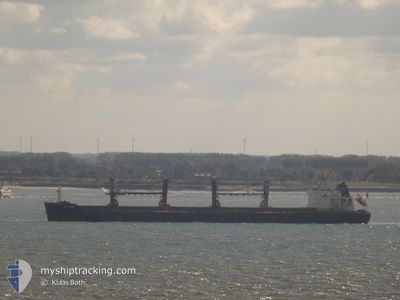
SFL HUDSON
Cargo
Current Trip
| Time Travelled | 3 days |
|---|---|
| Remaining Time | 5 days |
| Distance Travelled | 910.50 nm |
| Remaining Distance | 1697.43 nm |
| AVG Speed | 9.7 Knots |
| MAX Speed | 12.8 Knots |
| AVG Wind | 9 knots |
| MAX Wind | 26 knots |
| MIN Temp | 16.1°C / 60.98°F |
| MAX Temp | 20.3°C / 68.54°F |
| Draught | 10.4 m |
| Position Received | 1 h, 36 m ago |
Current Position
| Longitude | -8.92870° |
|---|---|
| Latitude | 33.26767° |
| Status | Under way using engine |
| Speed | 12 Knots |
| Course | 214° |
| Area | North Atlantic Ocean |
| Station | T-AIS |
| Position Received | 1 h, 36 m ago |
Info
Information
The current position of SFL HUDSON is in North Atlantic Ocean with coordinates 33.26767° / -8.92870° as reported on 2024-05-13 12:09 by AIS to our vessel tracker app. The vessel's current speed is 12 Knots and is heading at the port of CONAKRY. The estimated time of arrival as calculated by MyShipTracking vessel tracking app is 2024-05-19 12:07 LT
The vessel SFL HUDSON (IMO: 9525821, MMSI: 538004096) is a Cargo It's sailing under the flag of [MH] Marshall Is.
In this page you can find informations about the vessels current position, last detected port calls, and current voyage information. If the vessels is not in coverage by AIS you will find the latest position.
The current position of SFL HUDSON is detected by our AIS receivers and we are not responsible for the reliability of the data. The last position was recorded while the vessel was in Coverage by the Ais receivers of our vessel tracking app.
The current draught of SFL HUDSON as reported by AIS is 10.4 meters
Weather
| Temperature | 18.7°C / 65.66°F |
|---|---|
| Wind Speed | 14 knots |
| Direction | 11° N |
| Pressure | 1016.2 hPa |
| Humidity | 87.9 % |
| Cloud Coverage | 99 % |
Featured Company
Last Port Calls
| Port | Arrival | Departure | Time In Port |
|---|---|---|---|
| 2024-05-01 14:22 | 2024-05-09 15:07 | 8 d | |
| 2024-04-27 11:28 | 2024-04-28 13:22 | 1 d | |
| 2024-04-03 08:01 | 2024-04-06 22:30 | 3 d | |
| 2024-03-04 00:39 | 2024-03-05 12:21 | 1 d |
Most Visited Ports (Last year)
| Port | Arrivals | |
|---|---|---|
| 2 | ||
| 2 | ||
| 1 | ||
| 1 | ||
| 1 | ||
| 1 |
Last Trips
| Origin | Departure | Destination | Arrival | Distance | |
|---|---|---|---|---|---|
| 2024-04-28 14:22 | 2024-05-01 15:22 | 553.55 nm | |||
| 2024-04-06 22:30 | 2024-04-27 12:28 | 450.76 nm | |||
| 2024-03-05 07:21 | 2024-04-03 08:01 | 4265.90 nm | |||
| 2024-02-26 14:04 | 2024-03-03 19:39 | 1613.93 nm |
Events
| Time | Event | Details | Position / Dest | Info |
|---|---|---|---|---|
| 2024-05-13 12:12 | Status Changed | Default Under way using engine |
33.25712 / -8.93750
CONAKRY
|
Speed: 12 kn Course: 214° |
| 2024-05-13 12:09 | OUT of Coverage |
33.26767 / -8.92870
North Atlantic Ocean
CONAKRY
|
Speed: 12 kn Course: 214° |
|
| 2024-05-13 12:08 | Status Changed | Under way using engine Default |
33.27092 / -8.92608
CONAKRY
|
Speed: 11.9 kn Course: 214° |
| 2024-05-13 11:18 | Status Changed | Default Under way using engine |
33.40577 / -8.81053
CONAKRY
|
Speed: 12 kn Course: 217° |
| 2024-05-13 11:09 | Status Changed | Under way using engine Default |
33.42823 / -8.79072
CONAKRY
|
Speed: 12 kn Course: 216° |
| 2024-05-13 10:31 | Status Changed | Default Under way using engine |
33.53119 / -8.69775
CONAKRY
|
Speed: 11.7 kn Course: 218° |
| 2024-05-13 10:20 | Status Changed | Under way using engine Default |
33.55997 / -8.67212
CONAKRY
|
Speed: 11.8 kn Course: 218° |
| 2024-05-13 09:48 | Status Changed | Default Under way using engine |
33.64302 / -8.59568
CONAKRY
|
Speed: 11.7 kn Course: 218° |
| 2024-05-13 09:36 | Status Changed | Under way using engine Default |
33.67343 / -8.56722
CONAKRY
|
Speed: 11.7 kn Course: 213° |
| 2024-05-13 08:59 | Status Changed | Default Under way using engine |
33.77260 / -8.48133
CONAKRY
|
Speed: 11.5 kn Course: 217° |