
SENIORITY
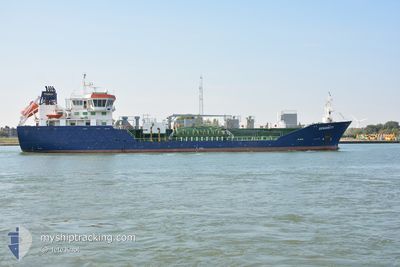
Oil/Chemical Tanker
Current Trip
| Time Travelled | 1 day |
|---|---|
| Remaining Time | 3 h, 23 mins |
| Distance Travelled | 379.53 nm |
| Remaining Distance | 37.93 nm |
| AVG Speed | 10.4 Knots |
| MAX Speed | 12.9 Knots |
| AVG Wind | 15.9 knots |
| MAX Wind | 31 knots |
| MIN Temp | 8.6°C / 47.48°F |
| MAX Temp | 12.6°C / 54.68°F |
| Draught | 5 m |
| Position Received | 7 h, 46 m ago |
Current Position
| Longitude | --- |
|---|---|
| Latitude | --- |
| Status | Under way using engine |
| Speed | 11.4 Knots |
| Course | 143.9° |
| Area | North Sea |
| Station | T-AIS |
| Position Received | 7 h, 46 m ago |
Info
Information
The current position of SENIORITY is in North Sea with coordinates 52.85160° / 2.07942° as reported on 2025-12-07 22:23 by AIS to our vessel tracker app. The vessel's current speed is 11.4 Knots and is heading at the port of AMSTERDAM. The estimated time of arrival as calculated by MyShipTracking vessel tracking app is 2025-12-08 09:33 LT
The vessel SENIORITY (IMO: 9285196, MMSI: 235098058) is a Oil/Chemical Tanker that was built in 2006 ( 19 years old ). It's sailing under the flag of [GB] United Kingdom.
In this page you can find informations about the vessels current position, last detected port calls, and current voyage information. If the vessels is not in coverage by AIS you will find the latest position.
The current position of SENIORITY is detected by our AIS receivers and we are not responsible for the reliability of the data. The last position was recorded while the vessel was in Coverage by the Ais receivers of our vessel tracking app.
The current draught of SENIORITY as reported by AIS is 5 meters
Weather
| Temperature | 11.7°C / 53.06°F |
|---|---|
| Wind Speed | 19 knots |
| Direction | 213° SSW |
| Pressure | 1006.6 hPa |
| Humidity | 86.7 % |
| Cloud Coverage | 55 % |
Featured Company
Last Port Calls
| Port | Arrival | Departure | Time In Port |
|---|---|---|---|
| 2025-12-05 15:49 | 2025-12-06 16:43 | 1 d | |
| 2025-12-03 11:46 | 2025-12-04 12:42 | 1 d | |
| 2025-12-01 13:38 | 2025-12-02 07:42 | 18 h | |
| 2025-11-29 11:34 | 2025-11-30 09:02 | 21 h | |
| 2025-11-27 12:50 | 2025-11-27 13:48 | 58 m | |
| 2025-11-26 11:42 | 2025-11-26 13:01 | 1 h | |
| 2025-11-23 21:05 | 2025-11-24 22:01 | 1 d | |
| 2025-11-17 07:15 | 2025-11-18 02:07 | 18 h | |
| 2025-11-08 12:50 | 2025-11-09 13:37 | 1 d | |
| 2025-11-07 12:09 | 2025-11-08 11:56 | 23 h |
Last Trips
| Origin | Departure | Destination | Arrival | Distance | |
|---|---|---|---|---|---|
| 2025-12-04 12:42 | 2025-12-05 15:49 | 253.49 nm | |||
| 2025-12-02 07:42 | 2025-12-03 11:46 | 256.30 nm | |||
| 2025-11-30 09:02 | 2025-12-01 13:38 | 252.94 nm | |||
| 2025-11-27 14:48 | 2025-11-29 11:34 | 340.20 nm | |||
| 2025-11-26 14:01 | 2025-11-27 13:50 | 2.81 nm | |||
| 2025-11-24 22:01 | 2025-11-26 12:42 | 338.02 nm | |||
| 2025-11-18 02:07 | 2025-11-23 21:05 | 636.15 nm | |||
| 2025-11-09 13:37 | 2025-11-17 07:15 | 210.59 nm | |||
| 2025-11-08 11:56 | 2025-11-08 12:50 | 6.89 nm | |||
| 2025-11-03 20:37 | 2025-11-07 12:09 | 744.05 nm |
Events
| Time | Event | Details | Position / Dest | Info |
|---|---|---|---|---|
| 2025-12-07 22:29 | Status Changed | Default Under way using engine |
52.83522 / 2.09799
AMSTERDAM
|
Speed: 11.4 kn Course: 143.9° |
| 2025-12-07 22:23 | OUT of Coverage |
52.85160 / 2.07942
North Sea
AMSTERDAM
|
Speed: 11.4 kn Course: 143.9° |
|
| 2025-12-07 19:45 | ETA Changed | 2025/12/08 08:00 2025/12/07 23:59 |
53.13587 / 1.33792
AMSTERDAM
|
Speed: 11.1 kn Course: 150.7° |
| 2025-12-07 19:42 | Status Changed | Under way using engine Default |
53.14254 / 1.33142
AMSTERDAM
|
Speed: 11.2 kn Course: 151° |
| 2025-12-07 19:41 | Status Changed | Default Under way using engine |
53.14482 / 1.32946
AMSTERDAM
|
Speed: 11.1 kn Course: 149.2° |
| 2025-12-07 19:33 | IN Coverage |
53.16205 / 1.31227
North Sea
AMSTERDAM
|
Speed: 11.1 kn Course: 149.2° |
|
| 2025-12-07 19:33 | Status Changed | Under way using engine Default |
53.16705 / 1.30729
AMSTERDAM
|
Speed: 11.3 kn Course: 149° |
| 2025-12-07 13:08 | Status Changed | Default Under way using engine |
54.01769 / .25662
AMSTERDAM
|
Speed: 8.7 kn Course: 132.6° |
| 2025-12-07 13:05 | OUT of Coverage |
54.02267 / .24767
North Sea
AMSTERDAM
|
Speed: 8.7 kn Course: 132.6° |
|
| 2025-12-07 13:02 | Status Changed | Under way using engine Default |
54.02703 / .23978
AMSTERDAM
|
Speed: 8.8 kn Course: 133° |