
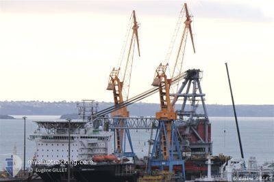
SEAWAY STRASHNOV
Crane Ship
Current Trip
DOGGER BANK B OWF
| Time Travelled | 8 h, 6 mins |
|---|---|
| Remaining Time | --- |
| Distance Travelled | 82.85 nm |
| Remaining Distance | --- |
| AVG Speed | 9.1 Knots |
| MAX Speed | 11.3 Knots |
| AVG Wind | 10.3 knots |
| MAX Wind | 16.1 knots |
| MIN Temp | 13.2°C / 55.76°F |
| MAX Temp | 14.9°C / 58.82°F |
| Draught | 11.5 m |
| Position Received | 21 m ago |
Current Position
| Longitude | 3.00686° |
|---|---|
| Latitude | 53.00807° |
| Status | Under way using engine |
| Speed | 11.1 Knots |
| Course | 340.8° |
| Area | North Sea |
| Station | T-AIS |
| Position Received | 21 m ago |
Info
Information
The current position of SEAWAY STRASHNOV is in North Sea with coordinates 53.00807° / 3.00686° as reported on 2024-05-14 07:56 by AIS to our vessel tracker app. The vessel's current speed is 11.1 Knots
The vessel SEAWAY STRASHNOV (IMO: 9452701, MMSI: 212905000) is a Crane Ship that was built in 2011 ( 13 years old ). It's sailing under the flag of [CY] Cyprus.
In this page you can find informations about the vessels current position, last detected port calls, and current voyage information. If the vessels is not in coverage by AIS you will find the latest position.
The current position of SEAWAY STRASHNOV is detected by our AIS receivers and we are not responsible for the reliability of the data. The last position was recorded while the vessel was in Coverage by the Ais receivers of our vessel tracking app.
The current draught of SEAWAY STRASHNOV as reported by AIS is 11.5 meters
Weather
| Temperature | 13.2°C / 55.76°F |
|---|---|
| Wind Speed | 16 knots |
| Direction | 124° SE |
| Pressure | 1003.2 hPa |
| Humidity | 91.1 % |
| Cloud Coverage | 18 % |
Featured Company
Last Port Calls
| Port | Arrival | Departure | Time In Port |
|---|---|---|---|
| 2024-05-13 11:39 | 2024-05-14 02:12 | 14 h | |
| 2024-05-09 23:06 | 2024-05-10 10:24 | 11 h | |
| 2024-05-06 03:07 | 2024-05-06 16:33 | 13 h | |
| 2024-04-29 11:41 | 2024-04-30 03:55 | 16 h | |
| 2024-03-26 15:14 | 2024-04-16 23:06 | 21 d | |
| 2024-03-18 07:05 | 2024-03-18 21:58 | 14 h |
Most Visited Ports (Last year)
| Port | Arrivals | |
|---|---|---|
| 31 | ||
| 2 | ||
| 2 |
Last Trips
| Origin | Departure | Destination | Arrival | Distance | |
|---|---|---|---|---|---|
| 2024-05-10 10:24 | 2024-05-13 11:39 | 436.27 nm | |||
| 2024-05-06 16:33 | 2024-05-09 23:06 | 453.23 nm | |||
| 2024-04-30 03:55 | 2024-05-06 03:07 | 474.78 nm | |||
| 2024-04-16 23:06 | 2024-04-29 11:41 | 622.16 nm | |||
| 2024-03-18 21:58 | 2024-03-26 15:14 | 1817.78 nm | |||
| 2024-02-28 14:37 | 2024-03-18 07:05 | 3803.62 nm |
Events
| Time | Event | Details | Position / Dest | Info |
|---|---|---|---|---|
| 2024-05-14 08:04 | Status Changed | Default Under way using engine |
53.02967 / 2.99443
DOGGER BANK B OWF
|
Speed: 11.1 kn Course: 340.8° |
| 2024-05-14 07:55 | Status Changed | Under way using engine Default |
53.00324 / 3.00963
DOGGER BANK B OWF
|
Speed: 11 kn Course: 341° |
| 2024-05-14 07:20 | Status Changed | Default Under way using engine |
52.90324 / 3.06589
DOGGER BANK B OWF
|
Speed: 11.2 kn Course: 340.6° |
| 2024-05-14 07:10 | Change Sea Area | United Kingdom part of the North Sea Dutch part of the North Sea |
52.87546 / 3.08219
North Sea
DOGGER BANK B OWF
|
Speed: 11.2 kn Course: 340.6° |
| 2024-05-14 07:10 | Status Changed | Under way using engine Default |
52.87546 / 3.08219
DOGGER BANK B OWF
|
Speed: 11.3 kn Course: 341° |
| 2024-05-14 06:53 | IN Coverage |
52.87546 / 3.08219
North Sea
DOGGER BANK B OWF
|
Speed: 11.2 kn Course: 340.6° |
|
| 2024-05-14 05:37 | Status Changed | Default Under way using engine |
52.59347 / 3.19694
DOGGER BANK B OWF
|
Speed: 11 kn Course: 340.5° |
| 2024-05-14 05:31 | OUT of Coverage |
52.57837 / 3.20562
North Sea
DOGGER BANK B OWF
|
Speed: 11 kn Course: 340.5° |
|
| 2024-05-14 05:29 | Status Changed | Under way using engine Default |
52.57163 / 3.20953
DOGGER BANK B OWF
|
Speed: 11 kn Course: 340° |
| 2024-05-14 05:13 | Status Changed | Default Under way using engine |
52.52446 / 3.23717
DOGGER BANK B OWF
|
Speed: 10.8 kn Course: 340.1° |