
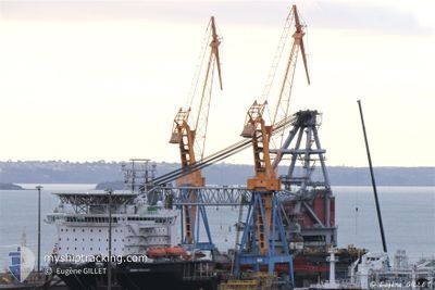
SEAWAY STRASHNOV
Crane Ship
Current Trip
| Trip Time | 12 days |
|---|---|
| Trip Distance | 622.16 nm |
| AVG Speed | 6.6 Noeuds |
| MAX Speed | 10.7 Noeuds |
| Tirant d eau | 11 m |
| AVG Wind | 17.9 knots |
| MAX Wind | 37.1 knots |
| MIN Temp | 4.8°C / 40.64°F |
| MAX Temp | 10.5°C / 50.9°F |
| Position reçue | 3 m depuis |
Current Position
| Longitude | 4.00302° |
|---|---|
| Latitude | 51.96552° |
| Etat | Moored |
| Vitesse | |
| Parcours | 353° |
| Zone | North Sea |
| Station | T-AIS |
| Position reçue | 3 m depuis |
Info
Information
The current position of SEAWAY STRASHNOV is in North Sea with coordinates 51.96552° / 4.00302° as reported on 2024-04-29 11:53 by AIS to our vessel tracker app. The vessel's current speed is 0 Noeuds and is currently inside the port of MAASVLAKTE - ROTTERDAM.
The vessel SEAWAY STRASHNOV (IMO: 9452701, MMSI: 212905000) is a Crane Ship that was built in 2011 ( 13 Age ). It's sailing under the flag of [CY] Cyprus.
In this page you can find informations about the vessels current position, last detected port calls, and current voyage information. If the vessels is not in coverage by AIS you will find the latest position.
The current position of SEAWAY STRASHNOV is detected by our AIS receivers and we are not responsible for the reliability of the data. The last position was recorded while the vessel was in Coverage by the Ais receivers of our vessel tracking app.
The current draught of SEAWAY STRASHNOV as reported by AIS is 11 meters
Weather
| Temperature | 11.8°C / 53.24°F |
|---|---|
| Wind Speed | 9 knots |
| Direction | 185° S |
| Pressure | 1018.8 hPa |
| Humidity | 78.6 % |
| Cloud Coverage | 5 % |
Featured Company
Last Port Calls
| Port | Arrival | Departure | Time In Port |
|---|---|---|---|
| 2024-04-29 09:41 | |||
| 2024-03-26 14:14 | 2024-04-16 21:06 | 21 d | |
| 2024-03-18 07:05 | 2024-03-18 21:58 | 14 h | |
| 2024-02-25 14:09 | 2024-02-28 13:37 | 2 d |
Most Visited Ports (Last year)
| Port | Arrivals | |
|---|---|---|
| 29 | ||
| 2 | ||
| 2 |
Last Trips
| Origin | Departure | Destination | Arrival | Distance | |
|---|---|---|---|---|---|
| 2024-04-16 23:06 | 2024-04-29 11:41 | 622.16 nm | |||
| 2024-03-18 21:58 | 2024-03-26 15:14 | 1817.78 nm | |||
| 2024-02-28 14:37 | 2024-03-18 07:05 | 3803.62 nm | |||
| 2023-12-01 20:44 | 2024-02-25 15:09 | 391.31 nm |
Events
| Heure | Evenement | Détails | Position/ Destination | Info |
|---|---|---|---|---|
| 2024-04-29 11:20 | Etat Changé | Moored Under way using engine |
51.96552 / 4.00303
[NL] MAASVLAKTE - ROTTERDAM
|
Vitesse: Parcours: 353° |
| 2024-04-29 10:30 | Arret |
51.96781 / 4.00056
[NL] MAASVLAKTE - ROTTERDAM
|
Vitesse: 0.3 kn Parcours: 320° |
|
| 2024-04-29 09:41 | Port d'arrivée |
|
51.96265 / 4.07973
[NL] MAASVLAKTE - ROTTERDAM
|
Vitesse: 5 kn Parcours: 254.1° |
| 2024-04-29 05:24 | Changement de destination | NLRTM DBB OWF |
52.22039 / 3.36622
NLRTM
|
Vitesse: 8.4 kn Parcours: 165.1° |
| 2024-04-29 05:24 | Changement d'ETA | 2024/04/29 09:00 2024/04/25 09:00 |
52.22039 / 3.36622
NLRTM
|
Vitesse: 8.4 kn Parcours: 165.1° |
| 2024-04-29 04:27 | Etat Changé | Under way using engine Default |
52.34731 / 3.30559
DBB OWF
|
Vitesse: 8.5 kn Parcours: 162° |
| 2024-04-29 04:22 | Etat Changé | Default Under way using engine |
52.35914 / 3.29937
DBB OWF
|
Vitesse: 8.5 kn Parcours: 162.2° |
| 2024-04-29 04:12 | Changement de zone | Dutch part of the North Sea United Kingdom part of the North Sea |
52.38032 / 3.28807
North Sea
|
Vitesse: 8.5 kn Parcours: 160.7° |
| 2024-04-29 04:12 | Etat Changé | Under way using engine Default |
52.38116 / 3.28759
DBB OWF
|
Vitesse: 8.6 kn Parcours: 158° |
| 2024-04-29 04:01 | Dans la zone couverte |
52.38032 / 3.28807
North Sea
|
Vitesse: 8.5 kn Parcours: 160.7° |