
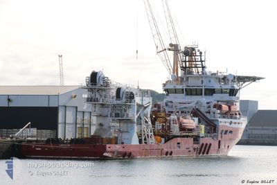
SEAMEC SWORDFISH
Offshore Supply Ship
Current Position
| Longitude | --- |
|---|---|
| Latitude | --- |
| Status | Moored |
| Speed | |
| Course | 184° |
| Area | Persian Gulf |
| Station | T-AIS |
| Position Received | 2 m ago |
Info
Information
The current position of SEAMEC SWORDFISH is in Persian Gulf with coordinates 25.26134° / 55.26038° as reported on 2025-03-04 10:45 by AIS to our vessel tracker app. The vessel's current speed is 0 Knots and is currently inside the port of DUBAI.
The vessel SEAMEC SWORDFISH (IMO: 9385300, MMSI: 538005198) is a Offshore Supply Ship that was built in 2007 ( 18 years old ). It's sailing under the flag of [MH] Marshall Is.
In this page you can find informations about the vessels current position, last detected port calls, and current voyage information. If the vessels is not in coverage by AIS you will find the latest position.
The current position of SEAMEC SWORDFISH is detected by our AIS receivers and we are not responsible for the reliability of the data. The last position was recorded while the vessel was in Coverage by the Ais receivers of our vessel tracking app.
The current draught of SEAMEC SWORDFISH as reported by AIS is 5.3 meters
Weather
| Temperature | 24.3°C / 75.74°F |
|---|---|
| Wind Speed | 6 knots |
| Direction | 343° NNW |
| Pressure | 1016.1 hPa |
| Humidity | 37.1 % |
| Cloud Coverage | 20 % |
Featured Company
Events
| Time | Event | Details | Position / Dest | Info |
|---|---|---|---|---|
| 2025-03-01 00:05 | ETA Changed | 2026/02/28 07:30 2025/02/28 07:30 |
25.26127 / 55.26036
[AE] DUBAI
|
Speed: Course: 184° |
| 2025-02-28 16:36 | Status Changed | Moored Under way using engine |
25.26149 / 55.26035
[AE] DUBAI
|
Speed: Course: 184° |
| 2025-02-28 16:36 | Status Changed | Under way using engine Moored |
25.26148 / 55.26035
[AE] DUBAI
|
Speed: 0.1 kn Course: 184° |
| 2025-02-28 16:35 | Status Changed | Moored Under way using engine |
25.26144 / 55.26036
[AE] DUBAI
|
Speed: Course: 184° |
| 2025-02-28 14:03 | STOP Moving |
25.25735 / 55.26054
[AE] DUBAI
|
Speed: 0.3 kn Course: 175° |
|
| 2025-02-28 13:36 | PORT ARRIVAL |
|
25.27421 / 55.25053
[AE] DUBAI
|
Speed: 3.7 kn Course: 151° |
| 2025-02-28 11:31 | START Moving | 11.82 nm, West of DUBAI |
25.34060 / 55.07155
DUBAI
|
Speed: 3.4 kn Course: 105° |
| 2025-02-28 11:25 | Status Changed | Under way using engine At anchor |
25.34158 / 55.06971
DUBAI
|
Speed: 0.4 kn Course: 247° |
| 2025-02-28 11:25 | STOP Moving | 11.93 nm, West of DUBAI |
25.34158 / 55.06971
DUBAI
|
Speed: 0.3 kn Course: 275° |
| 2025-02-28 10:47 | IN Coverage |
25.34120 / 55.07090
Persian Gulf
DUBAI
|
Speed: 0.7 kn Course: 1.3° |