
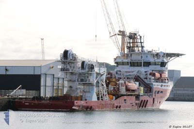
SEAMEC SWORDFISH
Offshore Supply Ship
Current Trip
ZULUF FIELD
| Time Travelled | --- |
|---|---|
| Remaining Time | --- |
| Distance Travelled | --- |
| Remaining Distance | --- |
| AVG Speed | --- |
| MAX Speed | --- |
| AVG Wind | --- |
| MAX Wind | --- |
| MIN Temp | --- |
| MAX Temp | --- |
| Djupgående | 5.7 m |
| Position mottagen | 3 h, 55 m sen |
Current Position
| Longitud | --- |
|---|---|
| Latitude | --- |
| Status | Restricted manoeuverability |
| Fart | |
| Kurs | 350° |
| Område | Persian Gulf |
| Station | T-AIS |
| Position mottagen | 3 h, 55 m sen |
Info
Information
The current position of SEAMEC SWORDFISH is in Persian Gulf with coordinates 28.47285° / 49.33947° as reported on 2025-12-08 15:47 by AIS to our vessel tracker app. The vessel's current speed is 0 Knop
The vessel SEAMEC SWORDFISH (IMO: 9385300, MMSI: 538005198) is a Offshore Supply Ship that was built in 2007 ( 18 År gammal ). It's sailing under the flag of [MH] Marshall Is.
In this page you can find informations about the vessels current position, last detected port calls, and current voyage information. If the vessels is not in coverage by AIS you will find the latest position.
The current position of SEAMEC SWORDFISH is detected by our AIS receivers and we are not responsible for the reliability of the data. The last position was recorded while the vessel was in Coverage by the Ais receivers of our vessel tracking app.
The current draught of SEAMEC SWORDFISH as reported by AIS is 5.7 meters
Weather
| Temperature | 24°C / 75.2°F |
|---|---|
| Wind Speed | 13 knots |
| Direction | 135° SE |
| Pressure | 1017.8 hPa |
| Humidity | 71.4 % |
| Cloud Coverage | 97 % |
Featured Company
Last Port Calls
Most Visited Ports (Last year)
| Port | Arrivals | |
|---|---|---|
| 5 | ||
| 2 | ||
| 1 | ||
| 1 |
Last Trips
| Origin | Departure | Destination | Arrival | Distance |
|---|
Events
| Tid | Event | Detaljer | Position / Dest | Information |
|---|---|---|---|---|
| 2025-12-08 15:47 | UTANFÖR täckningsområde |
28.47285 / 49.33947
Persian Gulf
|
Fart: Kurs: 330.5° |
|
| 2025-12-08 15:14 | I täckningsområde |
28.47284 / 49.33946
Persian Gulf
|
Fart: Kurs: 330.5° |
|
| 2025-12-08 02:41 | UTANFÖR täckningsområde |
28.46833 / 49.34223
Persian Gulf
|
Fart: Kurs: 73.2° |
|
| 2025-12-08 01:54 | I täckningsområde |
28.46841 / 49.34161
Persian Gulf
|
Fart: Kurs: 240.2° |
|
| 2025-12-07 22:59 | UTANFÖR täckningsområde |
28.46833 / 49.34157
Persian Gulf
|
Fart: Kurs: 169.9° |
|
| 2025-12-07 22:37 | I täckningsområde |
28.46825 / 49.34166
Persian Gulf
|
Fart: 0.1 kn Kurs: 169.9° |
|
| 2025-12-07 21:13 | UTANFÖR täckningsområde |
28.48758 / 49.32012
Persian Gulf
|
Fart: 1.7 kn Kurs: 178.4° |
|
| 2025-12-07 21:12 | I täckningsområde |
28.48758 / 49.32012
Persian Gulf
|
Fart: 1.7 kn Kurs: 178.4° |
|
| 2025-12-07 19:22 | UTANFÖR täckningsområde |
28.49016 / 49.32037
Persian Gulf
|
Fart: Kurs: 199.8° |
|
| 2025-12-07 15:18 | I täckningsområde |
28.47304 / 49.33839
Persian Gulf
|
Fart: 0.1 kn Kurs: 273.4° |