
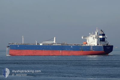
SEACALM
Tanker A
Current Trip
| Time Travelled | 3 days |
|---|---|
| Remaining Time | 1 day |
| Distance Travelled | 1081.15 nm |
| Remaining Distance | 343.92 nm |
| AVG Speed | 12.2 Knots |
| MAX Speed | 20 Knots |
| AVG Wind | 19.1 knots |
| MAX Wind | 32 knots |
| MIN Temp | 17.5°C / 63.5°F |
| MAX Temp | 21.1°C / 69.98°F |
| Draught | 12.5 m |
| Position Received | Now |
Current Position
| Longitude | 17.64925° |
|---|---|
| Latitude | 41.39596° |
| Status | Under way using engine |
| Speed | 12.7 Knots |
| Course | 311.1° |
| Area | Adriatic Sea |
| Station | T-AIS |
| Position Received | Now |
Info
Information
The current position of SEACALM is in Adriatic Sea with coordinates 41.39596° / 17.64925° as reported on 2024-05-07 15:52 by AIS to our vessel tracker app. The vessel's current speed is 12.7 Knots and is heading at the port of TRIESTE. The estimated time of arrival as calculated by MyShipTracking vessel tracking app is 2024-05-08 18:45 LT
The vessel SEACALM (IMO: 9773753, MMSI: 538007376) is a Tanker A It's sailing under the flag of [MH] Marshall Is.
In this page you can find informations about the vessels current position, last detected port calls, and current voyage information. If the vessels is not in coverage by AIS you will find the latest position.
The current position of SEACALM is detected by our AIS receivers and we are not responsible for the reliability of the data. The last position was recorded while the vessel was in Coverage by the Ais receivers of our vessel tracking app.
The current draught of SEACALM as reported by AIS is 12.5 meters
Weather
| Temperature | 18°C / 64.4°F |
|---|---|
| Wind Speed | 19 knots |
| Direction | 142° SE |
| Pressure | 1013.2 hPa |
| Humidity | 84.9 % |
| Cloud Coverage | 100 % |
Featured Company
Events
| Time | Event | Details | Position / Dest | Info |
|---|---|---|---|---|
| 2024-05-07 14:01 | Status Changed | Under way using engine Default |
41.15253 / 18.05937
IT TRS
|
Speed: 12.7 kn Course: 310° |
| 2024-05-07 13:57 | Status Changed | Default Under way using engine |
41.14222 / 18.07568
IT TRS
|
Speed: 12.7 kn Course: 309.8° |
| 2024-05-07 12:00 | Status Changed | Under way using engine Default |
40.87700 / 18.49169
IT TRS
|
Speed: 12.7 kn Course: 308° |
| 2024-05-07 11:34 | Status Changed | Default Under way using engine |
40.81963 / 18.58730
IT TRS
|
Speed: 12.7 kn Course: 308.1° |
| 2024-05-07 11:07 | ETA Changed | 2024/05/08 20:00 2024/05/08 21:00 |
40.76058 / 18.68621
IT TRS
|
Speed: 12.9 kn Course: 308.2° |
| 2024-05-07 11:04 | Change Sea Area | Italian part of the Adriatic Sea Albanian part of the Adriatic Sea |
40.75489 / 18.69553
Adriatic Sea
IT TRS
|
Speed: 13 kn Course: 308.8° |
| 2024-05-07 11:02 | Status Changed | Under way using engine Default |
40.74976 / 18.70417
IT TRS
|
Speed: 12.9 kn Course: 326° |
| 2024-05-07 10:49 | IN Coverage |
40.75489 / 18.69553
Adriatic Sea
IT TRS
|
Speed: 13 kn Course: 308.8° |
|
| 2024-05-07 09:10 | Status Changed | Default Under way using engine |
40.37671 / 18.91846
IT TRS
|
Speed: 13.1 kn Course: 338.6° |
| 2024-05-07 09:04 | OUT of Coverage |
40.35786 / 18.92794
Adriatic Sea
IT TRS
|
Speed: 13.1 kn Course: 338.6° |