
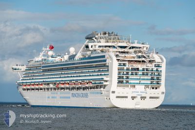
SAPPHIRE PRINCESS
Passengers Ship
Current Trip
| Time Travelled | 14 days |
|---|---|
| Remaining Time | 7 h, 47 mins |
| Distance Travelled | 5435.22 nm |
| Remaining Distance | 111.85 nm |
| AVG Speed | 16.7 Knots |
| MAX Speed | 21 Knots |
| AVG Wind | 13.8 knots |
| MAX Wind | 24 knots |
| MIN Temp | 14.3°C / 57.74°F |
| MAX Temp | 29.1°C / 84.38°F |
| Draught | 8.2 m |
| Position Received | Now |
Current Position
| Longitude | -118.23670° |
|---|---|
| Latitude | 31.92919° |
| Status | Under way using engine |
| Speed | 14 Knots |
| Course | 32.8° |
| Area | North Pacific Ocean |
| Station | T-AIS |
| Position Received | Now |
Info
Information
The current position of SAPPHIRE PRINCESS is in North Pacific Ocean with coordinates 31.92919° / -118.23670° as reported on 2024-05-07 03:09 by AIS to our vessel tracker app. The vessel's current speed is 14 Knots and is heading at the port of LOS ANGELES. The estimated time of arrival as calculated by MyShipTracking vessel tracking app is 2024-05-07 10:57 LT
The vessel SAPPHIRE PRINCESS (IMO: 9228186, MMSI: 235103357) is a Passengers Ship that was built in 2004 ( 20 years old ). It's sailing under the flag of [GB] United Kingdom.
In this page you can find informations about the vessels current position, last detected port calls, and current voyage information. If the vessels is not in coverage by AIS you will find the latest position.
The current position of SAPPHIRE PRINCESS is detected by our AIS receivers and we are not responsible for the reliability of the data. The last position was recorded while the vessel was in Coverage by the Ais receivers of our vessel tracking app.
The current draught of SAPPHIRE PRINCESS as reported by AIS is 8.2 meters
Weather
| Temperature | 14.3°C / 57.74°F |
|---|---|
| Wind Speed | 18 knots |
| Direction | 311° NW |
| Pressure | 1015.8 hPa |
| Humidity | 74.7 % |
| Cloud Coverage | --- |
Featured Company
Last Port Calls
| Port | Arrival | Departure | Time In Port |
|---|---|---|---|
| 2024-04-21 19:35 | 2024-04-22 10:55 | 15 h | |
| 2024-04-19 17:52 | 2024-04-20 04:45 | 10 h | |
| 2024-04-18 18:13 | 2024-04-19 05:25 | 11 h | |
| 2024-04-12 17:10 | 2024-04-13 04:07 | 10 h | |
| 2024-04-11 15:48 | 2024-04-12 09:01 | 17 h | |
| 2024-04-05 11:45 | 2024-04-06 03:35 | 15 h | |
| 2024-04-01 12:07 | 2024-04-01 22:23 | 10 h | |
| 2024-03-28 14:04 | 2024-03-29 01:09 | 11 h | |
| 2024-03-23 11:17 | 2024-03-24 22:29 | 1 d | |
| 2024-03-18 07:19 | 2024-03-18 22:58 | 15 h |
Last Trips
| Origin | Departure | Destination | Arrival | Distance | |
|---|---|---|---|---|---|
| 2024-04-19 17:45 | 2024-04-22 07:35 | 689.76 nm | |||
| 2024-04-19 18:25 | 2024-04-19 06:52 | 131.09 nm | |||
| 2024-04-12 18:07 | 2024-04-19 07:13 | 2319.60 nm | |||
| 2024-04-11 23:01 | 2024-04-12 07:10 | 98.72 nm | |||
| 2024-04-05 20:35 | 2024-04-11 05:48 | 2255.01 nm | |||
| 2024-04-01 16:23 | 2024-04-05 04:45 | 1137.02 nm | |||
| 2024-03-28 19:09 | 2024-04-01 06:07 | 1501.58 nm | |||
| 2024-03-24 17:29 | 2024-03-28 08:04 | 1426.11 nm | |||
| 2024-03-18 19:58 | 2024-03-23 06:17 | 1403.83 nm | |||
| 2024-03-12 16:08 | 2024-03-18 04:19 | 1751.31 nm |
Events
| Time | Event | Details | Position / Dest | Info |
|---|---|---|---|---|
| 2024-05-07 01:55 | ETA Changed | 2024/05/07 12:00 2024/05/07 11:30 |
31.68025 / -118.41454
LOS ANGELES
|
Speed: 14.1 kn Course: 33.1° |
| 2024-05-06 23:21 | Status Changed | Under way using engine Default |
31.17452 / -118.77936
LOS ANGELES
|
Speed: 12 kn Course: 31° |
| 2024-05-06 23:18 | Status Changed | Default Under way using engine |
31.16415 / -118.78665
LOS ANGELES
|
Speed: 12.1 kn Course: 31.2° |
| 2024-05-06 23:11 | Change Sea Area | United States part of the North Pacific Ocean Mexican part of the North Pacific Ocean |
31.14491 / -118.80000
North Pacific Ocean
LOS ANGELES
|
Speed: 12.1 kn Course: 31.2° |
| 2024-05-06 23:09 | Status Changed | Under way using engine Default |
31.14015 / -118.80350
LOS ANGELES
|
Speed: 11.9 kn Course: 33° |
| 2024-05-06 22:29 | Status Changed | Default Under way using engine |
31.02678 / -118.88631
LOS ANGELES
|
Speed: 11.9 kn Course: 33° |
| 2024-05-06 21:32 | Status Changed | Under way using engine Default |
30.87079 / -118.99770
LOS ANGELES
|
Speed: 11.4 kn Course: 31° |
| 2024-05-06 21:21 | Status Changed | Default Under way using engine |
30.84077 / -119.01914
LOS ANGELES
|
Speed: 11.8 kn Course: 31.8° |
| 2024-05-06 21:13 | Status Changed | Under way using engine Default |
30.81957 / -119.03452
LOS ANGELES
|
Speed: 12 kn Course: 32° |
| 2024-05-06 20:50 | Status Changed | Default Under way using engine |
30.74833 / -119.08500
LOS ANGELES
|
Speed: 13.4 kn Course: 32.4° |