
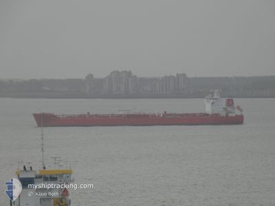
SANTIAGO I
Tanker
Current Trip
| Trip Time | 2 days |
|---|---|
| Trip Distance | 319.40 nm |
| AVG Speed | 9.5 Knots |
| MAX Speed | 15 Knots |
| Draught | 7.8 m |
| AVG Wind | 3.8 knots |
| MAX Wind | 9.6 knots |
| MIN Temp | 24.3°C / 75.74°F |
| MAX Temp | 31.8°C / 89.24°F |
| Position Received | 8 d ago |
Current Position
| Longitude | 103.42263° |
|---|---|
| Latitude | 1.24428° |
| Status | Under way using engine |
| Speed | 11.3 Knots |
| Course | 297.4° |
| Area | Malacca Strait |
| Station | T-AIS |
| Position Received | 8 d ago |
Info
Information
The current position of SANTIAGO I is in Malacca Strait with coordinates 1.24428° / 103.42263° as reported on 2024-04-24 16:29 by AIS to our vessel tracker app. The vessel's current speed is 11.3 Knots and is currently inside the port of DUMAI.
The vessel SANTIAGO I (IMO: 9730347, MMSI: 210362000) is a Tanker It's sailing under the flag of [CY] Cyprus.
In this page you can find informations about the vessels current position, last detected port calls, and current voyage information. If the vessels is not in coverage by AIS you will find the latest position.
The current position of SANTIAGO I is detected by our AIS receivers and we are not responsible for the reliability of the data. The last position was recorded while the vessel was in Coverage by the Ais receivers of our vessel tracking app.
The current draught of SANTIAGO I as reported by AIS is 7.8 meters
Weather
| Temperature | 24.6°C / 76.28°F |
|---|---|
| Wind Speed | 2 knots |
| Direction | 172° S |
| Pressure | 1007.1 hPa |
| Humidity | 98 % |
| Cloud Coverage | 99 % |
Featured Company
Most Visited Ports (Last year)
| Port | Arrivals | |
|---|---|---|
| 2 | ||
| 2 | ||
| 2 | ||
| 2 | ||
| 2 | ||
| 1 |
Events
| Time | Event | Details | Position / Dest | Info |
|---|---|---|---|---|
| 2024-05-02 08:20 | STOP Moving |
1.68882 / 101.45022
[ID] DUMAI
|
Speed: 0.3 kn Course: 93° |
|
| 2024-05-02 08:20 | PORT ARRIVAL |
|
1.68882 / 101.45022
[ID] DUMAI
|
Speed: 0.7 kn Course: 101° |
| 2024-05-02 07:00 | START Moving | 5.75 nm, North West of DUMAI |
1.74660 / 101.38060
IDBLW
|
Speed: 4.4 kn Course: 106° |
| 2024-05-01 05:29 | STOP Moving | 5.81 nm, North West of DUMAI |
1.74367 / 101.37743
IDBLW
|
Speed: 0.2 kn Course: 332° |
| 2024-04-29 21:00 | PORT DEPARTURE |
|
3.80660 / 98.72491
IDBLW
|
Speed: 9 kn Course: -1° |
| 2024-04-29 20:48 | START Moving |
3.78977 / 98.70306
[ID] BELAWAN
|
Speed: 6.3 kn Course: 83° |
|
| 2024-04-28 11:35 | STOP Moving |
3.78833 / 98.69666
[ID] BELAWAN
|
Speed: Course: -1° |
|
| 2024-04-28 11:08 | PORT ARRIVAL |
|
3.79425 / 98.71339
[ID] BELAWAN
|
Speed: 9 kn Course: 217° |
| 2024-04-28 10:08 | START Moving | 8.86 nm, North of BELAWAN |
3.93545 / 98.75304
IDBLW
|
Speed: 3.7 kn Course: 130° |
| 2024-04-26 01:53 | STOP Moving | 8.89 nm, North of BELAWAN |
3.93700 / 98.74968
IDBLW
|
Speed: 0.1 kn Course: 162° |