
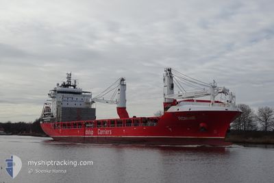
RONNIE
Cargo
Current Trip
| Time Travelled | 7 days |
|---|---|
| Remaining Time | --- |
| Distance Travelled | 2089.54 nm |
| Remaining Distance | --- |
| AVG Speed | 14 Knots |
| MAX Speed | 14 Knots |
| AVG Wind | 13.9 knots |
| MAX Wind | 21.6 knots |
| MIN Temp | 1.9°C / 35.42°F |
| MAX Temp | 19.3°C / 66.74°F |
| Draught | 6.2 m |
| Position Received | 5 d ago |
Current Position
| Longitude | -70.63640° |
|---|---|
| Latitude | 47.17194° |
| Status | Under way using engine |
| Speed | 10.6 Knots |
| Course | 38.2° |
| Area | Gulf of St-Lawrence |
| Station | T-AIS |
| Position Received | 5 d ago |
Info
Information
The current position of RONNIE is in Gulf of St-Lawrence with coordinates 47.17194° / -70.63640° as reported on 2024-05-09 07:44 by AIS to our vessel tracker app. The vessel's current speed is 10.6 Knots and is heading at the port of GIJON. The estimated time of arrival as calculated by MyShipTracking vessel tracking app is 2024-05-18 00:00 LT
The vessel RONNIE (IMO: 9736224, MMSI: 305434000) is a Cargo It's sailing under the flag of [AG] Antigua Barbuda.
In this page you can find informations about the vessels current position, last detected port calls, and current voyage information. If the vessels is not in coverage by AIS you will find the latest position.
The current position of RONNIE is detected by our AIS receivers and we are not responsible for the reliability of the data. The last position was recorded while the vessel was in Coverage by the Ais receivers of our vessel tracking app.
The current draught of RONNIE as reported by AIS is 6.2 meters
Weather
| Temperature | 14.2°C / 57.56°F |
|---|---|
| Wind Speed | 20 knots |
| Direction | 304° NW |
| Pressure | 1022 hPa |
| Humidity | 97.2 % |
| Cloud Coverage | 100 % |
Featured Company
Last Port Calls
| Port | Arrival | Departure | Time In Port |
|---|---|---|---|
| 2024-05-07 19:54 | 2024-05-07 21:40 | 1 h | |
| 2024-05-06 13:08 | 2024-05-06 13:42 | 34 m | |
| 2024-05-04 12:00 | 2024-05-04 12:52 | 52 m | |
| 2024-04-30 22:36 | 2024-05-03 05:00 | 2 d | |
| 2024-04-29 22:33 | 2024-04-29 22:46 | 12 m | |
| 2024-04-27 17:32 | 2024-04-27 23:52 | 6 h | |
| 2024-04-26 10:31 | 2024-04-26 11:11 | 40 m | |
| 2024-04-14 00:09 | 2024-04-14 17:45 | 17 h | |
| 2024-04-07 15:09 | 2024-04-11 14:45 | 3 d | |
| 2024-03-28 18:01 | 2024-03-31 00:56 | 2 d |
Most Visited Ports (Last year)
| Port | Arrivals | |
|---|---|---|
| 4 | ||
| 4 | ||
| 4 | ||
| 3 | ||
| 3 | ||
| 2 |
Last Trips
| Origin | Departure | Destination | Arrival | Distance | |
|---|---|---|---|---|---|
| 2024-05-06 09:42 | 2024-05-07 15:54 | 297.08 nm | |||
| 2024-05-04 08:52 | 2024-05-06 09:08 | 524.91 nm | |||
| 2024-05-03 00:00 | 2024-05-04 08:00 | 347.55 nm | |||
| 2024-04-29 18:46 | 2024-04-30 17:36 | 342.12 nm | |||
| 2024-04-27 19:52 | 2024-04-29 18:33 | 523.35 nm | |||
| 2024-04-26 07:11 | 2024-04-27 13:32 | 297.01 nm | |||
| 2024-04-14 12:45 | 2024-04-26 06:31 | 3472.53 nm | |||
| 2024-04-11 09:45 | 2024-04-13 19:09 | 12.40 nm | |||
| 2024-03-30 20:56 | 2024-04-07 10:09 | 903.98 nm | |||
| 2024-03-25 15:46 | 2024-03-28 14:01 | 894.05 nm |
Events
| Time | Event | Details | Position / Dest | Info |
|---|---|---|---|---|
| 2024-05-09 07:48 | Status Changed | Default Under way using engine |
47.18074 / -70.62565
ESGIJ
|
Speed: 10.6 kn Course: 38.2° |
| 2024-05-09 07:44 | OUT of Coverage |
47.17194 / -70.63640
Gulf of St-Lawrence
ESGIJ
|
Speed: 10.6 kn Course: 38.2° |
|
| 2024-05-09 07:38 | Status Changed | Under way using engine Default |
47.15784 / -70.65713
ESGIJ
|
Speed: 10 kn Course: 32° |
| 2024-05-09 07:30 | Status Changed | Default Under way using engine |
47.13958 / -70.67709
ESGIJ
|
Speed: 11.1 kn Course: 34.6° |
| 2024-05-09 04:36 | Status Changed | Under way using engine Default |
46.72240 / -71.37322
ESGIJ
|
Speed: 18 kn Course: 77° |
| 2024-05-09 04:27 | Status Changed | Default Under way using engine |
46.71258 / -71.44394
ESGIJ
|
Speed: 17.7 kn Course: 70.3° |
| 2024-05-09 04:12 | Status Changed | Under way using engine Default |
46.68967 / -71.54137
ESGIJ
|
Speed: 17.3 kn Course: 55° |
| 2024-05-09 04:06 | IN Coverage |
46.69450 / -71.52833
Gulf of St-Lawrence
ESGIJ
|
Speed: 17.6 kn Course: 61.7° |
|
| 2024-05-09 00:22 | Status Changed | Default Under way using engine |
46.26361 / -72.67796
ESGIJ
|
Speed: 15.7 kn Course: 56.5° |
| 2024-05-09 00:15 | OUT of Coverage |
46.25690 / -72.71962
Gulf of St-Lawrence
ESGIJ
|
Speed: 15.7 kn Course: 56.5° |