
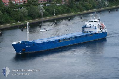
REYMAR
General Cargo
Current Trip
| Time Travelled | 3 days |
|---|---|
| Remaining Time | 2 days |
| Distance Travelled | 824.93 nm |
| Remaining Distance | 373.63 nm |
| AVG Speed | 8.9 Knots |
| MAX Speed | 11.6 Knots |
| AVG Wind | 10.4 knots |
| MAX Wind | 24.3 knots |
| MIN Temp | 3.7°C / 38.66°F |
| MAX Temp | 8.4°C / 47.12°F |
| Draught | 5.6 m |
| Position Received | 1 m ago |
Current Position
| Longitude | --- |
|---|---|
| Latitude | --- |
| Status | Under way using engine |
| Speed | 9 Knots |
| Course | 248.6° |
| Area | North Sea |
| Station | T-AIS |
| Position Received | 1 m ago |
Info
Information
The current position of REYMAR is in North Sea with coordinates 53.72793° / 5.87359° as reported on 2025-12-14 20:12 by AIS to our vessel tracker app. The vessel's current speed is 9 Knots and is heading at the port of HONFLEUR AVANT-PORT. The estimated time of arrival as calculated by MyShipTracking vessel tracking app is 2025-12-16 23:15 LT
The vessel REYMAR (IMO: 9552032, MMSI: 212880000) is a General Cargo that was built in 2011 ( 14 years old ). It's sailing under the flag of [CY] Cyprus.
In this page you can find informations about the vessels current position, last detected port calls, and current voyage information. If the vessels is not in coverage by AIS you will find the latest position.
The current position of REYMAR is detected by our AIS receivers and we are not responsible for the reliability of the data. The last position was recorded while the vessel was in Coverage by the Ais receivers of our vessel tracking app.
The current draught of REYMAR as reported by AIS is 5.6 meters
Weather
| Temperature | 7.9°C / 46.22°F |
|---|---|
| Wind Speed | 24 knots |
| Direction | 201° SSW |
| Pressure | 1015.4 hPa |
| Humidity | 91.6 % |
| Cloud Coverage | 81 % |
Featured Company
Last Port Calls
| Port | Arrival | Departure | Time In Port |
|---|---|---|---|
| 2025-12-10 02:18 | 2025-12-11 08:19 | 1 d | |
| 2025-12-08 20:05 | 2025-12-10 01:57 | 1 d | |
| 2025-12-06 17:47 | 2025-12-07 10:14 | 16 h | |
| 2025-12-04 18:29 | 2025-12-05 10:12 | 15 h | |
| 2025-12-02 08:23 | 2025-12-03 06:14 | 21 h | |
| 2025-11-28 10:07 | 2025-11-29 02:33 | 16 h | |
| 2025-11-23 12:21 | 2025-11-24 20:58 | 1 d | |
| 2025-11-21 03:14 | 2025-11-21 03:19 | 4 m | |
| 2025-11-19 11:31 | 2025-11-20 05:41 | 18 h | |
| 2025-11-13 20:08 | 2025-11-15 10:11 | 1 d |
Last Trips
| Origin | Departure | Destination | Arrival | Distance | |
|---|---|---|---|---|---|
| 2025-12-10 01:57 | 2025-12-10 02:18 | 0.87 nm | |||
| 2025-12-07 10:14 | 2025-12-08 20:05 | 351.73 nm | |||
| 2025-12-05 10:12 | 2025-12-06 17:47 | 359.74 nm | |||
| 2025-12-03 06:14 | 2025-12-04 18:29 | 372.66 nm | |||
| 2025-11-29 02:33 | 2025-12-02 08:23 | 740.80 nm | |||
| 2025-11-24 20:58 | 2025-11-28 10:07 | 814.03 nm | |||
| 2025-11-21 03:19 | 2025-11-23 12:21 | 628.13 nm | |||
| 2025-11-20 05:41 | 2025-11-21 03:14 | 176.57 nm | |||
| 2025-11-15 10:11 | 2025-11-19 11:31 | 812.74 nm | |||
| 2025-11-10 23:59 | 2025-11-13 20:08 | 560.63 nm |
Events
| Time | Event | Details | Position / Dest | Info |
|---|---|---|---|---|
| 2025-12-14 19:37 | Change Sea Area | Dutch part of the North Sea German part of the North Sea |
53.75763 / 6.00628
North Sea
FRHON
|
Speed: 8.3 kn Course: 250.9° |
| 2025-12-14 19:37 | Status Changed | Under way using engine Default |
53.75811 / 6.00832
FRHON
|
Speed: 8.2 kn Course: 251° |
| 2025-12-14 19:22 | IN Coverage |
53.75763 / 6.00628
North Sea
FRHON
|
Speed: 8.3 kn Course: 250.9° |
|
| 2025-12-14 15:58 | Status Changed | Default Under way using engine |
53.88484 / 6.77608
FRHON
|
Speed: 7.7 kn Course: 254.6° |
| 2025-12-14 15:50 | OUT of Coverage |
53.88863 / 6.80177
North Sea
FRHON
|
Speed: 7.7 kn Course: 254.6° |
|
| 2025-12-14 15:47 | Status Changed | Under way using engine Default |
53.89030 / 6.81319
FRHON
|
Speed: 6.8 kn Course: 258° |
| 2025-12-14 15:46 | Status Changed | Default Under way using engine |
53.89069 / 6.81576
FRHON
|
Speed: 6.8 kn Course: 255.6° |
| 2025-12-14 14:35 | Status Changed | Under way using engine Default |
53.92616 / 7.03249
FRHON
|
Speed: 6.7 kn Course: 255° |
| 2025-12-14 14:35 | IN Coverage |
53.92532 / 7.02815
North Sea
FRHON
|
Speed: 7 kn Course: 248.6° |
|
| 2025-12-14 08:17 | OUT of Coverage |
53.96987 / 8.54660
North Sea
FRHON
|
Speed: 10.8 kn Course: 282.9° |