
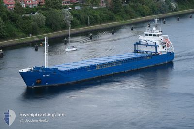
REYMAR
General Cargo
Current Trip
| Time Travelled | 2 days |
|---|---|
| Remaining Time | 1 day |
| Distance Travelled | 422.10 nm |
| Remaining Distance | 320.22 nm |
| AVG Speed | 9.8 Knots |
| MAX Speed | 10.5 Knots |
| AVG Wind | 14.5 knots |
| MAX Wind | 23 knots |
| MIN Temp | -2.6°C / 27.32°F |
| MAX Temp | 2°C / 35.6°F |
| Dybgang | 6.1 m |
| Position Modtaget | 9 h, 5 m siden |
Current Position
| Longitude | --- |
|---|---|
| Latitude | --- |
| Status | Under way using engine |
| Fart | 9.5 Knots |
| Kurs | 11.5° |
| Område | Gulf of Bothnia |
| Station | T-AIS |
| Position Modtaget | 9 h, 5 m siden |
Info
Information
The current position of REYMAR is in Gulf of Bothnia with coordinates 60.50036° / 19.04994° as reported on 2026-01-07 11:58 by AIS to our vessel tracker app. The vessel's current speed is 9.5 Knots and is heading at the port of ROYTTA. The estimated time of arrival as calculated by MyShipTracking vessel tracking app is 2026-01-09 04:14 LT
The vessel REYMAR (IMO: 9552032, MMSI: 212880000) is a General Cargo that was built in 2011 ( 15 år gamle ). It's sailing under the flag of [CY] Cyprus.
In this page you can find informations about the vessels current position, last detected port calls, and current voyage information. If the vessels is not in coverage by AIS you will find the latest position.
The current position of REYMAR is detected by our AIS receivers and we are not responsible for the reliability of the data. The last position was recorded while the vessel was in Coverage by the Ais receivers of our vessel tracking app.
The current draught of REYMAR as reported by AIS is 6.1 meters
Weather
| Temperature | -2.2°C / 28.04°F |
|---|---|
| Wind Speed | 20 knots |
| Direction | 123° ESE |
| Pressure | 1016 hPa |
| Humidity | 87.9 % |
| Cloud Coverage | 100 % |
Featured Company
Last Port Calls
| Port | Arrival | Departure | Time In Port |
|---|---|---|---|
| 2026-01-04 14:38 | 2026-01-05 21:57 | 1 d | |
| 2025-12-31 19:24 | 2025-12-31 20:13 | 49 m | |
| 2025-12-29 07:47 | 2025-12-31 14:28 | 2 d | |
| 2025-12-29 02:17 | 2025-12-29 02:46 | 29 m | |
| 2025-12-22 16:38 | 2025-12-23 19:24 | 1 d | |
| 2025-12-18 12:49 | 2025-12-22 11:39 | 3 d | |
| 2025-12-10 02:18 | 2025-12-11 08:19 | 1 d | |
| 2025-12-08 20:05 | 2025-12-10 01:57 | 1 d | |
| 2025-12-06 17:47 | 2025-12-07 10:14 | 16 h | |
| 2025-12-04 18:29 | 2025-12-05 10:12 | 15 h |
Last Trips
| Origin | Departure | Destination | Arrival | Distance | |
|---|---|---|---|---|---|
| 2025-12-31 20:13 | 2026-01-04 14:38 | 407.16 nm | |||
| 2025-12-31 14:28 | 2025-12-31 19:24 | 48.65 nm | |||
| 2025-12-29 02:46 | 2025-12-29 07:47 | 49.00 nm | |||
| 2025-12-23 19:24 | 2025-12-29 02:17 | 1091.96 nm | |||
| 2025-12-22 11:39 | 2025-12-22 16:38 | 54.23 nm | |||
| 2025-12-11 08:19 | 2025-12-18 12:49 | 1207.32 nm | |||
| 2025-12-10 01:57 | 2025-12-10 02:18 | 0.87 nm | |||
| 2025-12-07 10:14 | 2025-12-08 20:05 | 351.73 nm | |||
| 2025-12-05 10:12 | 2025-12-06 17:47 | 359.74 nm | |||
| 2025-12-03 06:14 | 2025-12-04 18:29 | 372.66 nm |
Events
| Tid | Hændelsen | Detaljer | Position / Dest | Info |
|---|---|---|---|---|
| 2026-01-07 12:05 | Status er ændret | Default Under way using engine |
60.51765 / 19.05686
FITOR
|
Fart: 9.5 kn Kurs: 11.5° |
| 2026-01-07 11:58 | Udenfor Dækning |
60.50036 / 19.04994
Gulf of Bothnia
FITOR
|
Fart: 9.5 kn Kurs: 11.5° |
|
| 2026-01-07 10:10 | Ændre havområde | Swedish part of the Gulf of Bothnia Finnish part of the Gulf of Bothnia |
60.21173 / 19.08395
Gulf of Bothnia
FITOR
|
Fart: 9.8 kn Kurs: 335.1° |
| 2026-01-07 06:54 | Fundet i havområde | Finnish part of the Gulf of Bothnia |
59.78674 / 19.77176
Gulf of Bothnia
FITOR
|
Fart: 9.8 kn Kurs: 318.3° |
| 2026-01-07 06:17 | Status er ændret | Under way using engine Default |
59.71160 / 19.90756
FITOR
|
Fart: 9.8 kn Kurs: 316° |
| 2026-01-07 06:17 | Status er ændret | Default Under way using engine |
59.71033 / 19.91008
FITOR
|
Fart: 10.3 kn Kurs: 319.2° |
| 2026-01-07 06:00 | Status er ændret | Under way using engine Default |
59.67692 / 19.97555
FITOR
|
Fart: 10 kn Kurs: 314° |
| 2026-01-07 05:57 | Status er ændret | Default Under way using engine |
59.67035 / 19.98850
FITOR
|
Fart: 9.6 kn Kurs: 315.4° |
| 2026-01-07 05:49 | Ændre havområde | Finnish part of the Baltic Sea Swedish part of the Baltic Sea |
59.65559 / 20.01726
Baltic Sea
FITOR
|
Fart: 9.8 kn Kurs: 305.1° |
| 2026-01-07 05:48 | Status er ændret | Under way using engine Default |
59.65336 / 20.02169
FITOR
|
Fart: 9.7 kn Kurs: 314° |