
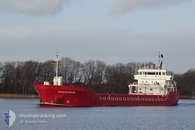
REGGEDIJK
General Cargo
Current Trip
| Time Travelled | 4 days |
|---|---|
| Remaining Time | --- |
| Distance Travelled | 662.90 nm |
| Remaining Distance | 8.85 nm |
| AVG Speed | 9.9 Knots |
| MAX Speed | 13.5 Knots |
| AVG Wind | 16.3 knots |
| MAX Wind | 26 knots |
| MIN Temp | -0.5°C / 31.1°F |
| MAX Temp | 7.1°C / 44.78°F |
| Draught | 6.2 m |
| Position Received | 3 m ago |
Current Position
| Longitude | --- |
|---|---|
| Latitude | --- |
| Status | At anchor |
| Speed | |
| Course | 13° |
| Area | Inner Seas off the West Coast of Scotland |
| Station | T-AIS |
| Position Received | 3 m ago |
Info
Information
The current position of REGGEDIJK is in Inner Seas off the West Coast of Scotland with coordinates 54.69883° / -5.66866° as reported on 2026-01-07 14:36 by AIS to our vessel tracker app. The vessel's current speed is 0 Knots and is heading at the port of BELFAST. The estimated time of arrival as calculated by MyShipTracking vessel tracking app is 2026-01-05 18:00 LT
The vessel REGGEDIJK (IMO: 9515034, MMSI: 246455000) is a General Cargo that was built in 2011 ( 15 years old ). It's sailing under the flag of [NL] Netherlands.
In this page you can find informations about the vessels current position, last detected port calls, and current voyage information. If the vessels is not in coverage by AIS you will find the latest position.
The current position of REGGEDIJK is detected by our AIS receivers and we are not responsible for the reliability of the data. The last position was recorded while the vessel was in Coverage by the Ais receivers of our vessel tracking app.
The current draught of REGGEDIJK as reported by AIS is 6.2 meters
Weather
| Temperature | 3.8°C / 38.84°F |
|---|---|
| Wind Speed | 7 knots |
| Direction | 276° W |
| Pressure | 1004.7 hPa |
| Humidity | 75.2 % |
| Cloud Coverage | 99 % |
Featured Company
Last Port Calls
| Port | Arrival | Departure | Time In Port |
|---|---|---|---|
| 2025-12-30 20:18 | 2026-01-02 23:41 | 3 d | |
| 2025-12-24 13:45 | 2025-12-29 06:23 | 4 d | |
| 2025-12-19 21:51 | 2025-12-23 13:30 | 3 d | |
| 2025-12-17 18:11 | 2025-12-18 13:59 | 19 h | |
| 2025-12-11 06:45 | 2025-12-17 13:33 | 6 d | |
| 2025-12-03 15:38 | 2025-12-06 06:32 | 2 d | |
| 2025-11-29 09:23 | 2025-12-02 14:27 | 3 d | |
| 2025-11-23 19:39 | 2025-11-25 15:27 | 1 d | |
| 2025-11-14 13:29 | 2025-11-19 04:26 | 4 d | |
| 2025-11-05 11:16 | 2025-11-10 12:51 | 5 d |
Last Trips
| Origin | Departure | Destination | Arrival | Distance | |
|---|---|---|---|---|---|
| 2025-12-29 06:23 | 2025-12-30 20:18 | 287.98 nm | |||
| 2025-12-23 13:30 | 2025-12-24 13:45 | 260.41 nm | |||
| 2025-12-18 13:59 | 2025-12-19 21:51 | 274.87 nm | |||
| 2025-12-17 13:33 | 2025-12-17 18:11 | 21.00 nm | |||
| 2025-12-06 06:32 | 2025-12-11 06:45 | 985.68 nm | |||
| 2025-12-02 14:27 | 2025-12-03 15:38 | 120.22 nm | |||
| 2025-11-25 15:27 | 2025-11-29 09:23 | 811.00 nm | |||
| 2025-11-19 04:26 | 2025-11-23 19:39 | 726.84 nm | |||
| 2025-11-10 12:51 | 2025-11-14 13:29 | 674.29 nm | |||
| 2025-11-05 11:10 | 2025-11-05 11:16 | 1.80 nm |
Events
| Time | Event | Details | Position / Dest | Info |
|---|---|---|---|---|
| 2026-01-05 20:35 | Status Changed | At anchor Default |
54.69928 / -5.66633
GBBEL
|
Speed: Course: 305° |
| 2026-01-05 20:32 | Status Changed | Default At anchor |
54.69929 / -5.66634
GBBEL
|
Speed: Course: 303° |
| 2026-01-05 17:23 | Status Changed | At anchor Under way using engine |
54.69959 / -5.66592
GBBEL
|
Speed: 0.1 kn Course: 305° |
| 2026-01-05 17:15 | STOP Moving | 2.15 nm, North of BANGOR |
54.70038 / -5.66768
GBBEL
|
Speed: 0.3 kn Course: 279° |
| 2026-01-05 14:49 | Change Sea Area | United Kingdom part of the Inner Seas off the West Coast of Scotland United Kingdom part of the Irish Sea and St. George's Channel |
54.45425 / -5.29439
Inner Seas off the West Coast of Scotland
GBBEL
|
Speed: 10.9 kn Course: 337.7° |
| 2026-01-05 13:04 | Status Changed | Under way using engine Default |
54.15642 / -5.24111
GBBEL
|
Speed: 9.9 kn Course: 356° |
| 2026-01-05 12:58 | Status Changed | Default Under way using engine |
54.14225 / -5.23972
GBBEL
|
Speed: 9.8 kn Course: 355.5° |
| 2026-01-05 12:52 | Change Sea Area | United Kingdom part of the Irish Sea and St. George's Channel Irish part of the Irish Sea and St. George's Channel |
54.12586 / -5.23780
Irish Sea and St. George's Channel
GBBEL
|
Speed: 9.8 kn Course: 355.5° |
| 2026-01-05 12:51 | Status Changed | Under way using engine Default |
54.12230 / -5.23736
GBBEL
|
Speed: 9.8 kn Course: 355° |
| 2026-01-05 12:51 | Status Changed | Default Under way using engine |
54.12096 / -5.23717
GBBEL
|
Speed: 9.8 kn Course: 355.5° |