
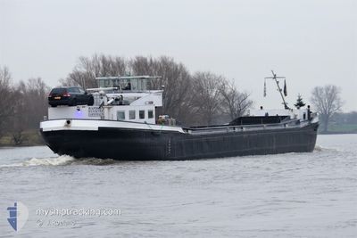
RAPIDO II
Not available
Current Trip
HERDERSEM
| Time Travelled | 19 h, 49 mins |
|---|---|
| Remaining Time | --- |
| Distance Travelled | 18.52 nm |
| Remaining Distance | --- |
| AVG Speed | 9.2 Knots |
| MAX Speed | 10.1 Knots |
| AVG Wind | 2.5 knots |
| MAX Wind | 4 knots |
| MIN Temp | 3.5°C / 38.3°F |
| MAX Temp | 4.1°C / 39.38°F |
| Draught | 0.3 m |
| Position Received | 13 h, 52 m ago |
Current Position
| Longitude | --- |
|---|---|
| Latitude | --- |
| Status | Under way using engine |
| Speed | 4.3 Knots |
| Course | 203.5° |
| Area | North Sea |
| Station | T-AIS |
| Position Received | 13 h, 52 m ago |
Info
Information
The current position of RAPIDO II is in North Sea with coordinates 50.99637° / 4.07694° as reported on 2024-12-12 16:32 by AIS to our vessel tracker app. The vessel's current speed is 4.3 Knots
The vessel RAPIDO II (MMSI: 244730050) is a Not available It's sailing under the flag of [NL] Netherlands.
In this page you can find informations about the vessels current position, last detected port calls, and current voyage information. If the vessels is not in coverage by AIS you will find the latest position.
The current position of RAPIDO II is detected by our AIS receivers and we are not responsible for the reliability of the data. The last position was recorded while the vessel was in Coverage by the Ais receivers of our vessel tracking app.
The current draught of RAPIDO II as reported by AIS is 0.3 meters
Weather
| Temperature | 3.9°C / 39.02°F |
|---|---|
| Wind Speed | 4 knots |
| Direction | 65° ENE |
| Pressure | 1029.6 hPa |
| Humidity | 80.4 % |
| Cloud Coverage | 100 % |
Featured Company
Last Port Calls
| Port | Arrival | Departure | Time In Port |
|---|---|---|---|
| 2024-12-12 08:32 | 2024-12-12 10:36 | 2 h | |
| 2024-12-11 19:24 | 2024-12-12 05:08 | 9 h | |
| 2024-12-10 19:31 | 2024-12-11 05:44 | 10 h | |
| 2024-12-10 08:51 | 2024-12-10 15:50 | 6 h | |
| 2024-12-06 03:53 | 2024-12-06 06:05 | 2 h | |
| 2024-12-05 17:19 | 2024-12-05 17:56 | 36 m | |
| 2024-12-04 22:41 | 2024-12-05 05:41 | 6 h | |
| 2024-12-04 13:09 | 2024-12-04 19:21 | 6 h | |
| 2024-12-02 23:35 | 2024-12-03 01:37 | 2 h | |
| 2024-12-02 18:40 | 2024-12-02 20:07 | 1 h |
Most Visited Ports (Last year)
| Port | Arrivals | |
|---|---|---|
| 99 | ||
| 66 | ||
| 50 | ||
| 28 | ||
| 10 | ||
| 8 |
Last Trips
| Origin | Departure | Destination | Arrival | Distance | |
|---|---|---|---|---|---|
| 2024-12-12 06:08 | 2024-12-12 09:32 | 29.39 nm | |||
| 2024-12-11 06:44 | 2024-12-11 20:24 | 68.08 nm | |||
| 2024-12-10 16:50 | 2024-12-10 20:31 | 22.11 nm | |||
| 2024-12-06 07:05 | 2024-12-10 09:51 | 43.92 nm | |||
| 2024-12-05 18:56 | 2024-12-06 04:53 | 50.73 nm | |||
| 2024-12-05 06:41 | 2024-12-05 18:19 | 49.84 nm | |||
| 2024-12-04 20:21 | 2024-12-04 23:41 | 22.12 nm | |||
| 2024-12-03 02:37 | 2024-12-04 14:09 | 44.41 nm | |||
| 2024-12-02 21:07 | 2024-12-03 00:35 | 29.30 nm | |||
| 2024-12-02 18:06 | 2024-12-02 19:40 | 17.16 nm |
Events
| Time | Event | Details | Position / Dest | Info |
|---|---|---|---|---|
| 2024-12-12 16:39 | Status Changed | Default Under way using engine |
50.98924 / 4.07195
HERDERSEM
|
Speed: 4.3 kn Course: 203.5° |
| 2024-12-12 16:32 | OUT of Coverage |
50.99637 / 4.07694
North Sea
|
Speed: 4.3 kn Course: 203.5° |
|
| 2024-12-12 15:26 | IN Coverage |
51.03854 / 4.07736
North Sea
|
Speed: 4 kn Course: 181.2° |
|
| 2024-12-12 13:08 | STOP Moving | 3.25 nm, West of BAASRODE |
51.04254 / 4.08244
HERDERSEM
|
Speed: Course: -1° |
| 2024-12-12 12:56 | Status Changed | Default Under way using engine |
51.04297 / 4.08326
HERDERSEM
|
Speed: 1.8 kn Course: 511° |
| 2024-12-12 12:56 | OUT of Coverage |
51.04297 / 4.08326
North Sea
|
Speed: 1.8 kn Course: 237° |
|
| 2024-12-12 12:42 | Status Changed | Under way using engine Default |
51.04120 / 4.09501
HERDERSEM
|
Speed: 6.7 kn Course: 224° |
| 2024-12-12 12:42 | IN Coverage |
51.04120 / 4.09501
North Sea
HERDERSEM
|
Speed: 8.6 kn Course: 329.2° |
|
| 2024-12-12 11:41 | Status Changed | Default Under way using engine |
51.07449 / 4.18832
HERDERSEM
|
Speed: 9.2 kn Course: 130.7° |
| 2024-12-12 11:36 | OUT of Coverage |
51.08469 / 4.18623
North Sea
HERDERSEM
|
Speed: 9.2 kn Course: 130.7° |