
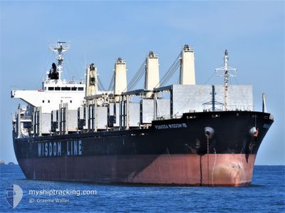
POAVOSA WISDOM VIII
Bulk Carrier
Current Trip
| Time Travelled | 20 days |
|---|---|
| Remaining Time | --- |
| Distance Travelled | 90.18 nm |
| Remaining Distance | --- |
| AVG Speed | 10 Knots |
| MAX Speed | 13.1 Knots |
| AVG Wind | 10.4 knots |
| MAX Wind | 21.3 knots |
| MIN Temp | 0.8°C / 33.44°F |
| MAX Temp | 20.3°C / 68.54°F |
| Draught | 5.2 m |
| Position Received | 1 m ago |
Current Position
| Longitude | 11.66807° |
|---|---|
| Latitude | 57.59268° |
| Status | At anchor |
| Speed | |
| Course | 136° |
| Area | Kattegat |
| Station | T-AIS |
| Position Received | 1 m ago |
Info
Information
The current position of POAVOSA WISDOM VIII is in Kattegat with coordinates 57.59268° / 11.66807° as reported on 2024-05-15 01:58 by AIS to our vessel tracker app. The vessel's current speed is 0 Knots
The vessel POAVOSA WISDOM VIII (IMO: 9641924, MMSI: 356188000) is a Bulk Carrier that was built in 2013 ( 11 years old ). It's sailing under the flag of [PA] Panama.
In this page you can find informations about the vessels current position, last detected port calls, and current voyage information. If the vessels is not in coverage by AIS you will find the latest position.
The current position of POAVOSA WISDOM VIII is detected by our AIS receivers and we are not responsible for the reliability of the data. The last position was recorded while the vessel was in Coverage by the Ais receivers of our vessel tracking app.
The current draught of POAVOSA WISDOM VIII as reported by AIS is 5.2 meters
Weather
| Temperature | 12.3°C / 54.14°F |
|---|---|
| Wind Speed | 12 knots |
| Direction | 103° ESE |
| Pressure | 1018.3 hPa |
| Humidity | 68.5 % |
| Cloud Coverage | 85 % |
Featured Company
Last Port Calls
| Port | Arrival | Departure | Time In Port |
|---|---|---|---|
| 2024-04-16 10:47 | 2024-04-24 13:40 | 8 d | |
| 2024-04-03 14:36 | 2024-04-05 11:47 | 1 d | |
| 2024-03-28 23:32 | 2024-03-30 17:23 | 1 d | |
| 2024-03-18 15:23 |
Most Visited Ports (Last year)
| Port | Arrivals | |
|---|---|---|
| 2 | ||
| 2 | ||
| 2 | ||
| 2 | ||
| 2 | ||
| 1 |
Last Trips
| Origin | Departure | Destination | Arrival | Distance | |
|---|---|---|---|---|---|
| 2024-04-05 11:47 | 2024-04-16 10:47 | 3256.15 nm | |||
| 2024-03-30 17:23 | 2024-04-03 14:36 | 1059.67 nm | |||
| 2024-03-18 15:23 | 2024-03-28 23:32 | 1158.43 nm |
Events
| Time | Event | Details | Position / Dest | Info |
|---|---|---|---|---|
| 2024-05-07 11:37 | Status Changed | At anchor Under way using engine |
57.59225 / 11.67394
FOR ORDER
|
Speed: 0.5 kn Course: 183° |
| 2024-05-07 11:30 | STOP Moving | 3.52 nm, West of VRANGO |
57.59109 / 11.67297
FOR ORDER
|
Speed: 0.3 kn Course: 166° |
| 2024-05-07 09:40 | Change Sea Area | Swedish part of the Kattegat Swedish part of the Skaggerak |
57.88281 / 11.36090
Kattegat
|
Speed: 11.9 kn Course: 182.1° |
| 2024-05-07 09:26 | Status Changed | Under way using engine At anchor |
57.92124 / 11.37330
FOR ORDER
|
Speed: 3.4 kn Course: 182° |
| 2024-05-07 09:25 | START Moving | 6.34 nm, West of STANSVIKS |
57.92177 / 11.37314
FOR ORDER
|
Speed: 3.2 kn Course: 180° |
| 2024-05-06 20:53 | Status Changed | At anchor Default |
57.92220 / 11.36767
FOR ORDER
|
Speed: Course: 151° |
| 2024-05-06 20:50 | Status Changed | Default At anchor |
57.92225 / 11.36768
FOR ORDER
|
Speed: Course: 152° |
| 2024-05-06 06:20 | Status Changed | At anchor Default |
57.92034 / 11.36613
FOR ORDER
|
Speed: Course: 72° |
| 2024-05-06 06:14 | Status Changed | Default At anchor |
57.92019 / 11.36626
FOR ORDER
|
Speed: Course: 78° |
| 2024-05-05 17:50 | Status Changed | At anchor Default |
57.91878 / 11.37057
FOR ORDER
|
Speed: Course: 353° |