
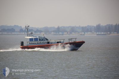
PL ST BRENDAN
Pilot Vessel
Current Trip
PILOTAGE
| Time Travelled | 1 day |
|---|---|
| Remaining Time | --- |
| Distance Travelled | 2.45 nm |
| Remaining Distance | --- |
| AVG Speed | 10.6 Knots |
| MAX Speed | 12.5 Knots |
| AVG Wind | 8.7 knots |
| MAX Wind | 10 knots |
| MIN Temp | 10°C / 50°F |
| MAX Temp | 10.4°C / 50.72°F |
| Draught | 2 m |
| Position Received | 10 h, 1 m ago |
Current Position
| Longitude | --- |
|---|---|
| Latitude | --- |
| Status | Under way using engine |
| Speed | |
| Course | 243° |
| Area | North Sea |
| Station | T-AIS |
| Position Received | 10 h, 1 m ago |
Info
Information
The current position of PL ST BRENDAN is in North Sea with coordinates 51.94730° / 1.29136° as reported on 2025-12-22 13:08 by AIS to our vessel tracker app. The vessel's current speed is 0 Knots
The vessel PL ST BRENDAN (MMSI: 235078345) is a Pilot Vessel It's sailing under the flag of [GB] United Kingdom.
In this page you can find informations about the vessels current position, last detected port calls, and current voyage information. If the vessels is not in coverage by AIS you will find the latest position.
The current position of PL ST BRENDAN is detected by our AIS receivers and we are not responsible for the reliability of the data. The last position was recorded while the vessel was in Coverage by the Ais receivers of our vessel tracking app.
The current draught of PL ST BRENDAN as reported by AIS is 2 meters
Weather
| Temperature | 10°C / 50°F |
|---|---|
| Wind Speed | 8 knots |
| Direction | 114° ESE |
| Pressure | 1009.4 hPa |
| Humidity | 82.8 % |
| Cloud Coverage | 100 % |
Featured Company
Last Port Calls
| Port | Arrival | Departure | Time In Port |
|---|---|---|---|
| 2025-12-21 11:15 | 2025-12-21 11:17 | 1 m | |
| 2025-12-16 01:38 | 2025-12-16 01:39 | 1 m | |
| 2025-12-11 14:48 | 2025-12-11 14:50 | 2 m | |
| 2025-12-11 14:33 | 2025-12-11 14:40 | 6 m | |
| 2025-12-11 14:14 | 2025-12-11 14:22 | 8 m | |
| 2025-12-10 11:58 | 2025-12-10 12:45 | 47 m | |
| 2025-12-05 15:09 | 2025-12-05 15:11 | 2 m | |
| 2025-12-05 08:34 | 2025-12-05 08:36 | 2 m | |
| 2025-12-05 01:26 | 2025-12-05 01:28 | 1 m | |
| 2025-12-04 07:53 | 2025-12-04 07:55 | 1 m |
Most Visited Ports (Last year)
| Port | Arrivals | |
|---|---|---|
| 227 | ||
| 30 | ||
| 15 | ||
| 7 | ||
| 1 |
Last Trips
| Origin | Departure | Destination | Arrival | Distance | |
|---|---|---|---|---|---|
| 2025-12-16 01:39 | 2025-12-21 11:15 | 739.80 nm | |||
| 2025-12-11 14:50 | 2025-12-16 01:38 | 85.33 nm | |||
| 2025-12-11 14:40 | 2025-12-11 14:48 | 0.79 nm | |||
| 2025-12-11 14:22 | 2025-12-11 14:33 | 1.52 nm | |||
| 2025-12-10 12:45 | 2025-12-11 14:14 | 25.92 nm | |||
| 2025-12-05 15:11 | 2025-12-10 11:58 | 89.76 nm | |||
| 2025-12-05 08:36 | 2025-12-05 15:09 | 38.79 nm | |||
| 2025-12-05 01:28 | 2025-12-05 08:34 | 33.25 nm | |||
| 2025-12-04 07:55 | 2025-12-05 01:26 | 56.19 nm | |||
| 2025-12-03 19:37 | 2025-12-04 07:53 | 75.78 nm |
Events
| Time | Event | Details | Position / Dest | Info |
|---|---|---|---|---|
| 2025-12-22 13:08 | OUT of Coverage |
51.94730 / 1.29136
North Sea
|
Speed: Course: 243° |
|
| 2025-12-22 08:37 | IN Coverage |
51.94731 / 1.29135
North Sea
|
Speed: 0.1 kn Course: 249° |
|
| 2025-12-21 14:39 | OUT of Coverage |
51.94731 / 1.29137
North Sea
|
Speed: 0.1 kn Course: 248° |
|
| 2025-12-21 12:27 | STOP Moving | 0.74 nm, South West of FELIXSTOWE |
51.94761 / 1.29172
PILOTAGE
|
Speed: 0.2 kn Course: 210° |
| 2025-12-21 12:21 | START Moving | 0.62 nm, South East of FELIXSTOWE |
51.95089 / 1.31030
PILOTAGE
|
Speed: 10.6 kn Course: 267.9° |
| 2025-12-21 12:18 | STOP Moving | 0.69 nm, South East of FELIXSTOWE |
51.95127 / 1.31346
PILOTAGE
|
Speed: 0.2 kn Course: 80° |
| 2025-12-21 12:13 | START Moving | 0.63 nm, South of FELIXSTOWE |
51.94919 / 1.29338
PILOTAGE
|
Speed: 10.6 kn Course: 48.3° |
| 2025-12-21 11:21 | STOP Moving | 0.74 nm, South West of FELIXSTOWE |
51.94761 / 1.29170
PILOTAGE
|
Speed: 0.2 kn Course: 206° |
| 2025-12-21 11:17 | PORT DEPARTURE |
|
51.95208 / 1.30752
PILOTAGE
|
Speed: 15 kn Course: 271° |
| 2025-12-21 11:17 | START Moving |
51.95191 / 1.31106
[GB] FELIXSTOWE
|
Speed: 12.1 kn Course: 279° |