
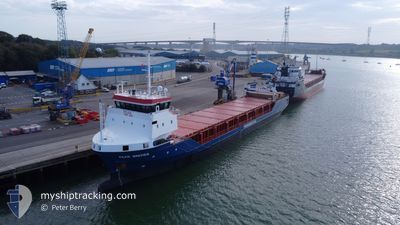
PEAK BREMEN
General Cargo
Current Trip
| Time Travelled | 2 days |
|---|---|
| Remaining Time | --- |
| Distance Travelled | 375.70 nm |
| Remaining Distance | --- |
| AVG Speed | 6 Knots |
| MAX Speed | 9.7 Knots |
| AVG Wind | 18.8 knots |
| MAX Wind | 36 knots |
| MIN Temp | 8.1°C / 46.58°F |
| MAX Temp | 11.7°C / 53.06°F |
| Draught | 3.7 m |
| Position Received | 7 m ago |
Current Position
| Longitude | --- |
|---|---|
| Latitude | --- |
| Status | At anchor |
| Speed | 1.2 Knots |
| Course | 242° |
| Area | North Sea |
| Station | T-AIS |
| Position Received | 7 m ago |
Info
Information
The current position of PEAK BREMEN is in North Sea with coordinates 54.77921° / -1.19865° as reported on 2025-12-11 09:57 by AIS to our vessel tracker app. The vessel's current speed is 1.2 Knots
The vessel PEAK BREMEN (IMO: 9612533, MMSI: 246779000) is a General Cargo that was built in 2011 ( 14 years old ). It's sailing under the flag of [NL] Netherlands.
In this page you can find informations about the vessels current position, last detected port calls, and current voyage information. If the vessels is not in coverage by AIS you will find the latest position.
The current position of PEAK BREMEN is detected by our AIS receivers and we are not responsible for the reliability of the data. The last position was recorded while the vessel was in Coverage by the Ais receivers of our vessel tracking app.
The current draught of PEAK BREMEN as reported by AIS is 3.7 meters
Weather
| Temperature | 8.7°C / 47.66°F |
|---|---|
| Wind Speed | 20 knots |
| Direction | 210° SSW |
| Pressure | 1011.2 hPa |
| Humidity | 77.5 % |
| Cloud Coverage | 100 % |
Featured Company
Last Port Calls
| Port | Arrival | Departure | Time In Port |
|---|---|---|---|
| 2025-12-08 07:19 | 2025-12-08 14:51 | 7 h | |
| 2025-12-05 16:10 | 2025-12-05 18:03 | 1 h | |
| 2025-12-03 10:37 | 2025-12-04 13:21 | 1 d | |
| 2025-11-29 22:38 | 2025-12-01 23:47 | 2 d | |
| 2025-11-28 19:02 | 2025-11-28 23:29 | 4 h | |
| 2025-11-28 10:11 | 2025-11-28 14:47 | 4 h | |
| 2025-11-28 09:34 | 2025-11-28 09:52 | 18 m | |
| 2025-11-26 05:47 | 2025-11-26 06:47 | 59 m | |
| 2025-11-23 11:56 | 2025-11-25 13:13 | 2 d | |
| 2025-11-20 10:17 | 2025-11-21 11:49 | 1 d |
Last Trips
| Origin | Departure | Destination | Arrival | Distance | |
|---|---|---|---|---|---|
| 2025-12-05 18:03 | 2025-12-08 07:19 | 646.70 nm | |||
| 2025-12-04 13:21 | 2025-12-05 16:10 | 278.20 nm | |||
| 2025-12-01 23:47 | 2025-12-03 10:37 | 328.38 nm | |||
| 2025-11-28 23:29 | 2025-11-29 22:38 | 257.93 nm | |||
| 2025-11-28 14:47 | 2025-11-28 19:02 | 24.96 nm | |||
| 2025-11-28 09:52 | 2025-11-28 10:11 | 1.15 nm | |||
| 2025-11-26 06:47 | 2025-11-28 09:34 | 362.69 nm | |||
| 2025-11-25 13:13 | 2025-11-26 05:47 | 177.71 nm | |||
| 2025-11-21 11:49 | 2025-11-23 11:56 | 308.22 nm | |||
| 2025-11-18 17:57 | 2025-11-20 10:17 | 324.64 nm |
Events
| Time | Event | Details | Position / Dest | Info |
|---|---|---|---|---|
| 2025-12-11 10:00 | Status Changed | Default At anchor |
54.77930 / -1.19915
GBTEE
|
Speed: 1.2 kn Course: 242° |
| 2025-12-11 09:45 | Status Changed | At anchor Default |
54.77904 / -1.19802
GBTEE
|
Speed: 0.9 kn Course: 171° |
| 2025-12-11 09:33 | Status Changed | Default At anchor |
54.77880 / -1.19758
GBTEE
|
Speed: 0.2 kn Course: 215° |
| 2025-12-11 09:27 | Status Changed | At anchor Default |
54.77928 / -1.19916
GBTEE
|
Speed: 0.8 kn Course: 186° |
| 2025-12-11 09:21 | Status Changed | Default At anchor |
54.77884 / -1.19760
GBTEE
|
Speed: 0.7 kn Course: 240° |
| 2025-12-11 08:57 | Status Changed | At anchor Default |
54.77922 / -1.19851
GBTEE
|
Speed: 0.4 kn Course: 224° |
| 2025-12-11 08:48 | Status Changed | Default At anchor |
54.77887 / -1.19769
GBTEE
|
Speed: 0.6 kn Course: 183° |
| 2025-12-11 08:30 | Status Changed | At anchor Default |
54.77913 / -1.19856
GBTEE
|
Speed: 1.1 kn Course: 167° |
| 2025-12-11 08:24 | Status Changed | Default At anchor |
54.77903 / -1.19794
GBTEE
|
Speed: 0.3 kn Course: 200° |
| 2025-12-11 08:09 | Status Changed | At anchor Default |
54.77917 / -1.19887
GBTEE
|
Speed: 0.9 kn Course: 251° |