
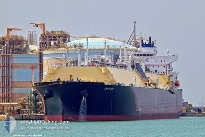
ORION IRIS
Tanker D
Current Trip
| Time Travelled | 6 days |
|---|---|
| Remaining Time | --- |
| Distance Travelled | 1936.11 nm |
| Remaining Distance | --- |
| AVG Speed | 14.5 Knots |
| MAX Speed | 19 Knots |
| AVG Wind | 12.6 knots |
| MAX Wind | 22.8 knots |
| MIN Temp | 0.2°C / 32.36°F |
| MAX Temp | 26°C / 78.8°F |
| Draught | 9.2 m |
| Position Received | 6 m ago |
Current Position
| Longitude | --- |
|---|---|
| Latitude | --- |
| Status | At anchor |
| Speed | 0.1 Knots |
| Course | 82° |
| Area | Gulf of Mexico |
| Station | T-AIS |
| Position Received | 6 m ago |
Info
Information
The current position of ORION IRIS is in Gulf of Mexico with coordinates 29.35311° / -93.70130° as reported on 2025-12-17 22:55 by AIS to our vessel tracker app. The vessel's current speed is 0.1 Knots
The vessel ORION IRIS (IMO: 9956604, MMSI: 228243350) is a Tanker D It's sailing under the flag of [FR] France.
In this page you can find informations about the vessels current position, last detected port calls, and current voyage information. If the vessels is not in coverage by AIS you will find the latest position.
The current position of ORION IRIS is detected by our AIS receivers and we are not responsible for the reliability of the data. The last position was recorded while the vessel was in Coverage by the Ais receivers of our vessel tracking app.
The current draught of ORION IRIS as reported by AIS is 9.2 meters
Weather
| Temperature | 18.5°C / 65.3°F |
|---|---|
| Wind Speed | 14 knots |
| Direction | 82° E |
| Pressure | 1014.4 hPa |
| Humidity | 91.6 % |
| Cloud Coverage | 100 % |
Featured Company
Last Port Calls
| Port | Arrival | Departure | Time In Port |
|---|---|---|---|
| 2025-12-10 09:57 | 2025-12-11 07:44 | 21 h | |
| 2025-12-02 14:07 | 2025-12-03 10:47 | 20 h | |
| 2025-10-29 07:44 | 2025-10-30 13:09 | 1 d | |
| 2025-10-16 07:35 | 2025-10-17 07:15 | 23 h |
Most Visited Ports (Last year)
| Port | Arrivals | |
|---|---|---|
| 7 | ||
| 2 | ||
| 2 | ||
| 1 | ||
| 1 | ||
| 1 |
Last Trips
| Origin | Departure | Destination | Arrival | Distance | |
|---|---|---|---|---|---|
| 2025-12-03 10:47 | 2025-12-10 09:57 | 2095.86 nm | |||
| 2025-10-30 13:09 | 2025-12-02 14:07 | 3916.81 nm | |||
| 2025-10-17 07:15 | 2025-10-29 07:44 | 3631.87 nm | |||
| 2025-09-12 07:14 | 2025-10-16 07:35 | 8026.78 nm |
Events
| Time | Event | Details | Position / Dest | Info |
|---|---|---|---|---|
| 2025-12-17 22:43 | Status Changed | At anchor Default |
29.35311 / -93.70129
US NSS
|
Speed: 0.1 kn Course: 92° |
| 2025-12-17 22:35 | Status Changed | Default At anchor |
29.35330 / -93.70138
US NSS
|
Speed: 0.1 kn Course: 87° |
| 2025-12-17 22:32 | Status Changed | At anchor Default |
29.35321 / -93.70131
US NSS
|
Speed: 0.1 kn Course: 81° |
| 2025-12-17 22:19 | Status Changed | Default At anchor |
29.35283 / -93.70132
US NSS
|
Speed: 0.1 kn Course: 90° |
| 2025-12-17 21:16 | Status Changed | At anchor Default |
29.35229 / -93.70109
US NSS
|
Speed: 0.1 kn Course: 64° |
| 2025-12-17 21:05 | Status Changed | Default At anchor |
29.35221 / -93.70102
US NSS
|
Speed: Course: 68° |
| 2025-12-17 20:07 | Status Changed | At anchor Default |
29.35178 / -93.70050
US NSS
|
Speed: Course: 36° |
| 2025-12-17 20:01 | Status Changed | Default At anchor |
29.35157 / -93.70026
US NSS
|
Speed: Course: 38° |
| 2025-12-17 19:46 | Status Changed | At anchor Default |
29.35174 / -93.70061
US NSS
|
Speed: 0.1 kn Course: 56° |
| 2025-12-17 19:38 | Status Changed | Default At anchor |
29.35211 / -93.70084
US NSS
|
Speed: 0.2 kn Course: 66° |