
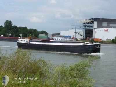
OPTIMIST
Cargo
Current Trip
FRRIB4991TLOCKB00282
Unknown Port
ETA*
---
| Time Travelled | 13 days |
|---|---|
| Remaining Time | --- |
| Distance Travelled | 449.21 nm |
| Remaining Distance | --- |
| AVG Speed | 5 Knots |
| MAX Speed | 7.7 Knots |
| AVG Wind | 7.9 knots |
| MAX Wind | 16.2 knots |
| MIN Temp | 1.9°C / 35.42°F |
| MAX Temp | 18.7°C / 65.66°F |
| Draught | 0 m |
| Position Received | 6 m ago |
Current Position
| Longitude | 4.43574° |
|---|---|
| Latitude | 51.04835° |
| Status | Under way using engine |
| Speed | 2.3 Knots |
| Course | --- |
| Area | North Sea |
| Station | T-AIS |
| Position Received | 6 m ago |
Info
info
Information
The current position of OPTIMIST is in North Sea with coordinates 51.04835° / 4.43574° as reported on 2024-04-23 13:55 by AIS to our vessel tracker app. The vessel's current speed is 2.3 Knots
The vessel OPTIMIST (MMSI: 244670990) is a Cargo It's sailing under the flag of [NL] Netherlands.
In this page you can find informations about the vessels current position, last detected port calls, and current voyage information. If the vessels is not in coverage by AIS you will find the latest position.
The current position of OPTIMIST is detected by our AIS receivers and we are not responsible for the reliability of the data. The last position was recorded while the vessel was in Coverage by the Ais receivers of our vessel tracking app.
Weather
| Temperature | 10.5°C / 50.9°F |
|---|---|
| Wind Speed | 7 knots |
| Direction | 301° WNW |
| Pressure | 1019.2 hPa |
| Humidity | 39 % |
| Cloud Coverage | 100 % |
Featured Company
Limited time offer - Install a base station receiver to your area and list your company on MyShipTracking Free forever!
Last Port Calls
| Port | Arrival | Departure | Time In Port |
|---|---|---|---|
| 2024-04-10 10:09 | 2024-04-10 13:20 | 3 h | |
| 2024-04-09 15:45 | 2024-04-10 05:51 | 14 h | |
| 2024-04-09 08:27 | 2024-04-09 08:43 | 16 m | |
| 2024-04-08 14:55 | 2024-04-09 06:55 | 16 h | |
| 2024-04-08 12:11 | 2024-04-08 13:19 | 1 h | |
| 2024-04-07 10:47 | |||
| 2024-04-06 15:46 | 2024-04-07 02:20 | 10 h | |
| 2024-04-06 14:16 | 2024-04-06 14:45 | 29 m | |
| 2024-04-03 16:07 | 2024-04-06 13:33 | 2 d | |
| 2024-04-03 12:10 | 2024-04-03 12:23 | 13 m |
Most Visited Ports (Last year)
| Port | Arrivals | |
|---|---|---|
| 25 | ||
| 15 | ||
| 8 | ||
| 7 | ||
| 6 | ||
| 6 |
Last Trips
| Origin | Departure | Destination | Arrival | Distance | |
|---|---|---|---|---|---|
| 2024-04-10 07:51 | 2024-04-10 12:09 | 16.50 nm | |||
| 2024-04-09 10:43 | 2024-04-09 17:45 | 38.45 nm | |||
| 2024-04-09 08:55 | 2024-04-09 10:27 | 5.45 nm | |||
| 2024-04-08 15:19 | 2024-04-08 16:55 | 3.40 nm | |||
| 2024-04-07 04:20 | 2024-04-08 14:11 | 41.67 nm | |||
| 2024-04-07 04:20 | 2024-04-07 12:47 | 40.61 nm | |||
| 2024-04-06 16:45 | 2024-04-06 17:46 | 4.73 nm | |||
| 2024-04-06 15:33 | 2024-04-06 16:16 | 4.76 nm | |||
| 2024-04-03 14:23 | 2024-04-03 18:07 | 24.09 nm | |||
| 2024-04-03 12:36 | 2024-04-03 14:10 | 10.57 nm |
Events
| Time | Event | Details | Position / Dest | Info |
|---|---|---|---|---|
| 2024-04-23 13:12 | STOP Moving | 6.24 nm, South East of HEMIKSEM |
51.06377 / 4.43053
FRRIB4991TLOCKB00282
|
Speed: 0.2 kn Course: 511° |
| 2024-04-23 13:02 | START Moving | 5.79 nm, South East of HEMIKSEM |
51.07008 / 4.42382
FRRIB4991TLOCKB00282
|
Speed: 3.8 kn Course: 152.8° |
| 2024-04-23 12:47 | STOP Moving | 5.42 nm, South East of HEMIKSEM |
51.07505 / 4.41805
FRRIB4991TLOCKB00282
|
Speed: Course: 511° |
| 2024-04-23 10:51 | Status Changed | Under way using engine Default |
51.11305 / 4.31150
FRRIB4991TLOCKB00282
|
Speed: 3.9 kn Course: -1° |
| 2024-04-23 10:47 | Status Changed | Default Under way using engine |
51.11694 / 4.31175
FRRIB4991TLOCKB00282
|
Speed: 3.3 kn Course: 176.8° |
| 2024-04-23 10:37 | Status Changed | Under way using engine Default |
51.12418 / 4.30472
FRRIB4991TLOCKB00282
|
Speed: 3.8 kn Course: -1° |
| 2024-04-23 10:36 | Status Changed | Default Under way using engine |
51.12402 / 4.30364
FRRIB4991TLOCKB00282
|
Speed: 5.2 kn Course: 96.2° |
| 2024-04-23 10:30 | Status Changed | Under way using engine Default |
51.12349 / 4.29093
FRRIB4991TLOCKB00282
|
Speed: 5.7 kn Course: 81° |
| 2024-04-23 10:30 | IN Coverage |
51.12349 / 4.29093
North Sea
|
Speed: 5.2 kn Course: 96.2° |
|
| 2024-04-23 07:58 | OUT of Coverage |
51.04786 / 4.05592
North Sea
|
Speed: 7.6 kn Course: 54.2° |