
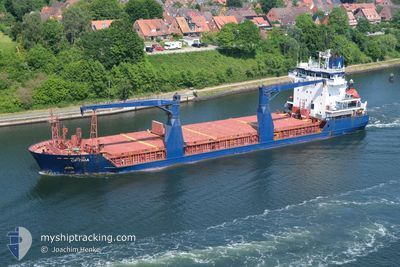
OPTIMA
General Cargo
Current Trip
IN_ORDER
| Time Travelled | 1 day |
|---|---|
| Remaining Time | --- |
| Distance Travelled | 340.30 nm |
| Remaining Distance | --- |
| AVG Speed | 10.7 Knots |
| MAX Speed | 11.8 Knots |
| AVG Wind | 11.2 knots |
| MAX Wind | 18.6 knots |
| MIN Temp | -3.6°C / 25.52°F |
| MAX Temp | -1°C / 30.2°F |
| Draught | 4.8 m |
| Position Received | 9 h, 31 m ago |
Current Position
| Longitude | --- |
|---|---|
| Latitude | --- |
| Status | Under way using engine |
| Speed | 11.1 Knots |
| Course | 58° |
| Area | Baltic Sea |
| Station | T-AIS |
| Position Received | 9 h, 31 m ago |
Info
Information
The current position of OPTIMA is in Baltic Sea with coordinates 55.78166° / 15.94242° as reported on 2026-02-18 13:15 by AIS to our vessel tracker app. The vessel's current speed is 11.1 Knots
The vessel OPTIMA (IMO: 9210244, MMSI: 305162000) is a General Cargo that was built in 2000 ( 26 years old ). It's sailing under the flag of [AG] Antigua Barbuda.
In this page you can find informations about the vessels current position, last detected port calls, and current voyage information. If the vessels is not in coverage by AIS you will find the latest position.
The current position of OPTIMA is detected by our AIS receivers and we are not responsible for the reliability of the data. The last position was recorded while the vessel was in Coverage by the Ais receivers of our vessel tracking app.
The current draught of OPTIMA as reported by AIS is 4.8 meters
Weather
| Temperature | -2.4°C / 27.68°F |
|---|---|
| Wind Speed | 11 knots |
| Direction | 339° NNW |
| Pressure | 1009.5 hPa |
| Humidity | 78.4 % |
| Cloud Coverage | 100 % |
Featured Company
Last Port Calls
| Port | Arrival | Departure | Time In Port |
|---|---|---|---|
| 2026-02-17 16:40 | 2026-02-17 16:42 | 2 m | |
| 2026-02-06 17:17 | 2026-02-08 07:52 | 1 d | |
| 2026-01-25 23:08 | 2026-01-28 18:30 | 2 d | |
| 2025-12-17 20:02 | 2025-12-20 11:59 | 2 d | |
| 2025-12-14 15:16 | 2025-12-14 15:21 | 5 m |
Most Visited Ports (Last year)
| Port | Arrivals | |
|---|---|---|
| 7 | ||
| 4 | ||
| 3 | ||
| 3 | ||
| 3 | ||
| 2 |
Last Trips
| Origin | Departure | Destination | Arrival | Distance | |
|---|---|---|---|---|---|
| 2026-02-08 07:52 | 2026-02-17 16:40 | 1927.02 nm | |||
| 2026-01-28 18:30 | 2026-02-06 17:17 | 272.90 nm | |||
| 2025-12-20 11:59 | 2026-01-25 23:08 | 3935.00 nm | |||
| 2025-12-14 15:21 | 2025-12-17 20:02 | 789.89 nm | |||
| 2025-11-28 17:09 | 2025-12-14 15:16 | 2448.54 nm |
Events
| Time | Event | Details | Position / Dest | Info |
|---|---|---|---|---|
| 2026-02-18 13:21 | Status Changed | Default Under way using engine |
55.79310 / 15.97087
IN_ORDER
|
Speed: 11.1 kn Course: 58° |
| 2026-02-18 13:15 | OUT of Coverage |
55.78166 / 15.94242
Baltic Sea
IN_ORDER
|
Speed: 11.1 kn Course: 58° |
|
| 2026-02-18 11:23 | Change Sea Area | Swedish part of the Baltic Sea Danish part of the Kattegat |
55.61338 / 15.40863
Baltic Sea
IN_ORDER
|
Speed: 10.8 kn Course: 59.4° |
| 2026-02-18 05:47 | Detected in Sea | Danish part of the Kattegat |
54.99557 / 14.04853
Kattegat
IN_ORDER
|
Speed: 11.1 kn Course: 73.1° |
| 2026-02-18 05:29 | Change Sea Area | Swedish part of the Baltic Sea German part of the Baltic Sea |
54.97915 / 13.95575
Baltic Sea
IN_ORDER
|
Speed: 11.1 kn Course: 72.2° |
| 2026-02-18 03:46 | Status Changed | Under way using engine Default |
54.87934 / 13.43429
IN_ORDER
|
Speed: 10.9 kn Course: 70° |
| 2026-02-18 03:21 | Status Changed | Default Under way using engine |
54.85451 / 13.31001
IN_ORDER
|
Speed: 10.5 kn Course: 72.7° |
| 2026-02-17 23:56 | Change Sea Area | German part of the Baltic Sea Danish part of the Baltic Sea |
54.59181 / 12.33220
Baltic Sea
IN_ORDER
|
Speed: 11.9 kn Course: 54.6° |
| 2026-02-17 23:47 | Change Sea Area | Danish part of the Baltic Sea German part of the Baltic Sea |
54.57059 / 12.30182
Baltic Sea
IN_ORDER
|
Speed: 11.5 kn Course: 17° |
| 2026-02-17 22:38 | Change Sea Area | German part of the Baltic Sea Danish part of the Baltic Sea |
54.40498 / 12.10398
Baltic Sea
IN_ORDER
|
Speed: 11.5 kn Course: 89.5° |