
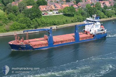
OPTIMA
General Cargo
Current Trip
| Time Travelled | 19 days |
|---|---|
| Remaining Time | --- |
| Distance Travelled | 2409.41 nm |
| Remaining Distance | --- |
| AVG Speed | 8.7 Noeuds |
| MAX Speed | 8.7 Noeuds |
| AVG Wind | 16.5 knots |
| MAX Wind | 44.8 knots |
| MIN Temp | -12.2°C / 10.04°F |
| MAX Temp | 12.3°C / 54.14°F |
| Tirant d eau | 8.4 m |
| Position reçue | 31 m depuis |
Current Position
| Longitude | --- |
|---|---|
| Latitude | --- |
| Etat | At anchor |
| Vitesse | 0.1 Noeuds |
| Parcours | 308° |
| Zone | English Channel |
| Station | T-AIS |
| Position reçue | 31 m depuis |
Info
Information
The current position of OPTIMA is in English Channel with coordinates 48.72029° / -2.83497° as reported on 2026-01-09 05:53 by AIS to our vessel tracker app. The vessel's current speed is 0.1 Noeuds and is heading at the port of JORF LASFAR. The estimated time of arrival as calculated by MyShipTracking vessel tracking app is 2026-01-12 22:00 LT
The vessel OPTIMA (IMO: 9210244, MMSI: 305162000) is a General Cargo that was built in 2000 ( 26 Age ). It's sailing under the flag of [AG] Antigua Barbuda.
In this page you can find informations about the vessels current position, last detected port calls, and current voyage information. If the vessels is not in coverage by AIS you will find the latest position.
The current position of OPTIMA is detected by our AIS receivers and we are not responsible for the reliability of the data. The last position was recorded while the vessel was in Coverage by the Ais receivers of our vessel tracking app.
The current draught of OPTIMA as reported by AIS is 8.4 meters
Weather
| Temperature | 8.7°C / 47.66°F |
|---|---|
| Wind Speed | 29 knots |
| Direction | 292° WNW |
| Pressure | 999.7 hPa |
| Humidity | 76.7 % |
| Cloud Coverage | 70 % |
Featured Company
Last Port Calls
| Port | Arrival | Departure | Time In Port |
|---|---|---|---|
| 2025-12-17 20:02 | 2025-12-20 11:59 | 2 d | |
| 2025-12-14 15:16 | 2025-12-14 15:21 | 5 m | |
| 2025-11-20 22:53 | 2025-11-28 17:09 | 7 d |
Most Visited Ports (Last year)
| Port | Arrivals | |
|---|---|---|
| 8 | ||
| 4 | ||
| 4 | ||
| 2 | ||
| 2 | ||
| 1 |
Last Trips
| Origin | Departure | Destination | Arrival | Distance | |
|---|---|---|---|---|---|
| 2025-12-14 15:21 | 2025-12-17 20:02 | 789.89 nm | |||
| 2025-11-28 17:09 | 2025-12-14 15:16 | 2448.54 nm | |||
| 2025-10-21 07:33 | 2025-11-20 22:53 | 2725.35 nm |
Events
| Heure | Evenement | Détails | Position/ Destination | Info |
|---|---|---|---|---|
| 2026-01-09 05:56 | Etat Changé | Default At anchor |
48.72017 / -2.83511
MAJFL
|
Vitesse: 0.1 kn Parcours: 308° |
| 2026-01-09 05:53 | Etat Changé | At anchor Default |
48.72029 / -2.83497
MAJFL
|
Vitesse: 0.2 kn Parcours: 317° |
| 2026-01-09 05:47 | Etat Changé | Default At anchor |
48.72015 / -2.83511
MAJFL
|
Vitesse: 0.2 kn Parcours: 310° |
| 2026-01-09 05:44 | Etat Changé | At anchor Default |
48.72025 / -2.83497
MAJFL
|
Vitesse: 0.1 kn Parcours: 307° |
| 2026-01-09 05:05 | Etat Changé | Default At anchor |
48.72050 / -2.83469
MAJFL
|
Vitesse: 0.2 kn Parcours: 304° |
| 2026-01-09 04:59 | Etat Changé | At anchor Default |
48.72055 / -2.83460
MAJFL
|
Vitesse: 0.4 kn Parcours: 309° |
| 2026-01-09 04:50 | Etat Changé | Default At anchor |
48.72068 / -2.83451
MAJFL
|
Vitesse: 0.4 kn Parcours: 314° |
| 2026-01-09 04:44 | Etat Changé | At anchor Default |
48.72048 / -2.83474
MAJFL
|
Vitesse: 0.5 kn Parcours: 311° |
| 2026-01-09 04:41 | Etat Changé | Default At anchor |
48.72052 / -2.83466
MAJFL
|
Vitesse: 0.4 kn Parcours: 311° |
| 2026-01-09 04:38 | Etat Changé | At anchor Default |
48.72051 / -2.83466
MAJFL
|
Vitesse: 0.5 kn Parcours: 314° |