
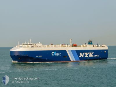
OPAL LEADER
Vehicles Carrier
Current Trip
BR SSZ
| Time Travelled | 1 day |
|---|---|
| Remaining Time | --- |
| Distance Travelled | 178.53 nm |
| Remaining Distance | --- |
| AVG Speed | 12.1 Knots |
| MAX Speed | 15.3 Knots |
| AVG Wind | 7.7 knots |
| MAX Wind | 12.9 knots |
| MIN Temp | 23.6°C / 74.48°F |
| MAX Temp | 31.9°C / 89.42°F |
| Draught | 8.7 m |
| Position Received | 56 m ago |
Current Position
| Longitude | -48.08660° |
|---|---|
| Latitude | -25.76793° |
| Status | Under way using engine |
| Speed | 1.5 Knots |
| Course | 108° |
| Area | South Atlantic Ocean |
| Station | T-AIS |
| Position Received | 56 m ago |
Info
Information
The current position of OPAL LEADER is in South Atlantic Ocean with coordinates -25.76793° / -48.08660° as reported on 2024-05-12 23:41 by AIS to our vessel tracker app. The vessel's current speed is 1.5 Knots
The vessel OPAL LEADER (IMO: 9318498, MMSI: 309285000) is a Vehicles Carrier that was built in 2007 ( 17 years old ). It's sailing under the flag of [BS] Bahamas.
In this page you can find informations about the vessels current position, last detected port calls, and current voyage information. If the vessels is not in coverage by AIS you will find the latest position.
The current position of OPAL LEADER is detected by our AIS receivers and we are not responsible for the reliability of the data. The last position was recorded while the vessel was in Coverage by the Ais receivers of our vessel tracking app.
The current draught of OPAL LEADER as reported by AIS is 8.7 meters
Weather
| Temperature | 25.4°C / 77.72°F |
|---|---|
| Wind Speed | 10 knots |
| Direction | 352° N |
| Pressure | 1007.5 hPa |
| Humidity | 82.4 % |
| Cloud Coverage | 82 % |
Featured Company
Last Port Calls
| Port | Arrival | Departure | Time In Port |
|---|---|---|---|
| 2024-05-10 19:56 | 2024-05-11 13:57 | 18 h | |
| 2024-05-08 18:12 | 2024-05-09 02:08 | 7 h | |
| 2024-04-25 06:38 | 2024-04-25 21:18 | 14 h | |
| 2024-04-18 12:28 | 2024-04-20 11:19 | 1 d | |
| 2024-04-15 04:33 | 2024-04-16 01:50 | 21 h | |
| 2024-04-10 05:47 | 2024-04-10 15:59 | 10 h | |
| 2024-03-26 11:38 | 2024-03-27 18:21 | 1 d | |
| 2024-03-25 12:52 | 2024-03-25 18:53 | 6 h | |
| 2024-03-19 13:45 | 2024-03-21 15:08 | 2 d | |
| 2024-03-11 06:07 | 2024-03-11 23:31 | 17 h |
Most Visited Ports (Last year)
| Port | Arrivals | |
|---|---|---|
| 7 | ||
| 7 | ||
| 7 | ||
| 6 | ||
| 6 | ||
| 6 |
Last Trips
| Origin | Departure | Destination | Arrival | Distance | |
|---|---|---|---|---|---|
| 2024-05-09 02:08 | 2024-05-10 19:56 | 501.10 nm | |||
| 2024-04-25 21:18 | 2024-05-08 18:12 | 4043.12 nm | |||
| 2024-04-20 11:19 | 2024-04-25 06:38 | 1476.66 nm | |||
| 2024-04-16 01:50 | 2024-04-18 12:28 | 618.80 nm | |||
| 2024-04-10 15:59 | 2024-04-15 04:33 | 1521.42 nm | |||
| 2024-03-27 18:21 | 2024-04-10 05:47 | 4520.92 nm | |||
| 2024-03-25 18:53 | 2024-03-26 11:38 | 180.53 nm | |||
| 2024-03-21 15:08 | 2024-03-25 12:52 | 991.47 nm | |||
| 2024-03-11 23:31 | 2024-03-19 13:45 | 1479.60 nm | |||
| 2024-02-26 04:42 | 2024-03-11 06:07 | 4180.19 nm |
Events
| Time | Event | Details | Position / Dest | Info |
|---|---|---|---|---|
| 2024-05-12 23:48 | Status Changed | Default Under way using engine |
-25.76863 / -48.08462
BR SSZ
|
Speed: 1.5 kn Course: 108° |
| 2024-05-12 23:38 | Status Changed | Under way using engine Default |
-25.76733 / -48.08533
BR SSZ
|
Speed: 1.4 kn Course: 110° |
| 2024-05-12 22:53 | Status Changed | Default Under way using engine |
-25.75906 / -48.06893
BR SSZ
|
Speed: 1.4 kn Course: 114° |
| 2024-05-12 22:52 | ETA Changed | 2024/05/11 22:00 2024/05/10 19:45 |
-25.75876 / -48.06832
BR SSZ
|
Speed: 1.4 kn Course: 114° |
| 2024-05-12 22:44 | Status Changed | Under way using engine Default |
-25.75751 / -48.06553
BR SSZ
|
Speed: 1.3 kn Course: 115° |
| 2024-05-12 22:29 | IN Coverage |
-25.75751 / -48.06553
South Atlantic Ocean
|
Speed: 1.4 kn Course: 245.1° |
|
| 2024-05-12 20:23 | Status Changed | Default Under way using engine |
-25.74510 / -48.00989
BR SSZ
|
Speed: 1.2 kn Course: 120° |
| 2024-05-12 20:17 | OUT of Coverage |
-25.74369 / -48.00845
South Atlantic Ocean
|
Speed: 1.2 kn Course: 221° |
|
| 2024-05-12 20:16 | Status Changed | Under way using engine Default |
-25.74349 / -48.00825
BR SSZ
|
Speed: 1.3 kn Course: 118° |
| 2024-05-12 20:04 | IN Coverage |
-25.74362 / -48.00836
South Atlantic Ocean
|
Speed: 1.1 kn Course: 222.4° |