
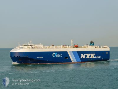
OPAL LEADER
Vehicles Carrier
Current Trip
| Trip Time | 2 days |
|---|---|
| Trip Distance | 618.80 nm |
| AVG Speed | 13.1 Noeuds |
| MAX Speed | 16.8 Noeuds |
| Tirant d eau | 8.3 m |
| AVG Wind | 12.7 knots |
| MAX Wind | 19.8 knots |
| MIN Temp | 22.1°C / 71.78°F |
| MAX Temp | 31.1°C / 87.98°F |
| Position reçue | 1 d depuis |
Current Position
| Longitude | -95.97635° |
|---|---|
| Latitude | 19.63648° |
| Etat | Under way using engine |
| Vitesse | 14.9 Noeuds |
| Parcours | 184.3° |
| Zone | Gulf of Mexico |
| Station | T-AIS |
| Position reçue | 1 d depuis |
Info
Information
The current position of OPAL LEADER is in Gulf of Mexico with coordinates 19.63648° / -95.97635° as reported on 2024-04-18 01:04 by AIS to our vessel tracker app. The vessel's current speed is 14.9 Noeuds and is currently inside the port of VERACRUZ.
The vessel OPAL LEADER (IMO: 9318498, MMSI: 309285000) is a Vehicles Carrier that was built in 2007 ( 17 Age ). It's sailing under the flag of [BS] Bahamas.
In this page you can find informations about the vessels current position, last detected port calls, and current voyage information. If the vessels is not in coverage by AIS you will find the latest position.
The current position of OPAL LEADER is detected by our AIS receivers and we are not responsible for the reliability of the data. The last position was recorded while the vessel was in Coverage by the Ais receivers of our vessel tracking app.
The current draught of OPAL LEADER as reported by AIS is 8.3 meters
Weather
| Temperature | 27.1°C / 80.78°F |
|---|---|
| Wind Speed | 7 knots |
| Direction | 34° NE |
| Pressure | 1013.3 hPa |
| Humidity | 75.4 % |
| Cloud Coverage | 1 % |
Featured Company
Last Port Calls
| Port | Arrival | Departure | Time In Port |
|---|---|---|---|
| 2024-04-18 17:28 | |||
| 2024-04-15 09:33 | 2024-04-16 06:50 | 21 h | |
| 2024-04-10 10:47 | 2024-04-10 20:59 | 10 h | |
| 2024-03-26 14:38 | 2024-03-27 21:21 | 1 d | |
| 2024-03-25 15:52 | 2024-03-25 21:53 | 6 h | |
| 2024-03-19 16:45 | 2024-03-21 18:08 | 2 d | |
| 2024-03-11 09:07 | 2024-03-12 02:31 | 17 h | |
| 2024-02-25 23:03 | 2024-02-26 10:42 | 11 h | |
| 2024-02-24 12:36 | 2024-02-25 06:48 | 18 h | |
| 2024-02-17 01:01 | 2024-02-20 03:44 | 3 d |
Last Trips
| Origin | Departure | Destination | Arrival | Distance | |
|---|---|---|---|---|---|
| 2024-04-16 01:50 | 2024-04-18 12:28 | 618.80 nm | |||
| 2024-04-10 15:59 | 2024-04-15 04:33 | 1521.42 nm | |||
| 2024-03-27 18:21 | 2024-04-10 05:47 | 4520.92 nm | |||
| 2024-03-25 18:53 | 2024-03-26 11:38 | 180.53 nm | |||
| 2024-03-21 15:08 | 2024-03-25 12:52 | 991.47 nm | |||
| 2024-03-11 23:31 | 2024-03-19 13:45 | 1479.60 nm | |||
| 2024-02-26 04:42 | 2024-03-11 06:07 | 4180.19 nm | |||
| 2024-02-25 01:48 | 2024-02-25 17:03 | 195.40 nm | |||
| 2024-02-19 21:44 | 2024-02-24 07:36 | 1448.95 nm | |||
| 2024-02-14 20:45 | 2024-02-16 19:01 | 602.24 nm |
Events
| Heure | Evenement | Détails | Position/ Destination | Info |
|---|---|---|---|---|
| 2024-04-18 17:46 | Arret |
19.20383 / -96.13480
[MX] VERACRUZ
|
Vitesse: 0.1 kn Parcours: 60° |
|
| 2024-04-18 17:28 | Port d'arrivée |
|
19.20383 / -96.13480
[MX] VERACRUZ
|
Vitesse: 8.1 kn Parcours: 251° |
| 2024-04-18 01:08 | Etat Changé | Default Under way using engine |
19.61634 / -95.97842
MX VER
|
Vitesse: 14.9 kn Parcours: 184.3° |
| 2024-04-18 01:04 | Hors de la zone couverte |
19.63648 / -95.97635
Gulf of Mexico
MX VER
|
Vitesse: 14.9 kn Parcours: 184.3° |
|
| 2024-04-18 01:03 | Etat Changé | Under way using engine Default |
19.63730 / -95.97627
MX VER
|
Vitesse: 15.1 kn Parcours: 187° |
| 2024-04-18 00:56 | Etat Changé | Default Under way using engine |
19.66757 / -95.97327
MX VER
|
Vitesse: 15 kn Parcours: 183.9° |
| 2024-04-18 00:31 | Etat Changé | Under way using engine Default |
19.76955 / -95.96623
MX VER
|
Vitesse: 14.8 kn Parcours: 184° |
| 2024-04-18 00:26 | Dans la zone couverte |
19.76955 / -95.96623
Gulf of Mexico
MX VER
|
Vitesse: 15.1 kn Parcours: 186.1° |
|
| 2024-04-17 09:36 | Etat Changé | Default Under way using engine |
23.21807 / -95.63321
MX VER
|
Vitesse: 14.9 kn Parcours: 185.9° |
| 2024-04-17 09:35 | Hors de la zone couverte |
23.22486 / -95.63250
Gulf of Mexico
MX VER
|
Vitesse: 14.9 kn Parcours: 185.9° |