
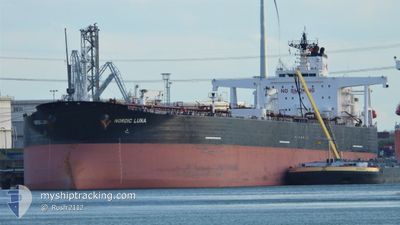
NORDIC LUNA
Crude Oil Tanker
Current Trip
| Time Travelled | 37 days |
|---|---|
| Remaining Time | 5 days |
| Distance Travelled | 6417.14 nm |
| Remaining Distance | 1606.77 nm |
| AVG Speed | 10.2 Knots |
| MAX Speed | 14.5 Knots |
| AVG Wind | 6.7 knots |
| MAX Wind | 18.9 knots |
| MIN Temp | 22.9°C / 73.22°F |
| MAX Temp | 30.9°C / 87.62°F |
| Draught | 15 m |
| Position Received | 9 h, 53 m ago |
Current Position
| Longitude | 76.82850° |
|---|---|
| Latitude | 6.89595° |
| Status | Under way using engine |
| Speed | 12 Knots |
| Course | 117° |
| Area | Laccadive Sea |
| Station | T-AIS |
| Position Received | 9 h, 53 m ago |
Info
Information
The current position of NORDIC LUNA is in Laccadive Sea with coordinates 6.89595° / 76.82850° as reported on 2024-04-25 19:12 by AIS to our vessel tracker app. The vessel's current speed is 12 Knots and is heading at the port of SINGAPORE. The estimated time of arrival as calculated by MyShipTracking vessel tracking app is 2024-05-01 07:29 LT
The vessel NORDIC LUNA (IMO: 9290933, MMSI: 319098500) is a Crude Oil Tanker that was built in 2004 ( 20 years old ). It's sailing under the flag of [KY] Cayman Is.
In this page you can find informations about the vessels current position, last detected port calls, and current voyage information. If the vessels is not in coverage by AIS you will find the latest position.
The current position of NORDIC LUNA is detected by our AIS receivers and we are not responsible for the reliability of the data. The last position was recorded while the vessel was in Coverage by the Ais receivers of our vessel tracking app.
The current draught of NORDIC LUNA as reported by AIS is 15 meters
Weather
| Temperature | 29.1°C / 84.38°F |
|---|---|
| Wind Speed | 2 knots |
| Direction | 179° S |
| Pressure | 1009.2 hPa |
| Humidity | 72 % |
| Cloud Coverage | 99 % |
Featured Company
Last Port Calls
| Port | Arrival | Departure | Time In Port |
|---|---|---|---|
| 2024-03-18 06:19 | 2024-03-19 22:52 | 1 d | |
| 2024-02-09 07:49 | 2024-02-09 08:31 | 41 m | |
| 2024-02-08 07:31 | 2024-02-08 08:55 | 1 h |
Most Visited Ports (Last year)
| Port | Arrivals | |
|---|---|---|
| 4 | ||
| 3 | ||
| 2 | ||
| 1 | ||
| 1 | ||
| 1 |
Last Trips
| Origin | Departure | Destination | Arrival | Distance | |
|---|---|---|---|---|---|
| 2024-02-09 16:31 | 2024-03-18 14:19 | 7800.35 nm | |||
| 2024-02-08 16:55 | 2024-02-09 15:49 | 1.64 nm | |||
| 2024-01-10 20:10 | 2024-02-08 15:31 | 4497.32 nm |
Events
| Time | Event | Details | Position / Dest | Info |
|---|---|---|---|---|
| 2024-04-25 19:24 | Status Changed | Default Under way using engine |
6.87793 / 76.86449
KWMIS > SGSIN
|
Speed: 12 kn Course: 117° |
| 2024-04-25 19:12 | Detected in Sea | Indian part of the Laccadive Sea |
6.89595 / 76.82850
Laccadive Sea
KWMIS > SGSIN
|
Speed: 12 kn Course: 117° |
| 2024-04-25 19:12 | OUT of Coverage |
6.89595 / 76.82850
Laccadive Sea
KWMIS > SGSIN
|
Speed: 12 kn Course: 117° |
|
| 2024-04-25 19:12 | Status Changed | Under way using engine Default |
6.89645 / 76.82755
KWMIS > SGSIN
|
Speed: 11.9 kn Course: 117° |
| 2024-04-25 18:54 | IN Coverage |
6.89595 / 76.82850
Laccadive Sea
KWMIS > SGSIN
|
Speed: 12 kn Course: 117° |
|
| 2024-04-20 09:52 | Status Changed | Default Under way using engine |
24.67235 / 57.07841
KWMIS > SGSIN
|
Speed: 12.3 kn Course: 132° |
| 2024-04-20 09:47 | OUT of Coverage |
24.68350 / 57.06507
Gulf of Oman
KWMIS > SGSIN
|
Speed: 12.3 kn Course: 132° |
|
| 2024-04-20 07:29 | Change Sea Area | Omani part of the Gulf of Oman United Arab Emirates part of the Gulf of Oman |
25.03777 / 56.74417
Gulf of Oman
KWMIS > SGSIN
|
Speed: 13 kn Course: 166° |
| 2024-04-20 04:26 | Change Sea Area | United Arab Emirates part of the Gulf of Oman Omani part of the Gulf of Oman |
25.67233 / 56.72188
Gulf of Oman
KWMIS > SGSIN
|
Speed: 12.1 kn Course: 185° |
| 2024-04-20 03:14 | Detected in Sea | Omani part of the Gulf of Oman |
25.92157 / 56.71125
Gulf of Oman
KWMIS > SGSIN
|
Speed: 11.8 kn Course: 178° |