
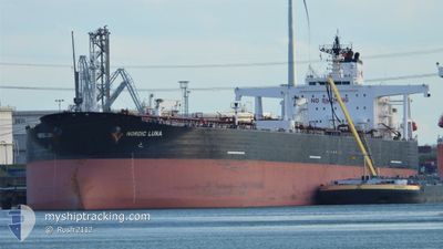
NORDIC LUNA
Crude Oil Tanker
Current Trip
| Time Travelled | 47 days |
|---|---|
| Remaining Time | --- |
| Distance Travelled | 5692.19 nm |
| Remaining Distance | --- |
| AVG Speed | 9.9 Knop |
| MAX Speed | 13.8 Knop |
| AVG Wind | 6 knots |
| MAX Wind | 18.9 knots |
| MIN Temp | 22.9°C / 73.22°F |
| MAX Temp | 32.5°C / 90.5°F |
| Djupgående | 8.6 m |
| Position mottagen | 1 d sen |
Current Position
| Longitud | 103.54473° |
|---|---|
| Latitude | 1.20415° |
| Status | Under way using engine |
| Fart | 12.4 Knop |
| Kurs | 283° |
| Område | Singapore Strait |
| Station | T-AIS |
| Position mottagen | 1 d sen |
Info
Information
The current position of NORDIC LUNA is in Singapore Strait with coordinates 1.20415° / 103.54473° as reported on 2024-05-04 18:48 by AIS to our vessel tracker app. The vessel's current speed is 12.4 Knop and is heading at the port of FUJAIRAH. The estimated time of arrival as calculated by MyShipTracking vessel tracking app is 2024-05-18 08:00 LT
The vessel NORDIC LUNA (IMO: 9290933, MMSI: 319098500) is a Crude Oil Tanker that was built in 2004 ( 20 År gammal ). It's sailing under the flag of [KY] Cayman Is.
In this page you can find informations about the vessels current position, last detected port calls, and current voyage information. If the vessels is not in coverage by AIS you will find the latest position.
The current position of NORDIC LUNA is detected by our AIS receivers and we are not responsible for the reliability of the data. The last position was recorded while the vessel was in Coverage by the Ais receivers of our vessel tracking app.
The current draught of NORDIC LUNA as reported by AIS is 8.6 meters
Weather
| Temperature | 30.9°C / 87.62°F |
|---|---|
| Wind Speed | 7 knots |
| Direction | 326° NW |
| Pressure | 1008.6 hPa |
| Humidity | 67.3 % |
| Cloud Coverage | 5 % |
Featured Company
Last Port Calls
| Port | Arrival | Departure | Time In Port |
|---|---|---|---|
| 2024-03-18 06:19 | 2024-03-19 22:52 | 1 d |
Most Visited Ports (Last year)
| Port | Arrivals | |
|---|---|---|
| 4 | ||
| 3 | ||
| 2 | ||
| 1 | ||
| 1 | ||
| 1 |
Last Trips
| Origin | Departure | Destination | Arrival | Distance | |
|---|---|---|---|---|---|
| 2024-02-09 16:31 | 2024-03-18 14:19 | 7800.35 nm |
Events
| Tid | Event | Detaljer | Position / Dest | Information |
|---|---|---|---|---|
| 2024-05-04 18:51 | Status ändrad | Default Under way using engine |
1.20672 / 103.53415
SGSIN=>AEFJR
|
Fart: 12.4 kn Kurs: 283° |
| 2024-05-04 18:48 | UTANFÖR täckningsområde |
1.20415 / 103.54473
Singapore Strait
SGSIN=>AEFJR
|
Fart: 12.4 kn Kurs: 283° |
|
| 2024-05-04 18:35 | Byter havsområde | Malaysian part of the Singapore Strait Indonesian part of the Singapore Strait |
1.19360 / 103.58760
Singapore Strait
SGSIN=>AEFJR
|
Fart: 12.4 kn Kurs: 283° |
| 2024-05-04 17:56 | Byter havsområde | Indonesian part of the Singapore Strait Singaporean part of the Singapore Strait |
1.15173 / 103.70863
Singapore Strait
SGSIN=>AEFJR
|
Fart: 11.2 kn Kurs: 298° |
| 2024-05-04 16:12 | STARTAR förflyttning | 3.04 nm, East of SINGAPORE |
1.24758 / 103.90413
SGSIN=>AEFJR
|
Fart: 3.3 kn Kurs: 200° |
| 2024-05-04 16:03 | Destination ändrad | SGSIN=>AEFJR SGSIN=>SGSIN(AEPA) |
1.25077 / 103.90675
SGSIN=>AEFJR
|
Fart: 0.3 kn Kurs: 223° |
| 2024-05-04 16:03 | ETA ändrat | 2024/05/18 08:00 2024/05/04 09:00 |
1.25077 / 103.90675
SGSIN=>AEFJR
|
Fart: 0.3 kn Kurs: 223° |
| 2024-05-04 15:56 | Status ändrad | Under way using engine At anchor |
1.25128 / 103.90738
SGSIN=>SGSIN(AEPA)
|
Fart: 0.4 kn Kurs: 226° |
| 2024-05-04 09:04 | STOPPAR förflyttning | 3.05 nm, East of SINGAPORE |
1.24933 / 103.90458
SGSIN=>SGSIN(AEPA)
|
Fart: 0.3 kn Kurs: 44° |
| 2024-05-04 09:01 | Status ändrad | At anchor Under way using engine |
1.24890 / 103.90443
SGSIN=>SGSIN(AEPA)
|
Fart: 0.5 kn Kurs: 42° |