
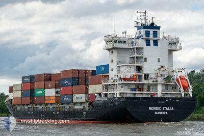
NORDIC ITALIA
Container Ship
Current Trip
| Time Travelled | 16 h, 41 mins |
|---|---|
| Remaining Time | 21 h, 17 mins |
| Distance Travelled | 261.27 nm |
| Remaining Distance | 353.58 nm |
| AVG Speed | 14.3 Knots |
| MAX Speed | 16.9 Knots |
| AVG Wind | 14.3 knots |
| MAX Wind | 17.9 knots |
| MIN Temp | 5.8°C / 42.44°F |
| MAX Temp | 10.6°C / 51.08°F |
| Draught | 8.1 m |
| Position Received | Now |
Current Position
| Longitude | 16.63254° |
|---|---|
| Latitude | 56.01063° |
| Status | Under way using engine |
| Speed | 15.8 Knots |
| Course | 61.8° |
| Area | Baltic Sea |
| Station | T-AIS |
| Position Received | Now |
Info
Information
The current position of NORDIC ITALIA is in Baltic Sea with coordinates 56.01063° / 16.63254° as reported on 2024-05-07 17:05 by AIS to our vessel tracker app. The vessel's current speed is 15.8 Knots and is heading at the port of TALLINN OLD HARBOR. The estimated time of arrival as calculated by MyShipTracking vessel tracking app is 2024-05-08 14:22 LT
The vessel NORDIC ITALIA (IMO: 9474395, MMSI: 255806451) is a Container Ship that was built in 2012 ( 12 years old ). It's sailing under the flag of [PT] Portugal.
In this page you can find informations about the vessels current position, last detected port calls, and current voyage information. If the vessels is not in coverage by AIS you will find the latest position.
The current position of NORDIC ITALIA is detected by our AIS receivers and we are not responsible for the reliability of the data. The last position was recorded while the vessel was in Coverage by the Ais receivers of our vessel tracking app.
The current draught of NORDIC ITALIA as reported by AIS is 8.1 meters
Weather
| Temperature | 6.1°C / 42.98°F |
|---|---|
| Wind Speed | 8 knots |
| Direction | 116° ESE |
| Pressure | 1024 hPa |
| Humidity | 81.7 % |
| Cloud Coverage | --- |
Featured Company
Last Port Calls
| Port | Arrival | Departure | Time In Port |
|---|---|---|---|
| 2024-05-07 00:21 | 2024-05-07 00:24 | 3 m | |
| 2024-05-04 21:15 | 2024-05-06 07:16 | 1 d | |
| 2024-05-02 21:33 | 2024-05-04 04:27 | 1 d | |
| 2024-04-27 14:12 | 2024-04-28 11:54 | 21 h | |
| 2024-04-10 07:30 | 2024-04-24 20:23 | 14 d | |
| 2024-04-09 04:37 | 2024-04-09 21:16 | 16 h | |
| 2024-04-05 08:35 | 2024-04-06 07:45 | 23 h | |
| 2024-03-29 19:52 | 2024-04-02 02:16 | 3 d | |
| 2024-03-28 04:46 | 2024-03-29 09:45 | 1 d | |
| 2024-03-22 01:19 | 2024-03-22 13:41 | 12 h |
Last Trips
| Origin | Departure | Destination | Arrival | Distance | |
|---|---|---|---|---|---|
| 2024-05-06 09:16 | 2024-05-07 02:21 | 131.27 nm | |||
| 2024-05-04 06:27 | 2024-05-04 23:15 | 122.19 nm | |||
| 2024-04-28 14:54 | 2024-05-02 23:33 | 871.54 nm | |||
| 2024-04-24 22:23 | 2024-04-27 17:12 | 759.30 nm | |||
| 2024-04-09 23:16 | 2024-04-10 09:30 | 115.97 nm | |||
| 2024-04-06 09:45 | 2024-04-09 06:37 | 713.79 nm | |||
| 2024-04-02 04:16 | 2024-04-05 10:35 | 777.85 nm | |||
| 2024-03-29 10:45 | 2024-03-29 20:52 | 115.03 nm | |||
| 2024-03-22 14:41 | 2024-03-28 05:46 | 1026.15 nm | |||
| 2024-03-21 03:24 | 2024-03-22 02:19 | 346.80 nm |
Events
| Time | Event | Details | Position / Dest | Info |
|---|---|---|---|---|
| 2024-05-07 14:08 | Change Sea Area | Swedish part of the Baltic Sea Danish part of the Kattegat |
55.62198 / 15.37726
Baltic Sea
EETLL
|
Speed: 16.6 kn Course: 60.8° |
| 2024-05-07 10:31 | Change Sea Area | Danish part of the Kattegat Swedish part of the Baltic Sea |
55.00310 / 14.05129
Kattegat
EETLL
|
Speed: 16.5 kn Course: 70.6° |
| 2024-05-07 10:16 | Change Sea Area | Swedish part of the Baltic Sea German part of the Baltic Sea |
54.97951 / 13.93932
Baltic Sea
EETLL
|
Speed: 16.3 kn Course: 70.5° |
| 2024-05-07 06:37 | Change Sea Area | German part of the Baltic Sea Danish part of the Baltic Sea |
54.59287 / 12.33500
Baltic Sea
EETLL
|
Speed: 15.6 kn Course: 50.4° |
| 2024-05-07 06:28 | Change Sea Area | Danish part of the Baltic Sea German part of the Baltic Sea |
54.56419 / 12.29473
Baltic Sea
EETLL
|
Speed: 15.5 kn Course: 13.7° |
| 2024-05-07 05:40 | Change Sea Area | German part of the Baltic Sea Danish part of the Baltic Sea |
54.40944 / 12.11875
Baltic Sea
EETLL
|
Speed: 15.5 kn Course: 91.7° |
| 2024-05-07 04:01 | Change Sea Area | Danish part of the Baltic Sea German part of the Baltic Sea |
54.50082 / 11.44170
Baltic Sea
EETLL
|
Speed: 15.2 kn Course: 123° |
| 2024-05-07 02:23 | Change Sea Area | German part of the Baltic Sea Danish part of the Baltic Sea |
54.56797 / 10.77640
Baltic Sea
EETLL
|
Speed: 15.4 kn Course: 83.6° |
| 2024-05-07 02:18 | ETA Changed | 2024/05/08 16:00 2024/05/08 15:30 |
54.56551 / 10.73752
EETLL
|
Speed: 15.4 kn Course: 83.5° |
| 2024-05-07 02:02 | Change Sea Area | Danish part of the Baltic Sea German part of the Baltic Sea |
54.55935 / 10.62321
Baltic Sea
EETLL
|
Speed: 15 kn Course: 79.6° |