
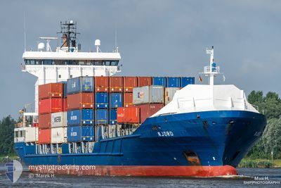
NJORD
Container Ship
Current Trip
| Time Travelled | 18 h, 47 mins |
|---|---|
| Remaining Time | 1 day |
| Distance Travelled | 284.03 nm |
| Remaining Distance | 806.95 nm |
| AVG Speed | 15.8 Knots |
| MAX Speed | 16.9 Knots |
| AVG Wind | 9 knots |
| MAX Wind | 12 knots |
| MIN Temp | 14.2°C / 57.56°F |
| MAX Temp | 17.7°C / 63.86°F |
| Draught | 7.3 m |
| Position Received | 17 h, 5 m ago |
Current Position
| Longitude | --- |
|---|---|
| Latitude | --- |
| Status | Under way using engine |
| Speed | 16 Knots |
| Course | 193.5° |
| Area | Mediterranean Sea - Western Basin |
| Station | T-AIS |
| Position Received | 17 h, 5 m ago |
Info
Information
The current position of NJORD is in Mediterranean Sea - Western Basin with coordinates 37.93644° / -0.44288° as reported on 2025-12-07 08:48 by AIS to our vessel tracker app. The vessel's current speed is 16 Knots and is heading at the port of LAS PALMAS. The estimated time of arrival as calculated by MyShipTracking vessel tracking app is 2025-12-09 21:26 LT
The vessel NJORD (IMO: 9349227, MMSI: 245872000) is a Container Ship that was built in 2007 ( 18 years old ). It's sailing under the flag of [NL] Netherlands.
In this page you can find informations about the vessels current position, last detected port calls, and current voyage information. If the vessels is not in coverage by AIS you will find the latest position.
The current position of NJORD is detected by our AIS receivers and we are not responsible for the reliability of the data. The last position was recorded while the vessel was in Coverage by the Ais receivers of our vessel tracking app.
The current draught of NJORD as reported by AIS is 7.3 meters
Weather
| Temperature | 16.4°C / 61.52°F |
|---|---|
| Wind Speed | 8 knots |
| Direction | 277° W |
| Pressure | 1022.1 hPa |
| Humidity | 71.7 % |
| Cloud Coverage | --- |
Featured Company
Last Port Calls
| Port | Arrival | Departure | Time In Port |
|---|---|---|---|
| 2025-12-06 18:11 | 2025-12-07 08:07 | 13 h | |
| 2025-12-03 13:21 | 2025-12-03 21:03 | 7 h | |
| 2025-12-02 19:55 | 2025-12-03 08:31 | 12 h | |
| 2025-11-28 15:51 | 2025-11-29 15:13 | 23 h | |
| 2025-11-27 06:11 | 2025-11-28 01:19 | 19 h | |
| 2025-11-21 14:06 | 2025-11-22 07:05 | 16 h | |
| 2025-11-17 05:38 | 2025-11-17 15:09 | 9 h | |
| 2025-11-16 11:06 | 2025-11-16 13:55 | 2 h | |
| 2025-11-13 17:18 | 2025-11-14 02:18 | 9 h | |
| 2025-11-12 05:03 | 2025-11-13 07:51 | 1 d |
Last Trips
| Origin | Departure | Destination | Arrival | Distance | |
|---|---|---|---|---|---|
| 2025-12-03 21:03 | 2025-12-06 18:11 | 1011.21 nm | |||
| 2025-12-03 08:31 | 2025-12-03 13:21 | 55.81 nm | |||
| 2025-11-29 15:13 | 2025-12-02 19:55 | 1234.57 nm | |||
| 2025-11-28 01:19 | 2025-11-28 15:51 | 226.66 nm | |||
| 2025-11-22 07:05 | 2025-11-27 06:11 | 1589.81 nm | |||
| 2025-11-17 15:09 | 2025-11-21 14:06 | 1506.05 nm | |||
| 2025-11-16 13:55 | 2025-11-17 05:38 | 226.93 nm | |||
| 2025-11-14 02:18 | 2025-11-16 11:06 | 907.34 nm | |||
| 2025-11-13 07:51 | 2025-11-13 17:18 | 113.51 nm | |||
| 2025-11-11 19:38 | 2025-11-12 05:03 | 55.79 nm |
Events
| Time | Event | Details | Position / Dest | Info |
|---|---|---|---|---|
| 2025-12-07 08:56 | Status Changed | Default Under way using engine |
37.90601 / -.45209
ESLPA
|
Speed: 16 kn Course: 193.5° |
| 2025-12-07 08:48 | Status Changed | Under way using engine Default |
37.93644 / -.44288
ESLPA
|
Speed: 16 kn Course: 193° |
| 2025-12-07 08:48 | OUT of Coverage |
37.93644 / -.44288
Mediterranean Sea - Western Basin
ESLPA
|
Speed: 16 kn Course: 193.5° |
|
| 2025-12-07 08:43 | Status Changed | Default Under way using engine |
37.95833 / -.43500
ESLPA
|
Speed: 16 kn Course: 193.5° |
| 2025-12-07 08:09 | Draught Changed | 7.3 6.5 |
38.10672 / -.39246
ESLPA
|
Speed: 15.9 kn Course: 191.7° |
| 2025-12-07 08:09 | Destination Changed | ESLPA ESALC |
38.10672 / -.39246
ESLPA
|
Speed: 15.9 kn Course: 191.7° |
| 2025-12-07 08:09 | ETA Changed | 2025/12/09 21:00 2025/12/06 17:00 |
38.10672 / -.39246
ESLPA
|
Speed: 15.9 kn Course: 191.7° |
| 2025-12-07 07:52 | Status Changed | Under way using engine Default |
38.17580 / -.38354
ESALC
|
Speed: 12.9 kn Course: 176° |
| 2025-12-07 07:47 | IN Coverage |
38.17580 / -.38354
Mediterranean Sea - Western Basin
|
Speed: 13 kn Course: 175.3° |
|
| 2025-12-07 07:07 | PORT DEPARTURE |
|
38.31739 / -.48770
ESALC
|
Speed: 7.7 kn Course: 168° |