
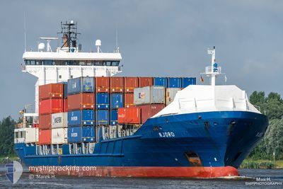
NJORD
Container Ship
Current Trip
| Time Travelled | 1 day |
|---|---|
| Remaining Time | 17 h, 42 mins |
| Distance Travelled | 736.43 nm |
| Remaining Distance | 320.93 nm |
| AVG Speed | 15.8 Knots |
| MAX Speed | 17.2 Knots |
| AVG Wind | 12.8 knots |
| MAX Wind | 26.3 knots |
| MIN Temp | 15°C / 59°F |
| MAX Temp | 19.3°C / 66.74°F |
| Dybgang | 6.4 m |
| Position Modtaget | 1 h, 11 m siden |
Current Position
| Longitude | --- |
|---|---|
| Latitude | --- |
| Status | Under way using engine |
| Fart | 16.6 Knots |
| Kurs | 81.4° |
| Område | Alboran Sea |
| Station | T-AIS |
| Position Modtaget | 1 h, 11 m siden |
Info
Information
The current position of NJORD is in Alboran Sea with coordinates 36.00824° / -5.17547° as reported on 2025-12-12 21:02 by AIS to our vessel tracker app. The vessel's current speed is 16.6 Knots and is heading at the port of ALICANTE. The estimated time of arrival as calculated by MyShipTracking vessel tracking app is 2025-12-13 16:55 LT
The vessel NJORD (IMO: 9349227, MMSI: 245872000) is a Container Ship that was built in 2007 ( 18 år gamle ). It's sailing under the flag of [NL] Netherlands.
In this page you can find informations about the vessels current position, last detected port calls, and current voyage information. If the vessels is not in coverage by AIS you will find the latest position.
The current position of NJORD is detected by our AIS receivers and we are not responsible for the reliability of the data. The last position was recorded while the vessel was in Coverage by the Ais receivers of our vessel tracking app.
The current draught of NJORD as reported by AIS is 6.4 meters
Weather
| Temperature | 16.6°C / 61.88°F |
|---|---|
| Wind Speed | 28 knots |
| Direction | 98° E |
| Pressure | 1013.7 hPa |
| Humidity | 82.4 % |
| Cloud Coverage | 100 % |
Featured Company
Last Port Calls
| Port | Arrival | Departure | Time In Port |
|---|---|---|---|
| 2025-12-10 13:12 | 2025-12-11 00:22 | 11 h | |
| 2025-12-09 22:30 | 2025-12-10 09:24 | 10 h | |
| 2025-12-06 18:11 | 2025-12-07 08:07 | 13 h | |
| 2025-12-03 13:21 | 2025-12-03 21:03 | 7 h | |
| 2025-12-02 19:55 | 2025-12-03 08:31 | 12 h | |
| 2025-11-28 15:51 | 2025-11-29 15:13 | 23 h | |
| 2025-11-27 06:11 | 2025-11-28 01:19 | 19 h | |
| 2025-11-21 14:06 | 2025-11-22 07:05 | 16 h | |
| 2025-11-17 05:38 | 2025-11-17 15:09 | 9 h | |
| 2025-11-16 11:06 | 2025-11-16 13:55 | 2 h |
Last Trips
| Origin | Departure | Destination | Arrival | Distance | |
|---|---|---|---|---|---|
| 2025-12-10 09:24 | 2025-12-10 13:12 | 54.19 nm | |||
| 2025-12-07 08:07 | 2025-12-09 22:30 | 1007.42 nm | |||
| 2025-12-03 21:03 | 2025-12-06 18:11 | 1011.21 nm | |||
| 2025-12-03 08:31 | 2025-12-03 13:21 | 55.81 nm | |||
| 2025-11-29 15:13 | 2025-12-02 19:55 | 1234.57 nm | |||
| 2025-11-28 01:19 | 2025-11-28 15:51 | 226.66 nm | |||
| 2025-11-22 07:05 | 2025-11-27 06:11 | 1589.81 nm | |||
| 2025-11-17 15:09 | 2025-11-21 14:06 | 1506.05 nm | |||
| 2025-11-16 13:55 | 2025-11-17 05:38 | 226.93 nm | |||
| 2025-11-14 02:18 | 2025-11-16 11:06 | 907.34 nm |
Events
| Tid | Hændelsen | Detaljer | Position / Dest | Info |
|---|---|---|---|---|
| 2025-12-12 21:03 | Status er ændret | Default Under way using engine |
36.00892 / -5.16987
ESALC
|
Fart: 16.6 kn Kurs: 81.4° |
| 2025-12-12 21:02 | Status er ændret | Under way using engine Default |
36.00824 / -5.17547
ESALC
|
Fart: 16.5 kn Kurs: 82° |
| 2025-12-12 21:02 | Udenfor Dækning |
36.00824 / -5.17547
Alboran Sea
ESALC
|
Fart: 16.6 kn Kurs: 81.4° |
|
| 2025-12-12 20:47 | Status er ændret | Default Under way using engine |
35.99809 / -5.25866
ESALC
|
Fart: 16.2 kn Kurs: 81.5° |
| 2025-12-12 20:46 | Status er ændret | Under way using engine Default |
35.99728 / -5.26471
ESALC
|
Fart: 16.1 kn Kurs: 79° |
| 2025-12-12 20:46 | Ændre havområde | Spanish part of the Alboran Sea Spanish part of the Strait of Gibraltar |
35.99728 / -5.26471
Alboran Sea
ESALC
|
Fart: 16.2 kn Kurs: 81.5° |
| 2025-12-12 20:33 | Status er ændret | Default Under way using engine |
35.98519 / -5.33640
ESALC
|
Fart: 16 kn Kurs: 73.1° |
| 2025-12-12 20:25 | Fundet i havområde | Spanish part of the Strait of Gibraltar |
35.97618 / -5.37350
Strait of Gibraltar
ESALC
|
Fart: 15.9 kn Kurs: 73.4° |
| 2025-12-12 20:25 | Status er ændret | Under way using engine Default |
35.97618 / -5.37350
ESALC
|
Fart: 15.9 kn Kurs: 70° |
| 2025-12-12 20:18 | Indenfor Dækning |
35.97618 / -5.37350
Strait of Gibraltar
ESALC
|
Fart: 15.9 kn Kurs: 73.4° |