
NEW JERSEY
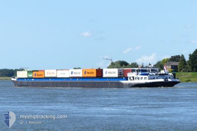
Cargo
Current Trip
ROTTERDAM
| Time Travelled | 10 h, 55 mins |
|---|---|
| Remaining Time | --- |
| Distance Travelled | 52.07 nm |
| Remaining Distance | --- |
| AVG Speed | 5 Knots |
| MAX Speed | 5.8 Knots |
| AVG Wind | 3.4 knots |
| MAX Wind | 4 knots |
| MIN Temp | -1.3°C / 29.66°F |
| MAX Temp | 1.6°C / 34.88°F |
| Draught | 0.4 m |
| Position Received | 1 m ago |
Current Position
| Longitude | --- |
|---|---|
| Latitude | --- |
| Status | Under way using engine |
| Speed | 5 Knots |
| Course | 136.5° |
| Area | North Sea |
| Station | T-AIS |
| Position Received | 1 m ago |
Info
Information
The current position of NEW JERSEY is in North Sea with coordinates 50.82000° / 7.02149° as reported on 2025-01-19 07:31 by AIS to our vessel tracker app. The vessel's current speed is 5 Knots
The vessel NEW JERSEY (MMSI: 244927482) is a Cargo It's sailing under the flag of [NL] Netherlands.
In this page you can find informations about the vessels current position, last detected port calls, and current voyage information. If the vessels is not in coverage by AIS you will find the latest position.
The current position of NEW JERSEY is detected by our AIS receivers and we are not responsible for the reliability of the data. The last position was recorded while the vessel was in Coverage by the Ais receivers of our vessel tracking app.
The current draught of NEW JERSEY as reported by AIS is 0.4 meters
Weather
| Temperature | -0.8°C / 30.56°F |
|---|---|
| Wind Speed | 2 knots |
| Direction | 139° SE |
| Pressure | 1023.5 hPa |
| Humidity | 67.6 % |
| Cloud Coverage | --- |
Featured Company
Last Port Calls
| Port | Arrival | Departure | Time In Port |
|---|---|---|---|
| 2025-01-18 17:46 | 2025-01-18 21:37 | 3 h | |
| 2025-01-17 22:36 | 2025-01-17 23:36 | 59 m | |
| 2025-01-17 13:51 | 2025-01-17 19:01 | 5 h | |
| 2025-01-16 22:19 | 2025-01-17 13:48 | 15 h | |
| 2025-01-16 08:31 | 2025-01-16 22:15 | 13 h | |
| 2025-01-14 05:49 | 2025-01-14 23:30 | 17 h | |
| 2025-01-13 21:35 | 2025-01-14 01:28 | 3 h | |
| 2025-01-12 06:17 | 2025-01-12 10:37 | 4 h | |
| 2025-01-11 12:26 | 2025-01-11 12:43 | 16 m | |
| 2025-01-10 18:36 | 2025-01-11 09:24 | 14 h |
Most Visited Ports (Last year)
| Port | Arrivals | |
|---|---|---|
| 116 | ||
| 90 | ||
| 49 | ||
| 49 | ||
| 47 | ||
| 29 |
Last Trips
| Origin | Departure | Destination | Arrival | Distance | |
|---|---|---|---|---|---|
| 2025-01-17 23:36 | 2025-01-18 17:46 | 98.34 nm | |||
| 2025-01-17 19:01 | 2025-01-17 22:36 | 28.74 nm | |||
| 2025-01-17 13:48 | 2025-01-17 13:51 | 0.90 nm | |||
| 2025-01-16 22:15 | 2025-01-16 22:19 | 0.45 nm | |||
| 2025-01-14 23:30 | 2025-01-16 08:31 | 310.57 nm | |||
| 2025-01-14 01:28 | 2025-01-14 05:49 | 23.77 nm | |||
| 2025-01-12 10:37 | 2025-01-13 21:35 | 170.86 nm | |||
| 2025-01-11 12:43 | 2025-01-12 06:17 | 97.69 nm | |||
| 2025-01-11 09:24 | 2025-01-11 12:26 | 28.64 nm | |||
| 2025-01-10 17:11 | 2025-01-10 18:36 | 14.06 nm |
Events
| Time | Event | Details | Position / Dest | Info |
|---|---|---|---|---|
| 2025-01-18 20:37 | PORT DEPARTURE |
|
51.36688 / 6.66591
ROTTERDAM
|
Speed: 4.7 kn Course: 253.8° |
| 2025-01-18 20:26 | START Moving |
51.38139 / 6.72805
[DE] HUCKINGEN
|
Speed: 3.7 kn Course: 240.7° |
|
| 2025-01-18 20:23 | Status Changed | Under way using engine Moored |
51.38184 / 6.73058
[DE] HUCKINGEN
|
Speed: Course: 511° |
| 2025-01-18 18:30 | Status Changed | Moored Default |
51.38182 / 6.73100
[DE] HUCKINGEN
|
Speed: Course: -1° |
| 2025-01-18 18:30 | IN Coverage |
51.38182 / 6.73100
North Sea
[DE] HUCKINGEN
|
Speed: Course: 280.2° |
|
| 2025-01-18 17:02 | OUT of Coverage |
51.38183 / 6.73100
North Sea
[DE] HUCKINGEN
|
Speed: Course: 0° |
|
| 2025-01-18 16:46 | STOP Moving |
51.38318 / 6.73195
[DE] HUCKINGEN
|
Speed: 0.3 kn Course: 511° |
|
| 2025-01-18 16:46 | PORT ARRIVAL |
|
51.38318 / 6.73195
[DE] HUCKINGEN
|
Speed: 0.7 kn Course: 511° |
| 2025-01-18 14:07 | IN Coverage |
51.55533 / 6.68196
North Sea
|
Speed: 5.5 kn Course: 208.5° |
|
| 2025-01-18 07:36 | OUT of Coverage |
51.84750 / 6.11762
North Sea
|
Speed: 5.7 kn Course: 90.8° |