
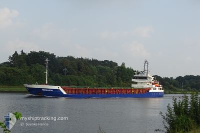
C. ATLAS
General Cargo
Current Trip
| Time Travelled | 7 days |
|---|---|
| Remaining Time | 1 day |
| Distance Travelled | 629.21 nm |
| Remaining Distance | 256.80 nm |
| AVG Speed | 7.5 Knots |
| MAX Speed | 9.9 Knots |
| AVG Wind | 14.4 knots |
| MAX Wind | 23 knots |
| MIN Temp | 11.3°C / 52.34°F |
| MAX Temp | 21.6°C / 70.88°F |
| Draught | 5.1 m |
| Position Received | 6 h, 3 m ago |
Current Position
| Longitude | -9.89801° |
|---|---|
| Latitude | 37.80904° |
| Status | Under way using engine |
| Speed | 9.1 Knots |
| Course | 168.3° |
| Area | North Atlantic Ocean |
| Station | T-AIS |
| Position Received | 6 h, 3 m ago |
Info
Information
The current position of C. ATLAS is in North Atlantic Ocean with coordinates 37.80904° / -9.89801° as reported on 2024-05-16 12:17 by AIS to our vessel tracker app. The vessel's current speed is 9.1 Knots and is heading at the port of CASABLANCA. The estimated time of arrival as calculated by MyShipTracking vessel tracking app is 2024-05-17 20:39 LT
The vessel C. ATLAS (IMO: 9199141, MMSI: 304498000) is a General Cargo that was built in 2003 ( 21 years old ). It's sailing under the flag of [AG] Antigua Barbuda.
In this page you can find informations about the vessels current position, last detected port calls, and current voyage information. If the vessels is not in coverage by AIS you will find the latest position.
The current position of C. ATLAS is detected by our AIS receivers and we are not responsible for the reliability of the data. The last position was recorded while the vessel was in Coverage by the Ais receivers of our vessel tracking app.
The current draught of C. ATLAS as reported by AIS is 5.1 meters
Weather
| Temperature | 17.4°C / 63.32°F |
|---|---|
| Wind Speed | 13 knots |
| Direction | 285° WNW |
| Pressure | 1013.1 hPa |
| Humidity | 80.8 % |
| Cloud Coverage | 10 % |
Featured Company
Last Port Calls
| Port | Arrival | Departure | Time In Port |
|---|---|---|---|
| 2024-05-08 00:26 | 2024-05-09 19:10 | 1 d | |
| 2024-04-23 18:05 | 2024-04-24 22:08 | 1 d | |
| 2024-04-13 08:11 | 2024-04-15 19:14 | 2 d | |
| 2024-04-08 05:06 | 2024-04-09 13:16 | 1 d | |
| 2024-04-03 07:10 | 2024-04-03 20:42 | 13 h | |
| 2024-03-27 08:15 | 2024-03-29 17:31 | 2 d | |
| 2024-03-25 07:53 | 2024-03-26 08:43 | 1 d | |
| 2024-03-10 16:11 | 2024-03-11 16:14 | 1 d | |
| 2024-03-07 11:32 | 2024-03-08 18:01 | 1 d |
Most Visited Ports (Last year)
| Port | Arrivals | |
|---|---|---|
| 2 | ||
| 2 | ||
| 2 | ||
| 2 | ||
| 1 | ||
| 1 |
Last Trips
| Origin | Departure | Destination | Arrival | Distance | |
|---|---|---|---|---|---|
| 2024-04-24 22:08 | 2024-05-08 00:26 | 2567.64 nm | |||
| 2024-04-15 19:14 | 2024-04-23 18:05 | 969.20 nm | |||
| 2024-04-09 13:16 | 2024-04-13 08:11 | 646.53 nm | |||
| 2024-04-03 20:42 | 2024-04-08 05:06 | 454.58 nm | |||
| 2024-03-29 17:31 | 2024-04-03 07:10 | 805.98 nm | |||
| 2024-03-26 08:43 | 2024-03-27 08:15 | 115.39 nm | |||
| 2024-03-11 16:14 | 2024-03-25 07:53 | 2741.25 nm | |||
| 2024-03-08 18:01 | 2024-03-10 16:11 | 371.28 nm | |||
| 2024-02-10 08:10 | 2024-03-07 11:32 | 3739.45 nm |
Events
| Time | Event | Details | Position / Dest | Info |
|---|---|---|---|---|
| 2024-05-16 12:22 | Status Changed | Default Under way using engine |
37.79499 / -9.89429
MACAS
|
Speed: 9.1 kn Course: 168.3° |
| 2024-05-16 12:17 | OUT of Coverage |
37.80904 / -9.89801
North Atlantic Ocean
MACAS
|
Speed: 9.1 kn Course: 168.3° |
|
| 2024-05-16 08:34 | Status Changed | Under way using engine Default |
38.35806 / -10.00789
MACAS
|
Speed: 9 kn Course: 170° |
| 2024-05-16 08:18 | Status Changed | Default Under way using engine |
38.39764 / -10.01667
MACAS
|
Speed: 8.9 kn Course: 172.3° |
| 2024-05-16 08:13 | Status Changed | Under way using engine Default |
38.41067 / -10.01932
MACAS
|
Speed: 8.9 kn Course: 173° |
| 2024-05-16 08:10 | Status Changed | Default Under way using engine |
38.41802 / -10.02063
MACAS
|
Speed: 9 kn Course: 172.4° |
| 2024-05-15 23:11 | Status Changed | Under way using engine Default |
39.69496 / -9.67791
MACAS
|
Speed: 9 kn Course: 205° |
| 2024-05-15 23:07 | Status Changed | Default Under way using engine |
39.70483 / -9.67288
MACAS
|
Speed: 9.2 kn Course: 202.9° |
| 2024-05-15 22:58 | Change Sea Area | Portuguese part of the North Atlantic Ocean Spanish part of the North Atlantic Ocean |
39.72431 / -9.66299
North Atlantic Ocean
MACAS
|
Speed: 9.2 kn Course: 202.9° |
| 2024-05-15 22:56 | Status Changed | Under way using engine Default |
39.72987 / -9.66025
MACAS
|
Speed: 8.9 kn Course: 201° |