
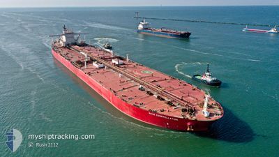
NAVE CONSTELLATION
Tanker
Current Trip
| Time Travelled | --- |
|---|---|
| Remaining Time | --- |
| Distance Travelled | 12070.88 nm |
| Remaining Distance | --- |
| AVG Speed | 10.5 Knots |
| MAX Speed | 15.1 Knots |
| AVG Wind | 13 knots |
| MAX Wind | 31.9 knots |
| MIN Temp | 6.2°C / 43.16°F |
| MAX Temp | 28.8°C / 83.84°F |
| Draught | 21.4 m |
| Position Received | 2 d ago |
Current Position
| Longitude | --- |
|---|---|
| Latitude | --- |
| Status | Under way using engine |
| Speed | 11.8 Knots |
| Course | 175.7° |
| Area | Gulf of Oman |
| Station | T-AIS |
| Position Received | 2 d ago |
Info
Information
The current position of NAVE CONSTELLATION is in Gulf of Oman with coordinates 25.54120° / 56.73998° as reported on 2025-03-02 07:54 by AIS to our vessel tracker app. The vessel's current speed is 11.8 Knots and is heading at the port of ZHOUSHAN. The estimated time of arrival as calculated by MyShipTracking vessel tracking app is 2025-03-22 20:00 LT
The vessel NAVE CONSTELLATION (IMO: 9515929, MMSI: 636020982) is a Tanker It's sailing under the flag of [LR] Liberia.
In this page you can find informations about the vessels current position, last detected port calls, and current voyage information. If the vessels is not in coverage by AIS you will find the latest position.
The current position of NAVE CONSTELLATION is detected by our AIS receivers and we are not responsible for the reliability of the data. The last position was recorded while the vessel was in Coverage by the Ais receivers of our vessel tracking app.
The current draught of NAVE CONSTELLATION as reported by AIS is 21.4 meters
Weather
| Temperature | 24.8°C / 76.64°F |
|---|---|
| Wind Speed | 13 knots |
| Direction | 24° NNE |
| Pressure | 1014.4 hPa |
| Humidity | 63.3 % |
| Cloud Coverage | 37 % |
Featured Company
Last Port Calls
Last Trips
| Origin | Departure | Destination | Arrival | Distance |
|---|
Events
| Time | Event | Details | Position / Dest | Info |
|---|---|---|---|---|
| 2025-03-02 07:59 | Status Changed | Default Under way using engine |
25.52404 / 56.74131
SA RTA >> CN ZOS
|
Speed: 11.8 kn Course: 175.7° |
| 2025-03-02 07:54 | OUT of Coverage |
25.54120 / 56.73998
Gulf of Oman
SA RTA >> CN ZOS
|
Speed: 11.8 kn Course: 175.7° |
|
| 2025-03-02 07:44 | Change Sea Area | United Arab Emirates part of the Gulf of Oman Omani part of the Gulf of Oman |
25.57531 / 56.73696
Gulf of Oman
SA RTA >> CN ZOS
|
Speed: 11.7 kn Course: 175.1° |
| 2025-03-02 07:44 | Status Changed | Under way using engine Default |
25.57531 / 56.73696
SA RTA >> CN ZOS
|
Speed: 11.5 kn Course: 178° |
| 2025-03-02 06:52 | Status Changed | Default Under way using engine |
25.74467 / 56.71889
SA RTA >> CN ZOS
|
Speed: 11.7 kn Course: 182.3° |
| 2025-03-02 06:04 | Change Sea Area | Omani part of the Gulf of Oman United Arab Emirates part of the Persian Gulf |
25.90434 / 56.70557
Gulf of Oman
SA RTA >> CN ZOS
|
Speed: 12.2 kn Course: 171.5° |
| 2025-03-02 06:03 | Status Changed | Under way using engine Default |
25.90648 / 56.70517
SA RTA >> CN ZOS
|
Speed: 11.9 kn Course: 174° |
| 2025-03-02 06:03 | IN Coverage |
25.90434 / 56.70557
Gulf of Oman
SA RTA >> CN ZOS
|
Speed: 12.2 kn Course: 171.5° |
|
| 2025-03-01 20:22 | Status Changed | Default Under way using engine |
25.91943 / 55.45898
SA RTA >> CN ZOS
|
Speed: 11.1 kn Course: 52.5° |
| 2025-03-01 20:16 | OUT of Coverage |
25.90872 / 55.44216
Persian Gulf
SA RTA >> CN ZOS
|
Speed: 11.1 kn Course: 52.5° |