
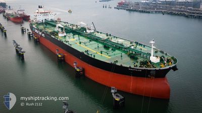
NAUTILUS
Crude Oil Tanker
Current Trip
| Time Travelled | 16 days |
|---|---|
| Remaining Time | 7 days |
| Distance Travelled | 3842.82 nm |
| Remaining Distance | 2361.79 nm |
| AVG Speed | 10.6 Knots |
| MAX Speed | 17 Knots |
| AVG Wind | 11.1 knots |
| MAX Wind | 25.7 knots |
| MIN Temp | 10.5°C / 50.9°F |
| MAX Temp | 37°C / 98.6°F |
| Draught | 16.6 m |
| Position Received | 6 d ago |
Current Position
| Longitude | 39.13287° |
|---|---|
| Latitude | 18.67132° |
| Status | Under way using engine |
| Speed | 12.1 Knots |
| Course | 160° |
| Area | Red Sea |
| Station | T-AIS |
| Position Received | 6 d ago |
Info
Information
The current position of NAUTILUS is in Red Sea with coordinates 18.67132° / 39.13287° as reported on 2024-04-20 07:43 by AIS to our vessel tracker app. The vessel's current speed is 12.1 Knots and is heading at the port of SINGAPORE. The estimated time of arrival as calculated by MyShipTracking vessel tracking app is 2024-05-04 19:12 LT
The vessel NAUTILUS (IMO: 9298765, MMSI: 240498000) is a Crude Oil Tanker that was built in 2006 ( 18 years old ). It's sailing under the flag of [GR] Greece.
In this page you can find informations about the vessels current position, last detected port calls, and current voyage information. If the vessels is not in coverage by AIS you will find the latest position.
The current position of NAUTILUS is detected by our AIS receivers and we are not responsible for the reliability of the data. The last position was recorded while the vessel was in Coverage by the Ais receivers of our vessel tracking app.
The current draught of NAUTILUS as reported by AIS is 16.6 meters
Weather
| Temperature | 29.3°C / 84.74°F |
|---|---|
| Wind Speed | 11 knots |
| Direction | 98° E |
| Pressure | 1007.8 hPa |
| Humidity | 77.2 % |
| Cloud Coverage | 88 % |
Featured Company
Last Port Calls
| Port | Arrival | Departure | Time In Port |
|---|---|---|---|
| 2024-04-17 06:26 | 2024-04-17 16:13 | 9 h | |
| 2024-04-07 08:09 | 2024-04-10 19:43 | 3 d | |
| 2024-03-29 11:28 | 2024-04-01 23:33 | 3 d |
Most Visited Ports (Last year)
| Port | Arrivals | |
|---|---|---|
| 2 | ||
| 2 | ||
| 2 | ||
| 1 | ||
| 1 | ||
| 1 |
Events
| Time | Event | Details | Position / Dest | Info |
|---|---|---|---|---|
| 2024-04-20 07:47 | Status Changed | Default Under way using engine |
18.65855 / 39.13892
SGSIN
|
Speed: 12.1 kn Course: 160° |
| 2024-04-20 07:43 | Status Changed | Under way using engine Default |
18.67132 / 39.13287
SGSIN
|
Speed: 12.1 kn Course: 162° |
| 2024-04-20 07:43 | OUT of Coverage |
18.67132 / 39.13287
Red Sea
SGSIN
|
Speed: 12.1 kn Course: 160° |
|
| 2024-04-20 07:25 | Status Changed | Default Under way using engine |
18.73048 / 39.11408
SGSIN
|
Speed: 12 kn Course: 156.7° |
| 2024-04-20 06:46 | Status Changed | Under way using engine Default |
18.85437 / 39.06237
SGSIN
|
Speed: 12.2 kn Course: 156° |
| 2024-04-20 06:39 | Status Changed | Default Under way using engine |
18.87495 / 39.05303
SGSIN
|
Speed: 12.2 kn Course: 155° |
| 2024-04-20 06:36 | Status Changed | Under way using engine Default |
18.88430 / 39.04867
SGSIN
|
Speed: 12.4 kn Course: 156° |
| 2024-04-20 05:55 | Status Changed | Default Under way using engine |
19.01375 / 38.98680
SGSIN
|
Speed: 12.6 kn Course: 155° |
| 2024-04-20 05:46 | Status Changed | Under way using engine Default |
19.04203 / 38.97293
SGSIN
|
Speed: 12.2 kn Course: 152° |
| 2024-04-20 05:27 | Status Changed | Default Under way using engine |
19.10290 / 38.94291
SGSIN
|
Speed: 12.8 kn Course: 152.4° |