
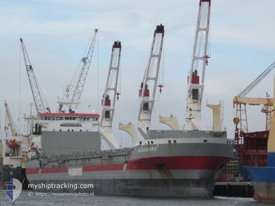
NASSAUBORG
General Cargo
Current Trip
| Time Travelled | 7 h, 9 mins |
|---|---|
| Remaining Time | --- |
| Distance Travelled | 80.20 nm |
| Remaining Distance | --- |
| AVG Speed | 12.3 Knots |
| MAX Speed | 14 Knots |
| AVG Wind | 13.7 knots |
| MAX Wind | 15.9 knots |
| MIN Temp | 18.8°C / 65.84°F |
| MAX Temp | 19.6°C / 67.28°F |
| Draught | 5.9 m |
| Position Received | 18 m ago |
Current Position
| Longitude | 28.59810° |
|---|---|
| Latitude | 31.94530° |
| Status | Under way using engine |
| Speed | 12.6 Knots |
| Course | 305° |
| Area | Mediterranean Sea - Eastern Basin |
| Station | T-AIS |
| Position Received | 18 m ago |
Info
Information
The current position of NASSAUBORG is in Mediterranean Sea - Eastern Basin with coordinates 31.94530° / 28.59810° as reported on 2024-04-25 07:59 by AIS to our vessel tracker app. The vessel's current speed is 12.6 Knots and is heading at the port of BAR. The estimated time of arrival as calculated by MyShipTracking vessel tracking app is 2024-04-28 00:00 LT
The vessel NASSAUBORG (IMO: 9248564, MMSI: 246430000) is a General Cargo that was built in 2006 ( 18 years old ). It's sailing under the flag of [NL] Netherlands.
In this page you can find informations about the vessels current position, last detected port calls, and current voyage information. If the vessels is not in coverage by AIS you will find the latest position.
The current position of NASSAUBORG is detected by our AIS receivers and we are not responsible for the reliability of the data. The last position was recorded while the vessel was in Coverage by the Ais receivers of our vessel tracking app.
The current draught of NASSAUBORG as reported by AIS is 5.9 meters
Weather
| Temperature | 18.8°C / 65.84°F |
|---|---|
| Wind Speed | 16 knots |
| Direction | 332° NNW |
| Pressure | 1009.3 hPa |
| Humidity | 77.9 % |
| Cloud Coverage | 100 % |
Featured Company
Last Port Calls
| Port | Arrival | Departure | Time In Port |
|---|---|---|---|
| 2024-04-17 11:20 | 2024-04-25 01:09 | 7 d | |
| 2024-03-21 23:39 | 2024-03-28 20:24 | 6 d | |
| 2024-03-13 06:36 | 2024-03-21 14:37 | 8 d | |
| 2024-03-11 14:06 | 2024-03-13 00:06 | 1 d | |
| 2024-03-06 07:32 | 2024-03-09 12:26 | 3 d | |
| 2024-02-16 09:39 | 2024-02-19 20:11 | 3 d | |
| 2024-02-13 18:35 | 2024-02-15 19:00 | 2 d | |
| 2024-02-06 14:26 | 2024-02-11 06:17 | 4 d |
Most Visited Ports (Last year)
| Port | Arrivals | |
|---|---|---|
| 3 | ||
| 1 | ||
| 1 | ||
| 1 | ||
| 1 | ||
| 1 |
Last Trips
| Origin | Departure | Destination | Arrival | Distance | |
|---|---|---|---|---|---|
| 2024-03-28 21:24 | 2024-04-17 13:20 | 4631.91 nm | |||
| 2024-03-21 16:37 | 2024-03-22 00:39 | 106.34 nm | |||
| 2024-03-13 02:06 | 2024-03-13 08:36 | 57.88 nm | |||
| 2024-03-09 14:26 | 2024-03-11 16:06 | 623.61 nm | |||
| 2024-02-19 23:11 | 2024-03-06 09:32 | 4109.17 nm | |||
| 2024-02-15 22:00 | 2024-02-16 12:39 | 100.38 nm | |||
| 2024-02-11 08:17 | 2024-02-13 21:35 | 779.44 nm | |||
| 2024-01-15 20:20 | 2024-02-06 16:26 | 4326.70 nm |
Events
| Time | Event | Details | Position / Dest | Info |
|---|---|---|---|---|
| 2024-04-25 08:01 | Status Changed | Default Under way using engine |
31.94906 / 28.59179
MEBAR
|
Speed: 12.6 kn Course: 305° |
| 2024-04-25 07:32 | Status Changed | Under way using engine Default |
31.89141 / 28.68819
MEBAR
|
Speed: 12.3 kn Course: 305° |
| 2024-04-25 07:26 | Status Changed | Default Under way using engine |
31.87927 / 28.70853
MEBAR
|
Speed: 12.1 kn Course: 305.1° |
| 2024-04-25 06:59 | Status Changed | Under way using engine Default |
31.82786 / 28.79441
MEBAR
|
Speed: 11.6 kn Course: 304° |
| 2024-04-25 06:45 | IN Coverage |
31.82786 / 28.79441
Mediterranean Sea - Eastern Basin
MEBAR
|
Speed: 11.7 kn Course: 305.2° |
|
| 2024-04-25 05:35 | Status Changed | Default Under way using engine |
31.67289 / 29.05320
MEBAR
|
Speed: 11.6 kn Course: 305.3° |
| 2024-04-25 05:34 | Status Changed | Under way using engine Default |
31.67067 / 29.05685
MEBAR
|
Speed: 11.6 kn Course: 305° |
| 2024-04-25 05:34 | OUT of Coverage |
31.67067 / 29.05685
Mediterranean Sea - Eastern Basin
MEBAR
|
Speed: 11.6 kn Course: 305.3° |
|
| 2024-04-25 04:42 | Status Changed | Default Under way using engine |
31.57495 / 29.21648
MEBAR
|
Speed: 11.9 kn Course: 304.6° |
| 2024-04-25 04:36 | Status Changed | Under way using engine Default |
31.56297 / 29.23652
MEBAR
|
Speed: 12 kn Course: 305° |