
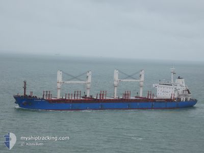
MYKONOS BAY
Bulk Carrier
Current Trip
| Time Travelled | 12 days |
|---|---|
| Remaining Time | --- |
| Distance Travelled | 779.42 nm |
| Remaining Distance | --- |
| AVG Speed | 11.9 Knots |
| MAX Speed | 17.1 Knots |
| AVG Wind | 3.3 knots |
| MAX Wind | 9.3 knots |
| MIN Temp | 22.9°C / 73.22°F |
| MAX Temp | 33.6°C / 92.48°F |
| Draught | 9.9 m |
| Position Received | 1 h, 23 m ago |
Current Position
| Longitude | -52.77307° |
|---|---|
| Latitude | -1.57294° |
| Status | Under way using engine |
| Speed | 15.3 Knots |
| Course | 103.1° |
| Area | South Atlantic Ocean |
| Station | T-AIS |
| Position Received | 1 h, 23 m ago |
Info
Information
The current position of MYKONOS BAY is in South Atlantic Ocean with coordinates -1.57294° / -52.77307° as reported on 2024-05-10 16:14 by AIS to our vessel tracker app. The vessel's current speed is 15.3 Knots and is heading at the port of KALININGRAD. The estimated time of arrival as calculated by MyShipTracking vessel tracking app is 2024-05-28 12:00 LT
The vessel MYKONOS BAY (IMO: 9517549, MMSI: 235102498) is a Bulk Carrier that was built in 2009 ( 15 years old ). It's sailing under the flag of [GB] United Kingdom.
In this page you can find informations about the vessels current position, last detected port calls, and current voyage information. If the vessels is not in coverage by AIS you will find the latest position.
The current position of MYKONOS BAY is detected by our AIS receivers and we are not responsible for the reliability of the data. The last position was recorded while the vessel was in Coverage by the Ais receivers of our vessel tracking app.
The current draught of MYKONOS BAY as reported by AIS is 9.9 meters
Weather
| Temperature | 31.2°C / 88.16°F |
|---|---|
| Wind Speed | 4 knots |
| Direction | 45° NE |
| Pressure | 1008.5 hPa |
| Humidity | 63.3 % |
| Cloud Coverage | 94 % |
Featured Company
Last Port Calls
| Port | Arrival | Departure | Time In Port |
|---|---|---|---|
| 2024-04-22 17:20 | 2024-04-27 18:14 | 5 d | |
| 2024-04-11 12:20 | 2024-04-17 11:44 | 5 d | |
| 2024-03-13 06:18 | 2024-03-19 22:14 | 6 d |
Most Visited Ports (Last year)
| Port | Arrivals | |
|---|---|---|
| 3 | ||
| 2 | ||
| 2 | ||
| 2 | ||
| 2 | ||
| 1 |
Last Trips
| Origin | Departure | Destination | Arrival | Distance | |
|---|---|---|---|---|---|
| 2024-04-17 08:44 | 2024-04-22 14:20 | 919.06 nm | |||
| 2024-03-20 01:14 | 2024-04-11 09:20 | 5603.41 nm | |||
| 2024-02-16 13:17 | 2024-03-13 09:18 | 5791.53 nm |
Events
| Time | Event | Details | Position / Dest | Info |
|---|---|---|---|---|
| 2024-05-10 16:20 | Status Changed | Default Under way using engine |
-1.57626 / -52.74778
RU KGD
|
Speed: 15.3 kn Course: 103.1° |
| 2024-05-10 16:14 | OUT of Coverage |
-1.57294 / -52.77307
South Atlantic Ocean
RU KGD
|
Speed: 15.3 kn Course: 103.1° |
|
| 2024-05-10 14:32 | Status Changed | Under way using engine Default |
-1.75700 / -53.11937
RU KGD
|
Speed: 15.6 kn Course: 91° |
| 2024-05-10 14:15 | IN Coverage |
-1.75700 / -53.11937
South Atlantic Ocean
RU KGD
|
Speed: 15.9 kn Course: 94.7° |
|
| 2024-05-10 09:24 | Status Changed | Default Under way using engine |
-2.34887 / -54.06000
RU KGD
|
Speed: 15 kn Course: 76.8° |
| 2024-05-10 09:18 | OUT of Coverage |
-2.36145 / -54.08174
South Atlantic Ocean
RU KGD
|
Speed: 15 kn Course: 76.8° |
|
| 2024-05-10 04:47 | Status Changed | Under way using engine Default |
-2.22290 / -55.00481
RU KGD
|
Speed: 13.7 kn Course: 50° |
| 2024-05-10 04:44 | Status Changed | Default Under way using engine |
-2.22987 / -55.01220
RU KGD
|
Speed: 11.8 kn Course: 64.8° |
| 2024-05-10 04:24 | Status Changed | Under way using engine Default |
-2.21033 / -55.07583
RU KGD
|
Speed: 14.6 kn Course: 124° |
| 2024-05-10 04:19 | Status Changed | Default Under way using engine |
-2.19881 / -55.09205
RU KGD
|
Speed: 14.6 kn Course: 119.3° |