
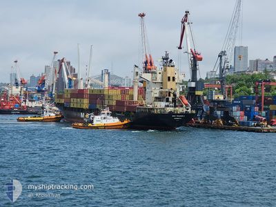
MSC TRADER II
Container Ship
Current Trip
PHMNN
| Time Travelled | 8 days |
|---|---|
| Remaining Time | --- |
| Distance Travelled | 2179.10 nm |
| Remaining Distance | --- |
| AVG Speed | 12.9 Knots |
| MAX Speed | 17.5 Knots |
| AVG Wind | 11.1 knots |
| MAX Wind | 32 knots |
| MIN Temp | 21.4°C / 70.52°F |
| MAX Temp | 29.2°C / 84.56°F |
| Draught | 9.7 m |
| Position Received | 9 d ago |
Current Position
| Longitude | --- |
|---|---|
| Latitude | --- |
| Status | Under way using engine |
| Speed | 2.1 Knots |
| Course | 39° |
| Area | South China Sea |
| Station | T-AIS |
| Position Received | 9 d ago |
Info
Information
The current position of MSC TRADER II is in South China Sea with coordinates 14.59378° / 120.87824° as reported on 2025-12-06 02:41 by AIS to our vessel tracker app. The vessel's current speed is 2.1 Knots
The vessel MSC TRADER II (IMO: 9230775, MMSI: 636020978) is a Container Ship that was built in 2001 ( 24 years old ). It's sailing under the flag of [LR] Liberia.
In this page you can find informations about the vessels current position, last detected port calls, and current voyage information. If the vessels is not in coverage by AIS you will find the latest position.
The current position of MSC TRADER II is detected by our AIS receivers and we are not responsible for the reliability of the data. The last position was recorded while the vessel was in Coverage by the Ais receivers of our vessel tracking app.
The current draught of MSC TRADER II as reported by AIS is 9.7 meters
Weather
| Temperature | 21.1°C / 69.98°F |
|---|---|
| Wind Speed | 23 knots |
| Direction | 56° NE |
| Pressure | 1017.5 hPa |
| Humidity | 79.9 % |
| Cloud Coverage | 100 % |
Featured Company
Last Port Calls
| Port | Arrival | Departure | Time In Port |
|---|---|---|---|
| 2025-12-06 14:37 | 2025-12-07 09:59 | 19 h | |
| 2025-12-05 11:11 | 2025-12-05 18:45 | 7 h | |
| 2025-11-30 01:34 | 2025-12-01 03:48 | 1 d | |
| 2025-11-27 09:10 | 2025-11-28 10:36 | 1 d | |
| 2025-11-16 19:14 | 2025-11-18 03:21 | 1 d | |
| 2025-11-14 20:17 | 2025-11-15 15:42 | 19 h | |
| 2025-11-12 16:04 | 2025-11-13 13:32 | 21 h | |
| 2025-11-11 04:16 | 2025-11-12 00:48 | 20 h | |
| 2025-10-28 14:03 | 2025-10-29 04:12 | 14 h | |
| 2025-10-14 02:20 | 2025-10-15 00:46 | 22 h |
Most Visited Ports (Last year)
| Port | Arrivals | |
|---|---|---|
| 9 | ||
| 8 | ||
| 7 | ||
| 7 | ||
| 6 | ||
| 2 |
Last Trips
| Origin | Departure | Destination | Arrival | Distance | |
|---|---|---|---|---|---|
| 2025-12-05 18:45 | 2025-12-06 14:37 | 104.75 nm | |||
| 2025-12-01 03:48 | 2025-12-05 11:11 | 1586.71 nm | |||
| 2025-11-28 10:36 | 2025-11-30 01:34 | 599.43 nm | |||
| 2025-11-18 03:21 | 2025-11-27 09:10 | 1406.79 nm | |||
| 2025-11-15 15:42 | 2025-11-16 19:14 | 166.30 nm | |||
| 2025-11-13 13:32 | 2025-11-14 20:17 | 444.96 nm | |||
| 2025-11-12 00:48 | 2025-11-12 16:04 | 216.12 nm | |||
| 2025-10-29 04:12 | 2025-11-11 04:16 | 2630.66 nm | |||
| 2025-10-15 00:46 | 2025-10-28 14:03 | 2917.55 nm | |||
| 2025-10-12 18:52 | 2025-10-14 02:20 | 184.94 nm |
Events
| Time | Event | Details | Position / Dest | Info |
|---|---|---|---|---|
| 2025-12-11 14:57 | START Moving | 5.95 nm, North of DAVAO |
7.21385 / 125.65746
PHMNN
|
Speed: 4.1 kn Course: 71° |
| 2025-12-10 16:05 | STOP Moving | 5.79 nm, North of DAVAO |
7.21073 / 125.65211
PHMNN
|
Speed: 0.3 kn Course: 322° |
| 2025-12-10 09:17 | START Moving | 14.81 nm, South East of DAVAO THERMA SOUTH |
6.77621 / 125.64951
PHMNN
|
Speed: 4.4 kn Course: 1° |
| 2025-12-10 07:21 | STOP Moving | 16.12 nm, South East of DAVAO THERMA SOUTH |
6.75979 / 125.66412
PHMNN
|
Speed: 0.3 kn Course: 64° |
| 2025-12-10 03:53 | START Moving | 20.77 nm, South East of DAVAO THERMA SOUTH |
6.67868 / 125.68694
PHMNN
|
Speed: 4.5 kn Course: 340° |
| 2025-12-10 01:05 | STOP Moving | 17.76 nm, South East of DAVAO THERMA SOUTH |
6.72442 / 125.66409
PHMNN
|
Speed: 0.3 kn Course: 1° |
| 2025-12-10 00:53 | START Moving | 17.93 nm, South East of DAVAO THERMA SOUTH |
6.72420 / 125.66840
PHMNN
|
Speed: 3.1 kn Course: 293° |
| 2025-12-10 00:17 | STOP Moving | 17.4 nm, South East of DAVAO THERMA SOUTH |
6.73811 / 125.67162
PHMNN
|
Speed: 0.3 kn Course: 341° |
| 2025-12-10 00:05 | START Moving | 17.51 nm, South East of DAVAO THERMA SOUTH |
6.73490 / 125.67071
PHMNN
|
Speed: 3.3 kn Course: 21° |
| 2025-12-09 23:09 | STOP Moving | 16.15 nm, South East of DAVAO THERMA SOUTH |
6.75627 / 125.66073
PHMNN
|
Speed: 0.2 kn Course: 355° |