
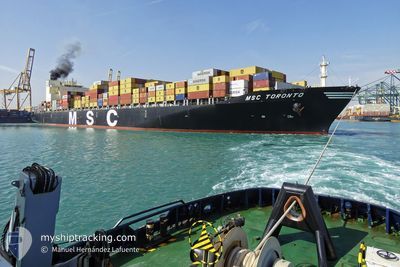
MSC TORONTO
Container Ship
Current Trip
| Time Travelled | 12 days |
|---|---|
| Remaining Time | 11 days |
| Distance Travelled | 5687.21 nm |
| Remaining Distance | 4403.38 nm |
| AVG Speed | 18.5 Knots |
| MAX Speed | 20.2 Knots |
| AVG Wind | 15.4 knots |
| MAX Wind | 36 knots |
| MIN Temp | 14.7°C / 58.46°F |
| MAX Temp | 27.3°C / 81.14°F |
| Draught | 14.3 m |
| Position Received | 1 d ago |
Current Position
| Longitude | --- |
|---|---|
| Latitude | --- |
| Status | Under way using engine |
| Speed | 16.8 Knots |
| Course | 141.2° |
| Area | South Atlantic Ocean |
| Station | T-AIS |
| Position Received | 1 d ago |
Info
Information
The current position of MSC TORONTO is in South Atlantic Ocean with coordinates -34.40504° / 18.30229° as reported on 2025-12-21 09:17 by AIS to our vessel tracker app. The vessel's current speed is 16.8 Knots and is heading at the port of JEBEL ALI. The estimated time of arrival as calculated by MyShipTracking vessel tracking app is 2026-01-03 03:54 LT
The vessel MSC TORONTO (IMO: 9299525, MMSI: 255806377) is a Container Ship that was built in 2006 ( 19 years old ). It's sailing under the flag of [PT] Portugal.
In this page you can find informations about the vessels current position, last detected port calls, and current voyage information. If the vessels is not in coverage by AIS you will find the latest position.
The current position of MSC TORONTO is detected by our AIS receivers and we are not responsible for the reliability of the data. The last position was recorded while the vessel was in Coverage by the Ais receivers of our vessel tracking app.
The current draught of MSC TORONTO as reported by AIS is 14.3 meters
Weather
| Temperature | 23.5°C / 74.3°F |
|---|---|
| Wind Speed | 35 knots |
| Direction | 57° ENE |
| Pressure | 1006.1 hPa |
| Humidity | 82.1 % |
| Cloud Coverage | 82 % |
Featured Company
Last Port Calls
| Port | Arrival | Departure | Time In Port |
|---|---|---|---|
| 2025-12-09 06:01 | 2025-12-09 20:01 | 13 h | |
| 2025-12-05 23:28 | 2025-12-07 13:39 | 1 d | |
| 2025-12-04 11:14 | 2025-12-05 07:59 | 20 h | |
| 2025-12-01 20:13 | 2025-12-03 09:33 | 1 d | |
| 2025-11-28 22:00 | 2025-11-30 19:14 | 1 d | |
| 2025-11-23 11:28 | 2025-11-24 08:53 | 21 h | |
| 2025-11-15 20:40 | 2025-11-16 17:37 | 20 h | |
| 2025-11-15 06:50 | 2025-11-15 16:39 | 9 h | |
| 2025-11-13 06:20 | 2025-11-14 07:32 | 1 d | |
| 2025-11-04 05:26 | 2025-11-04 14:42 | 9 h |
Most Visited Ports (Last year)
| Port | Arrivals | |
|---|---|---|
| 12 | ||
| 10 | ||
| 10 | ||
| 9 | ||
| 9 | ||
| 7 |
Last Trips
| Origin | Departure | Destination | Arrival | Distance | |
|---|---|---|---|---|---|
| 2025-12-07 13:39 | 2025-12-09 06:01 | 359.55 nm | |||
| 2025-12-05 07:59 | 2025-12-05 23:28 | 176.79 nm | |||
| 2025-12-03 09:33 | 2025-12-04 11:14 | 387.15 nm | |||
| 2025-11-30 19:14 | 2025-12-01 20:13 | 468.60 nm | |||
| 2025-11-24 08:53 | 2025-11-28 22:00 | 858.52 nm | |||
| 2025-11-16 17:37 | 2025-11-23 11:28 | 755.05 nm | |||
| 2025-11-14 07:32 | 2025-11-15 20:40 | 440.28 nm | |||
| 2025-11-14 07:32 | 2025-11-15 06:50 | 297.51 nm | |||
| 2025-11-03 09:52 | 2025-11-04 05:26 | 154.40 nm | |||
| 2025-10-29 15:30 | 2025-11-02 10:00 | 862.86 nm |
Events
| Time | Event | Details | Position / Dest | Info |
|---|---|---|---|---|
| 2025-12-21 09:21 | Status Changed | Default Under way using engine |
-34.41849 / 18.31567
ESAGP-AEJEA
|
Speed: 16.8 kn Course: 141.2° |
| 2025-12-21 09:17 | Status Changed | Under way using engine Default |
-34.40504 / 18.30229
ESAGP-AEJEA
|
Speed: 16.7 kn Course: 140° |
| 2025-12-21 09:17 | OUT of Coverage |
-34.40504 / 18.30229
South Atlantic Ocean
ESAGP-AEJEA
|
Speed: 16.8 kn Course: 141.2° |
|
| 2025-12-21 08:57 | Status Changed | Default Under way using engine |
-34.33267 / 18.23081
ESAGP-AEJEA
|
Speed: 17.2 kn Course: 143.8° |
| 2025-12-21 08:49 | Status Changed | Under way using engine Default |
-34.30295 / 18.20328
ESAGP-AEJEA
|
Speed: 17.1 kn Course: 144° |
| 2025-12-21 08:45 | Status Changed | Default Under way using engine |
-34.28698 / 18.18945
ESAGP-AEJEA
|
Speed: 17 kn Course: 142.8° |
| 2025-12-21 07:25 | Change Sea Area | South African part of the South Atlantic Ocean Namibian part of the South Atlantic Ocean |
-33.97573 / 17.91045
South Atlantic Ocean
ESAGP-AEJEA
|
Speed: 17.7 kn Course: 143.4° |
| 2025-12-21 07:15 | ETA Changed | 2026/01/01 17:00 2025/12/31 11:00 |
-33.93901 / 17.87855
ESAGP-AEJEA
|
Speed: 17.4 kn Course: 143.5° |
| 2025-12-21 07:09 | IN Coverage |
-33.92960 / 17.86929
South Atlantic Ocean
ESAGP-AEJEA
|
Speed: 17.4 kn Course: 139.5° |
|
| 2025-12-21 07:08 | Status Changed | Under way using engine Default |
-33.91190 / 17.85162
ESAGP-AEJEA
|
Speed: 17.4 kn Course: 139° |