
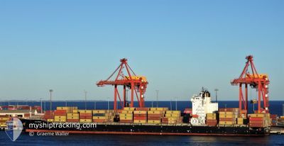
MSC SHAHAR
Container Ship
Current Trip
| Trip Time | 21 h, 7 mins |
|---|---|
| Trip Distance | 305.00 nm |
| AVG Speed | 12.1 Knots |
| MAX Speed | 18 Knots |
| Draught | 11.6 m |
| AVG Wind | 9.8 knots |
| MAX Wind | 17.2 knots |
| MIN Temp | 27.5°C / 81.5°F |
| MAX Temp | 32.2°C / 89.96°F |
| Position Received | 1 m ago |
Current Position
| Longitude | 54.64865° |
|---|---|
| Latitude | 24.80603° |
| Status | Moored |
| Speed | |
| Course | 232° |
| Area | Persian Gulf |
| Station | T-AIS |
| Position Received | 1 m ago |
Info
Information
The current position of MSC SHAHAR is in Persian Gulf with coordinates 24.80603° / 54.64865° as reported on 2024-05-15 17:50 by AIS to our vessel tracker app. The vessel's current speed is 0 Knots and is currently inside the port of KHALIFA.
The vessel MSC SHAHAR (IMO: 9471238, MMSI: 636020782) is a Container Ship that was built in 2011 ( 13 years old ). It's sailing under the flag of [LR] Liberia.
In this page you can find informations about the vessels current position, last detected port calls, and current voyage information. If the vessels is not in coverage by AIS you will find the latest position.
The current position of MSC SHAHAR is detected by our AIS receivers and we are not responsible for the reliability of the data. The last position was recorded while the vessel was in Coverage by the Ais receivers of our vessel tracking app.
The current draught of MSC SHAHAR as reported by AIS is 11.6 meters
Weather
| Temperature | 31.4°C / 88.52°F |
|---|---|
| Wind Speed | 10 knots |
| Direction | 41° NE |
| Pressure | 1008.5 hPa |
| Humidity | 55.2 % |
| Cloud Coverage | --- |
Featured Company
Last Port Calls
| Port | Arrival | Departure | Time In Port |
|---|---|---|---|
| 2024-05-15 08:14 | |||
| 2024-05-14 01:39 | 2024-05-14 10:07 | 8 h | |
| 2024-05-02 11:19 | 2024-05-05 20:59 | 3 d | |
| 2024-04-28 22:21 | 2024-04-30 08:23 | 1 d | |
| 2024-04-24 17:18 | 2024-04-26 05:23 | 1 d | |
| 2024-04-20 15:39 | 2024-04-23 04:59 | 2 d | |
| 2024-04-08 13:52 | 2024-04-15 07:29 | 6 d | |
| 2024-03-23 10:37 | 2024-03-26 20:11 | 3 d | |
| 2024-03-01 13:11 |
Last Trips
| Origin | Departure | Destination | Arrival | Distance | |
|---|---|---|---|---|---|
| 2024-05-14 10:07 | 2024-05-15 08:14 | 305.00 nm | |||
| 2024-05-05 20:59 | 2024-05-14 01:39 | 2818.99 nm | |||
| 2024-04-30 08:23 | 2024-05-02 11:19 | 655.90 nm | |||
| 2024-04-26 05:23 | 2024-04-28 22:21 | 616.18 nm | |||
| 2024-04-23 04:59 | 2024-04-24 17:18 | 528.56 nm | |||
| 2024-04-15 07:29 | 2024-04-20 15:39 | 464.99 nm | |||
| 2024-03-26 20:11 | 2024-04-08 13:52 | 1041.78 nm | |||
| 2024-03-01 13:11 | 2024-03-23 10:37 | 1450.82 nm |
Events
| Time | Event | Details | Position / Dest | Info |
|---|---|---|---|---|
| 2024-05-15 04:56 | Status Changed | Moored Under way using engine |
24.80600 / 54.64868
[AE] KHALIFA
|
Speed: Course: 231° |
| 2024-05-15 04:50 | STOP Moving |
24.80567 / 54.64877
[AE] KHALIFA
|
Speed: 0.3 kn Course: 234° |
|
| 2024-05-15 04:14 | PORT ARRIVAL |
|
24.83236 / 54.67199
[AE] KHALIFA
|
Speed: 9.8 kn Course: 140° |
| 2024-05-15 03:35 | START Moving | 7.63 nm, North West of KHALIFA |
24.92442 / 54.61093
AEKHL
|
Speed: 4.3 kn Course: 209° |
| 2024-05-15 03:15 | STOP Moving | 7.66 nm, North West of KHALIFA |
24.92551 / 54.61253
AEKHL
|
Speed: 0.3 kn Course: 151° |
| 2024-05-15 02:23 | START Moving | 11.37 nm, North West of KHALIFA |
24.96712 / 54.55394
AEKHL
|
Speed: 3.1 kn Course: 115° |
| 2024-05-15 02:21 | ETA Changed | 2024/05/15 03:30 2024/05/15 01:45 |
24.96771 / 54.55255
AEKHL
|
Speed: 2.1 kn Course: 115° |
| 2024-05-15 02:15 | STOP Moving | 11.51 nm, North West of KHALIFA |
24.96827 / 54.55138
AEKHL
|
Speed: 0.3 kn Course: 118° |
| 2024-05-14 21:41 | Change Sea Area | United Arab Emirates part of the Persian Gulf Iranian part of the Persian Gulf |
25.50071 / 53.60513
Persian Gulf
AEKHL
|
Speed: 16.3 kn Course: 121° |
| 2024-05-14 21:17 | ETA Changed | 2024/05/15 01:45 2024/05/15 02:00 |
25.55659 / 53.50170
AEKHL
|
Speed: 16.2 kn Course: 120.8° |